Chequerfield

Last updated

Chequerfield
'Circle shops', The Circle, Chequerfield, Pontefract (5th July 2019).jpg
Chequerfield Circle
West Yorkshire UK location map.svg
Red pog.svg
Chequerfield
Location within West Yorkshire
OS grid reference SE455215
  London 257 mi (414 km)
Metropolitan borough
Metropolitan county
Region
Country England
Sovereign state United Kingdom
Post town PONTEFRACT
Postcode district WF8
Dialling code 01977
Police West Yorkshire
Fire West Yorkshire
Ambulance Yorkshire
UK Parliament
List of places
UK
England
Yorkshire
53°41′28″N1°18′43″W / 53.691°N 1.312°W / 53.691; -1.312

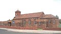
Chequerfield is a district made up mostly of council housing of Pontefract, West Yorkshire, England.

Contents

Amenities

Chequerfield Hotel The Chequerfield Hotel, The Circle, Chequerfield Estate, Pontefract. - geograph.org.uk - 239252.jpg
Chequerfield Hotel

The estate has a parade of shops situated around Chequerfield Circle; which includes a convenience store, fish and chip shop, several takeaways and a Betfred bookmakers. There is one pub; the Chequerfield Hotel also situated on the Cirle. Pontefract Sports and Social Club is situated on the edge of the estate. There are two churches on the estate; St Mary's Church of England church and Holy Family Roman Catholic Church (completed 1961) [1] There is one school; Pontefract De Lacy Primary School. There was formerly a second pub called the Grove Lea but this is now a Tesco Express.

Public transport

The Arriva Yorkshire routes 410 and 411 connect the estate with Pontefract bus station, Xscape and Leeds. The closest railway station is Pontefract Baghill with services to Sheffield and York. The main railway stations in the town have services to Wakefield, Castleford and Leeds but these are situated further away.

People

Notes

  1. "Pontefract – Holy Family". TAKING STOCK CATHOLIC CHURCHES OF ENGLAND & WALES. Retrieved 14 May 2020.
  2. "Book tells the story of life on estate". Pontefract and Castleford Express. 25 October 2016. Retrieved 14 May 2020.

Related Research Articles

<span class="mw-page-title-main">West Yorkshire</span> County of England

West Yorkshire is a ceremonial county in the Yorkshire and the Humber region of England. It borders North Yorkshire to the north and east, South Yorkshire and Derbyshire to the south, Greater Manchester to the south-west, and Lancashire to the west. The city of Leeds is the largest settlement.

<span class="mw-page-title-main">Castleford</span> Town in West Yorkshire, England

Castleford is a town within the City of Wakefield district, West Yorkshire, England. It had a population of 45,106 at a 2021 population estimate. Historically in the West Riding of Yorkshire, to the north of the town centre the River Calder joins the River Aire and the Aire and Calder Navigation. It is located north east of Wakefield, north of Pontefract and south east of Leeds. Castleford is the largest town in the Wakefield district after Wakefield itself.

<span class="mw-page-title-main">Wetherby</span> Town and civil parish in West Yorkshire, England

Wetherby is a market town and civil parish in the City of Leeds district, West Yorkshire, England, close to West Yorkshire county's border with North Yorkshire, and lies approximately 12 miles from Leeds City Centre, 12 mi (19 km) from York and 8 mi (13 km) from Harrogate. The town stands on the River Wharfe, and for centuries has been a crossing place and staging post on the Great North Road midway between London and Edinburgh.

<span class="mw-page-title-main">Pontefract</span> Market town in West Yorkshire, England

Pontefract is a historic market town in the Metropolitan Borough of Wakefield in West Yorkshire, England, east of Wakefield and south of Castleford. Historically part of the West Riding of Yorkshire, it is one of the towns in the City of Wakefield district and had a population of 30,881 at the 2011 Census. Pontefract's motto is Post mortem patris pro filio, Latin for "After the death of the father, support the son", a reference to the town's Royalist sympathies in the English Civil War. Small villages and settlements in the immediate area include Stapleton.

<span class="mw-page-title-main">Featherstone</span> Town and civil parish in West Yorkshire, England

Featherstone is a town and civil parish in the City of Wakefield, West Yorkshire, England, two miles south-west of Pontefract. Historically part of the West Riding of Yorkshire, in 2011 it had a population of 15,244. Featherstone railway station is on the Pontefract Line.

<span class="mw-page-title-main">Horsforth</span> Town and civil parish in West Yorkshire, England

Horsforth is a town and civil parish in the City of Leeds, West Yorkshire, England, five miles north-west of Leeds city centre. Historically a village within the West Riding of Yorkshire, it had a population of 18,895 at the 2011 Census. It became part of the City of Leeds metropolitan borough in 1974. In 1999, a civil parish was created for the area, and the parish council voted to rename itself a town council. The area is within the Horsforth ward of Leeds City Council, which also includes the southern part of Rawdon.

<span class="mw-page-title-main">Ackworth, West Yorkshire</span> Village in West Yorkshire, England

Ackworth is a village and civil parish in the metropolitan borough of Wakefield, West Yorkshire, England. It stands between Pontefract, Barnsley and Doncaster on the River Went. It has four parts: High Ackworth, Low Ackworth, Ackworth Moor Top, and Brackenhill. The 2001 census gave it a population of 6,493, which rose to 7,049 at the 2011 census. There is also a city ward called Ackworth, North Elmsall and Upton, with a 2011 census population of 16,099.

<span class="mw-page-title-main">Seacroft</span> Suburb of Leeds, West Yorkshire, England

Seacroft is an outer-city suburb/township consisting mainly of council estate housing covering an extensive area of east Leeds, West Yorkshire, England. It lies in the LS14 Leeds postcode area, around 4 miles (6.4 km) east of Leeds city centre.

<span class="mw-page-title-main">Gipton</span> Human settlement in England

Gipton is a suburb of east Leeds, West Yorkshire, England, between the A58 to the north and the A64 to the south.

<span class="mw-page-title-main">Middleton, Leeds</span> Suburb of Leeds, West Yorkshire, England

Middleton is a largely residential suburb of Leeds in West Yorkshire, England and historically a village in the West Riding of Yorkshire. It is situated on a hill 4 miles (6 km) south of Leeds city centre and 165 miles (266 km) north north-west of London.

<span class="mw-page-title-main">South Elmsall</span> Town and civil parish in West Yorkshire, England

South Elmsall is a town and civil parish in the City of Wakefield in West Yorkshire, England. South Elmsall lies to the east of Hemsworth. The town had a population in 2001 of 6,107, increasing to 6,519 at the 2011 Census.

Streethouse is a semi rural village in West Yorkshire, England that is situated to the east of Wakefield, the west of Featherstone and the south-west of Castleford. It is also situated on a Roman road.

<span class="mw-page-title-main">Garforth</span> Town in West Yorkshire, England

Garforth is a town in the metropolitan borough of the City of Leeds, West Yorkshire, England.

<span class="mw-page-title-main">Methley</span> Village in West Yorkshire, England

Methley is a dispersed village in the City of Leeds metropolitan borough, south east of Leeds, West Yorkshire, England. It is located near Rothwell, Oulton, Woodlesford, Mickletown and Allerton Bywater. The Leeds City Ward is called Kippax and Methley. It is within the triangle formed by Leeds, Castleford and Wakefield, and between the confluence of the River Aire and River Calder. The latter is crossed by Methley Bridge, the A639 road, about a mile south-east of the village.

<span class="mw-page-title-main">Castleford railway station</span> Railway station in West Yorkshire, England

Castleford railway station serves the town of Castleford in West Yorkshire. It lies on the Hallam and Pontefract lines, 11 miles (18 km) south-east of Leeds.

<span class="mw-page-title-main">Pontefract Monkhill railway station</span> Railway station in West Yorkshire, England

Pontefract Monkhill railway station is the busiest station in the town of Pontefract, West Yorkshire, England. The station is on the Pontefract Line managed by Northern but is also served by Grand Central and is 14 miles (23 km) south east of Leeds.

<span class="mw-page-title-main">Darrington, West Yorkshire</span> Village and civil parish in West Yorkshire, England

Darrington is a small village and civil parish in the City of Wakefield in West Yorkshire, England, 3 miles (4.8 km) from Pontefract and 25 miles (40 km) from the city of York. The village is split in two by the busy A1 trunk road which runs from London to Scotland. The 2011 census population was 1,403.

<span class="mw-page-title-main">Woodlesford</span> Village in West Yorkshire, England

Woodlesford is a suburban village in the City of Leeds, West Yorkshire, England, 6 miles (10 km) south-east of Leeds city centre. Formerly part of the Rothwell Urban District, it is now within the Rothwell ward of Leeds City Council. The village sits on the banks of the Aire and Calder Navigation and river system.

<span class="mw-page-title-main">Crofton, West Yorkshire</span> Village near Wakefield, West Yorkshire, England

Crofton is a village in West Yorkshire, England, about 4 miles (6 km) south-east of Wakefield, some 6 miles (10 km) to the west of the town of Pontefract, and 4 miles (6 km) from the town of Featherstone. The population of the civil parish at the 2011 census was 5,781.

<span class="mw-page-title-main">Castleford bus station</span> Bus station in West Yorkshire, England

Castleford Bus Station serves the town of Castleford, West Yorkshire, England. The bus station is owned and managed by West Yorkshire Metro.