
One Tree Hill is a town on the outskirts of Adelaide, South Australia. It is located in the City of Playford.

St Andrews is a town in Victoria, Australia, 52 km north-east of Melbourne's Central Business District. Its local government area is the Shire of Nillumbik. At the 2016 Census, St Andrews had a population of 1,226.

Uraidla is a small town in the Adelaide Hills of South Australia, Australia. At the 2016 census, Uraidla had a population of 575. However it also sits at the centre of a larger population catchment of rural townships which include Summertown, Piccadilly, Ashton, Basket Range, Carey Gully, Norton Summit and Cherryville.

Risdon Vale is an outer suburb of Hobart, capital of Tasmania, Australia on the eastern shore of the River Derwent, and adjacent to Risdon Cove, which was the site of the British colonisation of Van Diemen's Land.

Cudlee Creek is a small town near Adelaide, South Australia. It is located in the Adelaide Hills Council local government area.

Marble Hill was the Vice-Regal summer residence for the Governor of South Australia for seventy-five years, from 1880 to 1955. It is also the name of a ward of the Adelaide Hills Council, and a suburb, both named after the residence and in which the residence is located. It is about 20 kilometres (12 mi) east of Adelaide between the towns of Ashton and Cherryville, and has expansive views of the Adelaide Hills to the North and East, and the Adelaide Plains to the West.

West Beach is a seaside suburb of Adelaide, South Australia. It is located in both the City of Charles Sturt and the City of West Torrens.

Upper Sturt is a suburb in the inner south of Adelaide, South Australia. The suburb is nestled in the lower reaches of the Mount Lofty Ranges with the Western Half located in the City of Mitcham local government area, and the eastern portion located in the Adelaide Hills Council Local Government Area.

Athelstone is a suburb of Adelaide in the City of Campbelltown. It was established in the 19th century but only became part of suburban Adelaide in the second half of the 20th century.

Scamander is a small town at the mouth of the Scamander River between St Helens and St Marys on the north-east coast of Tasmania in Australia. The town is a popular holiday destination because of its wide, sandy beaches and views of the ocean. Recreational activities include surfing, swimming and fishing for bream in the river.
Plympton is an inner south-western suburb of Adelaide, South Australia. The name is believed to have been given by Henry Mooringe Boswarva to a private subdivision in the area, naming after his home town in Devon, England. It was accepted as an official name for the suburb in 1944.

Inglewood is a small town near Adelaide, South Australia. It is located in the Adelaide Hills Council local government area, and is adjacent to Houghton, Paracombe and the rural districts of Upper Hermitage and Chain of Ponds. At the 2006 census, Inglewood had a population of 264.
Castambul is a small locality near Adelaide, South Australia. It is located in the Adelaide Hills Council local government area.
Rosewater is one of the western suburbs of Adelaide and is located 10 km north-west of Adelaide's central business district. Although mainly residential, there are many shops along Grand Junction Road and the closed Rosewater Loop railway line runs through the suburb. Rosewater is split in half by Grand Junction Road and bordered on the east by Addison Road, and on the south by Torrens Road.

The Hundred of Adelaide is a cadastral hundred in the city of Adelaide spanning all the inner suburbs south of River Torrens. It is one of the eleven hundreds of the County of Adelaide, and was one of the first hundreds to be proclaimed. Like the city it surrounds, the Hundred was named after Queen Adelaide, and was named by Governor Frederick Robe in 1846. It is 106 square miles (270 km2); close to but not exactly one hundred square miles as with most of the other hundreds. Its north boundary is the Torrens River and the Sturt River forms the south east boundary, with the hundred extending to the Adelaide foothills.

The Black Sunday bushfires were a series of bushfires that broke out across South Australia on 2 January 1955. Extreme morning temperatures coupled with strong north-westerly winds contributed to the breakout of numerous fires in the Adelaide Hills, Jamestown, Waterloo, Kingston and Millicent. Most were caused by sparks from powerlines in the wind.

Basket Range is a small town in the Adelaide Hills, South Australia. It is located on an approximately north-south ridge that runs from Deep Creek in the north to Greenhill Road in the south. The area is completely encircled by hills, giving the town the appearance of nestling within a large basket, hence "Basket Range".

The summer of 2012–13, had above average fire potential for most of the southern half of the continent from the east coast to the west. This is despite having extensive fire in parts of the country over the last 12 months. The reason for this prediction is the abundant grass growth spurred by two La Niña events over the last two years.
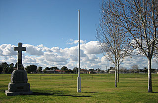
The 2013 Cherryville Bushfire occurred on 9–11 May 2013 near the Adelaide Hills townships of Cherryville, Marble Hill and Basket Range, South Australia.

