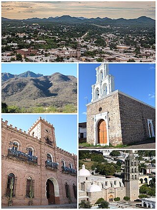
Álamos is a town in Álamos Municipality in the Mexican state of Sonora, in northwestern Mexico.

Ahome is a municipality on the coast of the Gulf of California in the northwestern part of the Mexican state of Sinaloa; it is adjacent to the southern border of Sonora state. It reported 388,344 inhabitants in the 2005 census. Ahome is also the name of the second-largest community in the municipality. The municipal seat is the port city of Los Mochis, its largest community. It is a commercial corridor to the northwest of the country. It is situated on the Pacific coastal plain, at the entrance of the Gulf of California and lies in the heart of a rich agricultural region, Fort Valley. It stands at 25°33′50″N108°46′00″W.

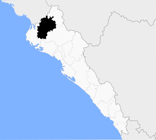
Guasave is a city and the seat of the homonymous municipality known as the Agricultural Heart of Mexico in the Mexican state of Sinaloa. It is located in the northwestern part of Mexico, 62km southeast of the city of Los Mochis and 150km northeast the state capital Culiacán. It stands at 25°34′04.5″N108°28′10.8″W.

Ojinaga Municipality is one of the 67 municipalities of Chihuahua, in northern Mexico. The municipal seat lies at Ojinaga, a rural bordertown on the U.S.-Mexico border. The municipality has an area of 9,500.50 km2 (3,668.16 sq mi).

The Mayo or Yoreme are an Indigenous group in Mexico, living in southern Sonora, northern Sinaloa and small settlements in Durango.

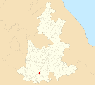
Ahuehuetitla Municipality is a municipality in the Mexican state of Puebla in south-eastern Mexico.

Domingo Arenas Municipality is a municipality in the Mexican state of Puebla in south-eastern Mexico.

General Felipe Ángeles (municipality) is a town and municipality in the center of the state of Puebla in south-eastern Mexico. It is named after General Felipe Ángeles.
Santiago Miahuatlán (municipality) is a town and municipality in the Mexican state of Puebla in south-eastern Mexico.
Tianguismanalco (municipality) is a town and municipality in the Mexican state of Puebla in south-eastern Mexico.
Álamos Municipality is a municipality in south-western Sonora, Mexico. It includes the town of Álamos.
Bacerac (municipality) is a municipality in the Mexican state of Sonora in north-western Mexico.
Benjamín Hill Municipality is a municipality in the Mexican state of Sonora in north-western Mexico.
Huachinera Municipality is a municipality in the Mexican state of Sonora in north-western Mexico.
Nácori Chico Municipality is a municipality in the Mexican state of Sonora in north-western Mexico.
Sahuaripa Municipality is a municipality in the Mexican state of Sonora in north-western Mexico.

Angostura Municipality is a municipality in the Mexican state of Sinaloa in northwestern Mexico. Its seat is the city of Angostura.

Municipality of El Fuerte is a municipality in the Mexican state of Sinaloa in northwestern Mexico. Its seat is El Fuerte city.
La Brecha is a town in the Mexican state of Sinaloa. It stands at 25°22′16″N108°25′09″W. It is part of Guasave Municipality.

Fausto Isidro Meza Flores alias "El Chapo Isidro", is a Mexican drug lord and leader of Los Mazatlecos. He has a high-ranking in the Beltrán Leyva Cartel and was the right-hand man of Alfredo Beltrán Leyva before he got incarcerated in United States.


