Sinaloa Municipality

Last updated

Sinaloa Municipality
Municipio de Sinaloa
Seal of Sinaloa.png
Sinaloa en Sinaloa.svg
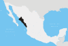
Location of the municipality in Sinaloa
Coordinates: 25°49′N108°13′W / 25.817°N 108.217°W / 25.817; -108.217
CountryFlag of Mexico.svg  Mexico
State Coat of arms of Sinaloa.svg Sinaloa
Seat Sinaloa de Leyva
No. of Sindicaturas9
Foundation1915
Government
   Municipal president Saúl Rubio Valenzuela PAN Party (Mexico).svg
Area
  Total
6,186.5 km2 (2,388.6 sq mi)
Population
 (2010)
  Total
88,282 [1]
Time zone UTC-7 (Zona Pacífico)
Website Official website OOjs UI icon edit-ltr-progressive.svg

Sinaloa is a municipality in the state of Sinaloa in northwestern Mexico. It is the largest municipality in Sinaloa [2] and its seat is Sinaloa de Leyva.

Contents

Political subdivision

The municipality of Sinaloa is subdivided in 9 sindicaturas:

Economy

Agriculture is one of the three main economic activities in this municipality, with cultivation of maize, beans, soy, wheat, sorghum, tomato and sesame representing the main preferences. Cattle farming is another of the three activities, with 6820 registered cattle farmers, as well as 52235 heads of cattle. In a much more reduced quantity, pigs are reared, as well as domestic birds. The industrial aspect of the economy consists of a furniture factory, as well as a hydroelectric plant belonging to the Federal Electricity Commission (CFE).[ citation needed ]

References

  1. "Main results by locality 2010". INEGI. 2010.
  2. "-". Enciclopedia de los Municipios de México. Instituto Nacional para el Federalismo y el Desarrollo Municipal . Retrieved 11 January 2010.

Commons-logo.svg Media related to Sinaloa Municipality at Wikimedia Commons