Escuinapa Municipality

Last updated
Escuinapa Municipality
Municipio de Escuinapa
Seal of Escuinapa.png
Escuinapa en Sinaloa.svg
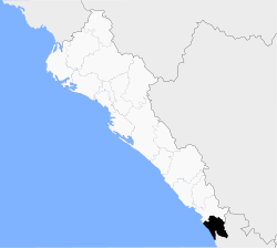
Location of the municipality in Sinaloa
CountryFlag of Mexico.svg  Mexico
State Coat of arms of Sinaloa.svg Sinaloa
Seat Escuinapa de Hidalgo
No. of Sindicaturas4
Foundation1915
Government
   Municipal president Fernanda "Miss Tilapias" Oceguera Burques
Area
  Total1,633.22 km2 (630.59 sq mi)
Population
 (2010)
  Total54,131 [1]
Time zone UTC-7 (Mountain Standard Time)
Website Escuinapa Government page

Municipality of Escuinapa is a municipality in the Mexican state of Sinaloa in northwestern Mexico. [2] The seat is Escuinapa de Hidalgo.

Commons-logo.svg Media related to Escuinapa Municipality at Wikimedia Commons

Related Research Articles

<span class="mw-page-title-main">Escuinapa de Hidalgo</span> City in the Mexican state of Sinaloa

Escuinapa de Hidalgo is a city in Escuinapa Municipality of the same name, located at the extreme southern end of the Mexican state of Sinaloa. At the census of 2005 the city had a population of 28,789 inhabitants, while the municipality reported 49,655 inhabitants. The municipality has an area of 1633.22 km² and includes the towns of Isla del Bosque and Teacapan, in addition to many smaller localities.

Huajicori is both a municipality and the municipal seat of the same in the Mexican state of Nayarit. The population of the municipality was 10,294 in 2000 in a total area of 2,603.5 km2. Its area makes up almost 10% of the state. The population of the town was 2,201 (2005).

<span class="mw-page-title-main">Cabañes de Esgueva</span> Municipality and town in Castile and León, Spain

Cabañes de Esgueva is a municipality located in the province of Burgos, Castile and León, Spain. According to the 2004 census (INE), the municipality has a population of 243 inhabitants.

<span class="mw-page-title-main">San Martín de la Virgen de Moncayo</span> Place in Aragon, Spain

San Martín de la Virgen de Moncayo is a municipality located in the province of Zaragoza, Aragon, Spain. According to the 2004 census (INE), the municipality has a population of 291 inhabitants.

<span class="mw-page-title-main">Carrillo Puerto (municipality)</span> Municipality in Veracruz, Mexico

Carrillo Puerto Municipality is a municipality in the Mexican state of Veracruz. It is located in the central area of the State of Veracruz, at 18°47′N96°34′W. It has a surface of 246.76 km2 and a population of 18,888 as of 2020. Its seat is Tamarindo and its most populated town is El Palmar (1,259).

Santos Reyes Yucuná is a town and municipality in Oaxaca in south-western Mexico. The municipality covers an area of km2. It is part of the Huajuapan District in the north of the Mixteca Region.

<span class="mw-page-title-main">Acatzingo</span> Municipality in Puebla, Mexico

Acatzingo Municipality is a municipality in the Mexican state of Puebla in south-eastern Mexico.

<span class="mw-page-title-main">Chignahuapan</span> Municipality and town in Puebla, Mexico

Chignahuapan Municipality is a town and municipality in the Mexican state of Puebla in south-eastern Mexico. The municipality is the location of many touristic places very well known all over the state such as the Basilica of the Immaculate Conception, which is the biggest figure of the virgin Mary in Latin America, and also, Las Aguas Termales de Chignahuapan.

<span class="mw-page-title-main">Chignautla</span> Municipality and town in Puebla, Mexico

Chignautla (municipality) is a town and municipality of the Mexican state of Puebla, in eastern Central Mexico.

Palmar de Bravo (municipality) is a town and municipality in the Mexican state of Puebla in south-eastern Mexico.

Tzicatlacoyan (municipality) is a town and municipality in the Mexican state of Puebla in south-eastern Mexico.

<span class="mw-page-title-main">Yehualtepec</span> Municipality and town in Puebla, Mexico

Yehualtepec (municipality) is a town and municipality in the Mexican state of Puebla in south-eastern Mexico.

<span class="mw-page-title-main">Altar Municipality</span> Municipality in Sonora, Mexico

Altar is a municipality in the Mexican state of Sonora in north-western Mexico. The municipality had a 2010 census population of 9,049 inhabitants, the vast majority of whom lived in the municipal seat of Altar, which had a population of 7,927 inhabitants. There are no other localities with over 1,000 inhabitants.

Imuris Municipality is a municipality in the Mexican state of Sonora in north-western Mexico.

Matlapa is a town and municipality in the Mexican state of San Luis Potosí in central Mexico.

<span class="mw-page-title-main">Tamazunchale</span> Town & Municipality in San Luis Potosí, Mexico

Tamazunchale is a town and municipality in the Mexican state of San Luis Potosí, central Mexico. In 2010 the area of the municipality was 354 square kilometres (137 sq mi) and the population was 96,820. The population of the town was 24,562.

<span class="mw-page-title-main">Mazatlán Municipality</span> Municipality in the Mexican state of Sinaloa

Municipality of Mazatlán is a municipality in the Mexican state of Sinaloa in northwestern Mexico.

Boca Teacapan is the outlet of the Estero de Teacapán that drains two large coastal lagoons, Agua Grande Lagoon in Sinaloa and Agua Brava Lagoon in Nayarit to the Pacific Ocean. It forms part of the border between the Escuinapa Municipality of Sinaloa, and Nayarit in Mexico.

Teacapan Estuary is an estuary in Mexico, within the two provinces of Sinaloa and Nayarit. This long outlet drains two large coastal lagoons, Agua Grande Lagoon in Sinaloa on its northern end and Agua Brava Lagoon in Nayarit at its southern end, into the Pacific Ocean at its mouth, the Boca Teacapan. The estuary forms part of the border between the Escuinapa Municipality, Sinaloa, and the Tecuala Municipality of Nayarit.

<span class="mw-page-title-main">Hurricane Willa</span> Category 5 Pacific hurricane in 2018

Hurricane Willa was a powerful tropical cyclone that brought torrential rains and destructive winds to southwestern Mexico, particularly the states of Sinaloa and Nayarit, during late October 2018. It was the twenty-fifth tropical cyclone, twenty-second named storm, thirteenth hurricane, tenth major hurricane, and record-tying third Category 5 hurricane of the 2018 Pacific hurricane season. Willa was the first major hurricane to make landfall in the Mexican state of Sinaloa since Lane in 2006.

References

  1. "Main results by locality 2010". INEGI. 2010.
  2. "-". Enciclopedia de los Municipios de México. Instituto Nacional para el Federalismo y el Desarrollo Municipal. Archived from the original on January 28, 2007. Retrieved January 11, 2010.

22°50′N105°47′W / 22.833°N 105.783°W / 22.833; -105.783