Arani is a province in Cochabamba Department, Bolivia. Its capital is Arani, situated about 53 km from Cochabamba. Arani is known for its bread but also for the town's artisan wickerwork.

Mizque is a province in the Cochabamba Department, Bolivia. Its capital is Mizque.

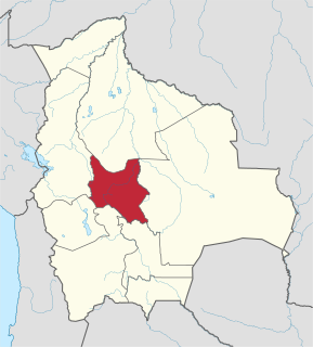
Oropeza is a province in the Chuquisaca Department, Bolivia. Its seat is Sucre which is also the constitutional capital of Bolivia and the capital of the Chuquisaca Department.

Chayanta is a province in the northern parts of the Bolivian Potosí Department. Its capital is Colquechaca.

Mizque Municipality is the first municipal section of the Mizque Province in the Cochabamba Department, Bolivia. Its seat is Mizque.

Vila Vila or Wila Wila (Aymara) is the second municipal section of the Mizque Province in the Cochabamba Department, Bolivia. Its seat is Vila Vila.

Tacopaya Municipality is the second municipal section of the Arque Province in the Cochabamba Department in Bolivia. Its seat is Tacopaya. At the time of census 2001 the municipality had 11,658 inhabitants.

Ravelo Municipality is the second municipal section of the Chayanta Province in the Potosí Department in Bolivia. Its seat is Ravelo.

Jatun Q'asa is a mountain in the Tunari mountain range of the Bolivian Andes, about 5,025 m (16,486 ft) high. It is situated north-west of Cochabamba in the Cochabamba Department, Quillacollo Province, in the west of the Quillacollo Municipality.
Liqiliqini is a mountain in the Bolivian Andes which reaches a height of approximately 4,400 m (14,400 ft). It is located in the Cochabamba Department, Ayopaya Province, Morochata Municipality. It lies east of the village of Paranani.
Jatun Yuraq Q'asa is a mountain in the Bolivian Andes which reaches a height of approximately 4,160 m (13,650 ft). It is located in the Cochabamba Department, Ayopaya Province, Morochata Municipality. It lies northwest of Liqiliqini.
Quna Quna Q'asa is a mountain in the Bolivian Andes which reaches a height of approximately 4,720 m (15,490 ft). It is located in the Cochabamba Department, Quillacollo Province, Quillacollo Municipality. Quna Quna Q'asa lies southeast of Wila Qullu Punta and Q'illu Suchusqa.
Chullpa Urqu is a mountain in the Bolivian Andes which reaches a height of approximately 3,540 m (11,610 ft). It is located in the Chuquisaca Department, Oropeza Province, Yotala Municipality.
Tuqtu Q'asa is a mountain in the Bolivian Andes which reaches a height of approximately 3,120 m (10,240 ft). It is located in the Chuquisaca Department, Oropeza Province, Poroma Municipality. Tuqtu Q'asa lies southeast of Markawi.
Llamayuq Q'asa is a mountain in the Bolivian Andes which reaches a height of approximately 4,640 m (15,220 ft). It is located in the Cochabamba Department, Ayopaya Province, Cocapata Municipality. Llamayuq Q'asa lies northeast of a lake named Wallatani Quta.
Inka Q'asa is a mountain in the Bolivian Andes which reaches a height of approximately 4,160 m (13,650 ft). It is located in the Cochabamba Department, Ayopaya Province, Morochata Municipality. The Ch'uya Mayu originates west of the mountain. It flows to the west as a left tributary of the Río Negro.
Supay Q'asa is a mountain in the Bolivian Andes which reaches a height of approximately 2,920 m (9,580 ft). It is located in the Chuquisaca Department, Tomina Province, Sopachuy Municipality. It lies at the Supay Q'asa River.
Jatun Q'asa is a mountain in the Bolivian Andes which reaches a height of approximately 3,500 m (11,500 ft). It is located in the Chuquisaca Department, Jaime Zudáñez Province, Icla Municipality. Jatun Q'asa lies between the Lampasar River and the Warmi Wañusqa River, southwest of Chullunkhäni.
Jatun Q'asa is a 3,526-metre-high (11,568 ft) mountain in the Bolivian Andes. It is located in the Chuquisaca Department, Azurduy Province, Tarvita Municipality. Llaqta Punta is the neighboring peak to the northwest.
Qiwiña Q'asa is a mountain in the Bolivian Andes which reaches a height of approximately 4,140 m (13,580 ft). It is located in the Potosí Department, Antonio Quijarro Province, Porco Municipality, west of Porco.