Colomi

Last updated
Colomi
Qulumi
Bolivia adm location map.svg
Red pog.svg
Colomi
Location of Colomi within Bolivia
Coordinates: 17°21′0″S65°52′0″W / 17.35000°S 65.86667°W / -17.35000; -65.86667
Country Flag of Bolivia.svg Bolivia
Department Flag of Cochabamba.svg Cochabamba Department
Province Chapare Province
Municipality Colomi Municipality
Canton Colomi Canton
Population
 (2001)
  Total3,699
Time zone UTC-4 (BOT)

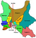
Colomi (Quechua : Qulumi) is a locality in the Cochabamba Department in central Bolivia. It is the seat of the Colomi Municipality, the second municipal section of the Chapare Province. At the time of census 2001 it had a population of 3,699. [1]

Contents

In 2021, 21 people were killed in a bus crash.

Climate

Climate data for Colomi, elevation 3,309 m (10,856 ft) (2007–2011)
MonthJanFebMarAprMayJunJulAugSepOctNovDecYear
Mean daily maximum °C (°F)14.7
(58.5)
14.8
(58.6)
14.9
(58.8)
15.1
(59.2)
15.2
(59.4)
15.6
(60.1)
14.8
(58.6)
15.1
(59.2)
15.2
(59.4)
15.3
(59.5)
15.3
(59.5)
15.6
(60.1)
15.1
(59.2)
Daily mean °C (°F)10.1
(50.2)
10.4
(50.7)
10.4
(50.7)
10.3
(50.5)
8.8
(47.8)
7.6
(45.7)
7.0
(44.6)
8.0
(46.4)
8.6
(47.5)
9.3
(48.7)
10.2
(50.4)
10.2
(50.4)
9.2
(48.6)
Mean daily minimum °C (°F)5.4
(41.7)
6.0
(42.8)
5.8
(42.4)
5.6
(42.1)
1.9
(35.4)
−0.6
(30.9)
−0.5
(31.1)
0.8
(33.4)
1.9
(35.4)
3.3
(37.9)
5.2
(41.4)
4.8
(40.6)
3.3
(37.9)
Average precipitation mm (inches)144.7
(5.70)
107.7
(4.24)
83.3
(3.28)
26.7
(1.05)
6.8
(0.27)
7.1
(0.28)
13.8
(0.54)
7.4
(0.29)
22.0
(0.87)
29.5
(1.16)
36.0
(1.42)
98.1
(3.86)
583.1
(22.96)
Source: Servicio Nacional de Meteorología e Hidrología de Bolivia (precipitation 1999–2011) [2]

Related Research Articles

<span class="mw-page-title-main">Cochabamba Department</span> Department of Bolivia

Cochabamba, from Quechua qucha or qhucha, meaning "lake", pampa meaning "plain", is one of the nine departments of Bolivia. It is known to be the "granary" of the country because of its variety of agricultural products from its geographical position. It has an area of 55,631 km2. Its population in the 2012 census was 1,758,143. Its capital is the city of Cochabamba, known as the "City of Eternal Spring" and "The Garden City" because of its spring-like temperatures all year.

<span class="mw-page-title-main">Chapare Province</span>

Chapare (Spanish:[tʃaˈpaɾe], also called The Chapare, is a rural province in the northern region of Cochabamba Department in central Bolivia. Most of the territory consists of valley rainforests that surround the area's main waterway, the Chapare River, which is also a tributary of the Amazon River. The provincial capital is Sacaba, 11 km east of Cochabamba. Its principal town is Villa Tunari, a popular tourist destination.

Chapare may refer to:

<span class="mw-page-title-main">Sacaba</span> City and Municipality in Cochabamba Department, Bolivia

Sacaba is a capital city and a municipality in the Bolivian province of Chapare. The city, located 13 kilometers eastward from Cochabamba, is the second largest city in the Cochabamba Department after Cochabamba city. Post-colonial architecture may be seen in the inner part of Sacaba; however, some has been destroyed due to lack of municipal care.

<span class="mw-page-title-main">Cordillera Oriental (Bolivia)</span> Mountain range in Bolivia

The Cordillera Oriental or Eastern Cordillera is a set of parallel mountain ranges of the Bolivian Andes, emplaced on the eastern and north eastern margin of the Andes. Large parts of Cordillera Oriental are forested and humid areas rich in agricultural and livestock products. Geologically, the Cordillera Oriental is formed by the Central Andean fold and thrust belt.

<span class="mw-page-title-main">Villa Tunari</span> Place in Cochabamba Department, Bolivia

Villa Tunari or Tunari is a location in the department of Cochabamba, Bolivia. It is the seat of the Villa Tunari Municipality, the third municipal section of the Chapare Province. According to the census 2012 the population was 3,213 in the town which is an increment from 2,510 registered during the 2001 census.

<span class="mw-page-title-main">Chapare River</span> River in Cochabamba Department, Bolivia

The Chapare River is a river in Bolivia, which is a tributary of the Mamoré River in the Amazon Basin. The river has its source at the confluence of Espíritu Santo River and San Mateo River in the Cochabamba Department at Villa Tunari. It is the main waterway of Chapare Province in central Bolivia.

Chimoré is a location in the Carrasco Province, Cochabamba Department, Bolivia. It is the seat of the Chimoré Municipality.

<i>Chapare mammarenavirus</i> Species of virus

Chapare mammarenavirus or Chapare virus is a virus from the family Arenaviridae which causes a hemorrhagic fever in humans known as Chapare hemorrhagic fever. It was first described after an outbreak of a novel zoonotic mammarenavirus infection occurred in the village of Samuzabeti, Chapare Province, Bolivia, in January 2003. A small number of people were infected and one person died.

Chimoré Municipality is the fourth municipal section of the Carrasco Province in the Cochabamba Department, Bolivia. Its seat is Chimoré.

Colomi Municipality is the second municipal section of the Chapare Province in the Cochabamba Department, Bolivia. Its seat is Colomi.

<span class="mw-page-title-main">Sacaba Municipality</span> Municipality in Cochabamba Department, Bolivia

Sacaba Municipality is the first municipal section of the Chapare Province in the Cochabamba Department, Bolivia. Its seat is Sacaba.

<span class="mw-page-title-main">Santiváñez Municipality</span> Municipality in Cochabamba Department, Bolivia

Santiváñez Municipality is the second municipal section of the Capinota Province in the Cochabamba Department, Bolivia. Its seat is Santiváñez.

<span class="mw-page-title-main">Villa Tunari Municipality</span> Municipality in Cochabamba Department, Bolivia

Villa Tunari Municipality is the third municipal section of the Chapare Province in the Cochabamba Department, Bolivia. Its seat is Villa Tunari. The population grew from 52,886 to 71,146 during 2001 to 2012 according to the census. Only 8,692 of the population are urban and are concentrated in the small towns of Villa Tunari (3.213), Eterazama (3,359) and Villa 14 the Septiembre (2,123). The municipality is famous for tourist especially the Villa Tunari town where the tourist industry is concentrated with infrastructure, and also because of the closeness of the Machia Park.

Caracollo, Q'araqullu or Q'ara Qullu is a small town in Bolivia. It is situated in the Cercado Province of the Oruro Department. In 2010 it had an estimated population of 5,429. Located at the place where the highway from La Paz splits into two roads towards Cochabamba and Oruro, the town is a frequent starting point for long marches intended to influence the Bolivian government.

The Villa Tunari Massacre was a 27 June 1988 mass murder committed by UMOPAR troops in response to a protest by coca-growing peasants (cocaleros) in the town of Villa Tunari in Chapare Province, Bolivia. The cocalero movement had mobilized since late May 1988 in opposition to coca eradication under Law 1008, then on the verge of becoming law. According to video evidence and a joint church-labor investigative commission, UMOPAR opened fired on unarmed protesters, at least two of whom were fatally shot, and many of whom fled to their deaths over a steep drop into the San Mateo River. The police violence caused the deaths of 9 to 12 civilian protesters, including three whose bodies were never found, and injured over a hundred. The killings were followed by further state violence in Villa Tunari, Sinahota, Ivirgarzama, and elsewhere in the region, including machine gun fire, beatings, and arrests.

<span class="mw-page-title-main">Coca in Bolivia</span>

Coca has been cultivated in medium-altitude parts of the Bolivian Andes since at least the Inca era, primarily in the Yungas north and east of La Paz. Cultivation expanded substantially in the 1980s into the Chapare region of Cochabamba and some production flowed into the international cocaine market. The US-backed efforts to criminalize and eradicate coca as part of the War on Drugs were met by the cocalero movement's growing capacity to organize. Violence between drug police and the Bolivian armed forces on one side and the movement on the other occurred episodically between 1987 and 2003. The cocaleros became an increasingly important political force during this period, co-founding the Movement for Socialism – Political Instrument for the Sovereignty of the Peoples party. Coca growers from both the Yungas and the Chapare have advocated for policies of "social control" over coca growing, maintaining a pre-set maximum area of cultivation as an alternative to drug war policies. In 2005, cocalero union leader Evo Morales was elected president of Bolivia. Morales has pursued a combined policy of legalizing coca production in the Chapare and Yungas and eradication of the crop elsewhere.

Inkachaka or Inka Chaka is an archaeological site in Bolivia. It is situated in the Cochabamba Department, Chapare Province, Colomi Municipality. The site was declared a Cultural Heritage of Bolivia by Law 2533 on October 24, 2003.

The Chapare Drug Cartel is a Bolivian criminal organization dedicated to drug trafficking and human trafficking that operates in the Chapare region. For this, several journalists have baptized this organization simply as the Chapare Cartel

The Colomi bus crash took place on 2 March 2021, when a bus traveling along Route 7 between the departments of Cochabamba and Santa Cruz, fell into an abyss, the accident caused 21 deaths and 17 injuries. The bus was carrying students from the Universidad Pública de El Alto, which had suffered another tragedy that same day, when a balcony collapsed at the college during a protest.

References

  1. World-Gazetteer [ dead link ]
  2. "Base de datos Sistema Meteorológico–SISMET" (in Spanish). Servicio Nacional de Meteorología e Hidrología de Bolivia. Archived from the original on 7 June 2018. Retrieved 11 June 2024.