Tacopaya Municipality

Last updated
Tacopaya Municipality
Municipality
Bolivia adm location map.svg
Red pog.svg
Tacopaya Municipality
Location within Bolivia
Coordinates: 17°49′S66°39′W / 17.817°S 66.650°W / -17.817; -66.650
CountryFlag of Bolivia.svg  Bolivia
Department Cochabamba Department
Province Arque Province
Cantons 2
Seat Tacopaya
Government
  MayorRamon Quispe Mamani (2007)
  PresidentBacilo Ugarte Medrano (2007)
Area
  Total218 sq mi (565 km2)
Elevation
13,000 ft (4,000 m)
Population
 (2001)
  Total11,658
Time zone UTC-4 (BOT)

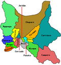
Tacopaya Municipality is the second municipal section of the Arque Province in the Cochabamba Department in Bolivia. Its seat is Tacopaya. At the time of census 2001 the municipality had 11,658 inhabitants. [1]

Contents

Geography

Some of the highest mountains of the municipality are listed below: [2] [3]

Cantons

The municipality is divided into two cantons. They are (their seats in parentheses):

Languages

The languages spoken in the Tacopaya Municipality are mainly Quechua and Spanish. [4]

LanguageInhabitants
Quechua 10,766
Aymara 123
Guaraní 3
Another native132
Spanish 3,309
Foreign9
Only native7,552
Native and Spanish3,236
Only Spanish74

Related Research Articles

Arani Province Province in Cochabamba Department, Bolivia

Arani is a province in Cochabamba Department, Bolivia. Its capital is Arani, situated about 53 km from Cochabamba. Arani is known for its bread and its artisan wickerwork.

Arque Province Province in Cochabamba Department, Bolivia

Arque is a rural province in Cochabamba Department in the eastern cordillera of the South American state of Bolivia.

Carrasco Province Province in Cochabamba Department, Bolivia

Carrasco is a province in the Cochabamba Department in central Bolivia. Its capital is Totora.

Mizque Province Province in Cochabamba, Bolivia

Mizque is a province in the Cochabamba Department, Bolivia. Its capital is Mizque.

Quillacollo Province Province in Cochabamba Department, Bolivia

Quillacollo is a province in the Cochabamba Department, Bolivia. It is known for its festival in August where people from all over Bolivia come and pay homage to the Virgin of Urqupiña. Quillacollo is said to be one of the fastest growing cities in Bolivia.

Tapacarí Province Province in Cochabamba Department, Bolivia

Tapacarí is a province in the Cochabamba Department, Bolivia. Its capital is Tapacarí. The province is located at a turnoff from the major highway that links Cochabamba and Oruro. It has traditionally been amongst the poorest in the department. Tapacarí Province and neighboring Arque Province are the two poorest of the 16 provinces that make up the department of Cochabamba.

Aroma Province Province in La Paz Department, Bolivia

Aroma is one of the twenty provinces of the Bolivian La Paz Department. It is situated in the southern parts of the department. Its seat is Sica Sica.

Ingavi Province Province in La Paz Department, Bolivia

Ingavi is a province in the La Paz Department in Bolivia. This is where the Battle of Ingavi occurred on November 18, 1841 and where the World Heritage Site of Tiwanaku is situated.

Inquisivi Province Province in La Paz, Bolivia

Inquisivi is a province in the La Paz Department in Bolivia. During the presidency of José Ballivián it was created on November 2, 1844. The capital of the province is Inquisivi.

Larecaja Province Province in La Paz Department, Bolivia

Larecaja is a province in the Bolivian La Paz Department. It was founded by Antonio José de Sucre on October 18, 1826. Its capital is Sorata.

Loayza Province Province in La Paz Department, Bolivia

Loayza or José Ramón Loayza is a province in the La Paz Department, Bolivia. Its seat is Luribay.

Tomás Frías Province Province in Potosí Department, Bolivia

Tomás Frías is a province in the northern parts of the Bolivian Potosí Department. Its capital is Potosí which is also the capital of the department. The province is named after the former president Tomás Frías Ametller.

Antonio Quijarro Province Province in Potosí Department, Bolivia

Antonio Quijarro is a province in the central parts of the Bolivian Potosí Department situated at the Salar de Uyuni. Its seat is Uyuni.

Eduardo Abaroa Province Province in Oruro, Bolivia

Eduardo Abaroa, also Eduardo Avaroa, or Challapata is a province in the southeastern parts of the Bolivian department of Oruro. Its seat is Challapata. The province was named after Colonel Eduardo Abaroa, Bolivia's hero of the War of the Pacific.

Pocona Municipality Municipality in Cochabamba Department, Bolivia

Pocona Municipality is the third municipal section of the Carrasco Province in the Cochabamba Department in Bolivia. Its seat is Pocona. At the time of census 2001 the municipality had 13,488 inhabitants.

Jesús de Machaca Municipality Municipality in La Paz Department, Bolivia

Jesús de Machaca Municipality is the sixth municipal section of the Ingavi Province in the La Paz Department in Bolivia. It was created by Law No. 2351 on May 7, 2002, during the presidency of Jorge Quiroga Ramírez. Its seat is Jesús de Machaca.

Cairoma Municipality is the fifth municipal section of the Loayza Province in the La Paz Department, Bolivia. Its seat is Cairoma.

Alalay Municipality Municipality in Cochabamba Department, Bolivia

Alalay Municipality is the third municipal section of the Mizque Province in the Cochabamba Department, Bolivia. Its seat is Alalay.

Arque Municipality Municipality in Cochabamba Department, Bolivia

Arque Municipality is the first municipal section of the Arque Province in the Cochabamba Department, Bolivia. Its seat is Arque. At the time of census 2001 the municipality had 11,806 inhabitants. It has the lowest HDI of Bolivia with 0.311.

Vila Vila Municipality Municipality in Cochabamba Department, Bolivia

Vila Vila or Wila Wila (Aymara) is the second municipal section of the Mizque Province in the Cochabamba Department, Bolivia. Its seat is Vila Vila.

References

  1. Instituto Nacional de Estadística Bolivia (INE) 2001 Archived 2009-10-27 at the Wayback Machine (Spanish)
  2. Bolivia 1:100,000 Tarata 3635, Map prepared and published by the Defense Mapping Agency, Hydrographic/Topographic Center, Bethesda, MD
  3. "Tacopaya". INE, Bolivia. Retrieved March 30, 2016.
  4. obd.descentralizacion.gov.bo / Observatorio Bolivia Democrático Archived 2009-02-18 at the Wayback Machine (Spanish)


Coordinates: 17°49′00″S66°39′00″W / 17.8167°S 66.65°W / -17.8167; -66.65