Cocapata Municipality

Last updated
Cocapata Municipality
Kukapata
Municipality
Bolivia Cochabamba Ayopaya.png
Cochabamba Bolivia Ayopaya.png
Bolivia adm location map.svg
Red pog.svg
Cocapata Municipality
Location within Bolivia
Coordinates: 16°40′S66°30′W / 16.667°S 66.500°W / -16.667; -66.500
Country Bolivia
Department Cochabamba Department
Province Ayopaya Province
FoundationFebruary 6, 2009
Seat Cocapata
Time zone UTC-4 (BOT)

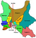
Cocapata Municipality (Quechua : Kukapata) is the third municipal section of the Ayopaya Province in the Cochabamba Department in central Bolivia. [1] [2] Its seat Cocapata had 411 inhabitants at the time of census 2001. [3]

Cocapata has many tourist attractions, as rock art (painting rocks) andean bear o (kucumari) the wild vicuñas in the region altamachi, many natural lakes which it has fish truchas and a variety of cultural heritage.

See also

Related Research Articles

<span class="mw-page-title-main">Bolivia</span> Country in South America

Bolivia, officially the Plurinational State of Bolivia, is a landlocked country located in western-central South America. It is bordered by Brazil to the north and east, Paraguay to the southeast, Argentina to the south, Chile to the southwest, and Peru to the west. The seat of government and administrative capital is La Paz, which contains the executive, legislative, and electoral branches of government, while the constitutional capital is Sucre, the seat of the judiciary. The largest city and principal industrial center is Santa Cruz de la Sierra, located on the Llanos Orientales, a mostly flat region in the east of the country.

<span class="mw-page-title-main">Santa Cruz de la Sierra</span> Largest city in Bolivia

Santa Cruz de la Sierra, commonly known as Santa Cruz, is the largest city in Bolivia and the capital of the Santa Cruz department.

<span class="mw-page-title-main">Cochabamba Department</span> Department of Bolivia

Cochabamba, from Quechua qucha or qhucha, meaning "lake", pampa meaning "plain", is one of the nine departments of Bolivia. It is known to be the "granary" of the country because of its variety of agricultural products from its geographical position. It has an area of 55,631 km2. Its population in the 2012 census was 1,758,143. Its capital is the city of Cochabamba, known as the "City of Eternal Spring" and "The Garden City" because of its spring-like temperatures all year.

<span class="mw-page-title-main">Cochabamba</span> City & Municipality in Bolivia

Cochabamba is a city and municipality in central Bolivia in a valley in the Andes mountain range. It is the capital of the Cochabamba Department and the fourth largest city in Bolivia, with a population of 630,587 according to the 2012 Bolivian census. Its name is from a compound of the Quechua words qucha "lake" and pampa, "open plain." Residents of the city and the surrounding areas are commonly referred to as cochalas or, more formally, cochabambinos.

<span class="mw-page-title-main">Ayopaya Province</span> Province of Bolivia

Ayopaya is a province in the Cochabamba Department, Bolivia. Its capital is Ayopaya.

<span class="mw-page-title-main">Afro-Bolivians</span> Ethnic group in Bolivia

Afro-Bolivians are Bolivian people of Sub-Saharan African heritage and therefore the descriptive "Afro-Bolivian" may refer to historical or cultural elements in Bolivia thought to emanate from their community. It can also refer to the combining of African and other cultural elements found in Bolivian society such as religion, music, language, the arts, and class culture. The Afro-Bolivians are recognized as one of the constituent ethnic groups of Bolivia by the country's government, and are ceremonially led by a king who traces his descent back to a line of monarchs that reigned in Africa during the medieval period. They numbered 432,000 according to the 2012 census.

The Yorkshire Ramblers' Club (YRC) is the second-oldest mountaineering club in England, the oldest being the Alpine Club.

Jatun Q'asa is a mountain in the Tunari mountain range of the Bolivian Andes, about 5,025 m (16,486 ft) high. It is situated north-west of Cochabamba in the Cochabamba Department, Quillacollo Province, in the west of the Quillacollo Municipality.

Puma Apachita is a mountain in the Tunari mountain range of the Bolivian Andes, about 4,920 m (16,142 ft) high. It is situated in the Cochabamba Department, Quillacollo Province, Quillacollo Municipality, northwest of Cochabamba. Puma Apachita lies southeast of Jatun Q'asa.

Tunari is a mountain in the Tunari mountain range of the Bolivian Andes, about 5,023 m (16,480 ft) high. It is situated in the Cochabamba Department, Quillacollo Province, Quillacollo Municipality, northwest of Quillacollo. Tunari lies southeast of Wayna Tunari.

Wari Warini is a mountain in the Bolivian Andes, about 4,832 m (15,853 ft) high. It is situated in the Cochabamba Department, Quillacollo Province, Quillacollo Municipality, east of the Ipilla Mayu.

Pirwata is a 5,060-metre-high (16,600 ft) mountain in the Bolivian Andes. It is located in the Cochabamba Department, on the border of the Ayopaya Province, Morochata Municipality, and the Quillacollo Province, Quillacollo Municipality.

Waka P'iqi is a 4,578-metre-high (15,020 ft) mountain in the Bolivian Andes. It is located in the Cochabamba Department, Ayopaya Province, Cocapata Municipality, west of the village of Chorito. Wak'a P'iqi lies at the left bank of the Jatun Mayu.

Llamayuq Q'asa is a mountain in the Bolivian Andes which reaches a height of approximately 4,640 m (15,220 ft). It is located in the Cochabamba Department, Ayopaya Province, Cocapata Municipality. Llamayuq Q'asa lies northeast of a lake named Wallatani Quta.

Ch'uñu Pata is a mountain in the Bolivian Andes which reaches a height of approximately 4,560 m (14,960 ft). It is located in the Cochabamba Department, Ayopaya Province, Cocapata Municipality. Ch'uñu Pata lies east of the Sinturani Lake.

P'iq'iñ Q'ara is a mountain in the Bolivian Andes which reaches a height of approximately 4,480 m (14,700 ft). It is located in the Cochabamba Department, Ayopaya Province, Cocapata Municipality. It lies northeast of the two lakes named Iskay Qucha.

Turi Turini is a mountain in the Bolivian Andes which reaches a height of approximately 4,640 m (15,220 ft). It is located in the Cochabamba Department, Ayopaya Province, Morochata Municipality, southwest of the village of Chorito.

Inka Q'asa is a mountain in the Bolivian Andes which reaches a height of approximately 4,160 m (13,650 ft). It is located in the Cochabamba Department, Ayopaya Province, Morochata Municipality. The Ch'uya Mayu originates west of the mountain. It flows to the west as a left tributary of the Río Negro.

Cocapata is a locality in the Cochabamba Department in central Bolivia. It is the seat of the Cocapata Municipality, the third municipal section of the Ayopaya Province. At the time of 2012 census, it had a population of 401.

<span class="mw-page-title-main">Kanata Metropolitan Area</span> Conurbation in Bolivia

The Kanata Metropolitan Area is the Metropolitan Region of the Department of Cochabamba. The region is made up of the municipalities of Cochabamba, Colcapirhua, Quillacollo, Sacaba, Sipe Sipe, Tiquipaya and Vinto, adding a total of seven con-urbanized municipalities. It limits to the north with the municipalities of Cocapata and Villa Tunari, to the west with the municipalities of Morochata and Tapacarí to the south with the municipalities of Arbieto, Arque, Capinota, San Benito, Santiváñez, Sicaya and Tolata to the east with the municipalities of Colomi and Tiraque. being the penultimate included as part of this region in its plans for future development, the municipalities of the metropolitan area are arranged in an east–west direction and vice versa, structured by the most important road in the country, Route 4. With a total area of 2,611 km2 where approximately 1.5 million inhabitants coexist.

References

  1. www.descentralizacion.org.bo [ permanent dead link ] (Spanish)
  2. www.bolivia.com (Spanish)
  3. Instituto Nacional de Estadistica de Bolivia Archived October 27, 2009, at the Wayback Machine (Spanish)