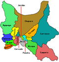
Omereque

Last updated
Omereque
Town
Bolivia adm location map.svg
Red pog.svg
Omereque
Location within Bolivia
Coordinates: 18°06′24″S64°54′26″W / 18.10667°S 64.90722°W / -18.10667; -64.90722 Coordinates: 18°06′24″S64°54′26″W / 18.10667°S 64.90722°W / -18.10667; -64.90722
CountryBandera de Bolivia (Estado).svg  Bolivia
Department Cochabamba Department
Province Narciso Campero Province
Municipality Omereque Municipality
Elevation
5,210 ft (1,588 m)
Population
 (2001)
  Total6,071
Time zone UTC-4 (BOT)

Omereque is a location in the Cochabamba Department in central Bolivia. It is the seat of the Omereque Municipality, the third municipal section of the Narciso Campero Province.

The archeological site Fuerte de Samaipata is about 115 km away from the town. It is about 187 km away from the city of Potosí. [1]

Related Research Articles

Karabük Province Province of Turkey in West Black Sea

Karabük Province is a landlocked province in the northern part of Anatolia, located about 200 km (124 mi) north of Ankara, 115 km (71 mi) away from Zonguldak and 113 km (70 mi) away from Kastamonu. In 2010 it had a population of 227,610. The main city is Karabük which is located about 100 km (62 mi) south of the Black Sea coast.

Karur City in Tamil Nadu, India

Karur is a city in the Indian state of Tamil Nadu. Karur is the administrative headquarters of Karur district. It is located on the banks of River Amaravathi, Kaveri and Noyyal. Karur is well known for the export of Home Textile products to USA, UK, Australia, Europe and many more countries. It is situated at about 395 kilometers southwest of the state capital Chennai, 75 km from Tiruchirapalli, 120 km away from Coimbatore, 295 km away from Bengaluru and 300 km away from Kochi.

Ermelo, Mpumalanga Place in Mpumalanga, South Africa

Ermelo is the educational, industrial and commercial town of the 7,750 km2 Gert Sibande District Municipality in Mpumalanga province, Republic of South Africa. It is both a mixed agriculture and mining region. It is located 210 km east of Johannesburg.

Sangareddy City in Telangana, India

Sangareddy, is a city and district headquarters of the Sangareddy district in the Indian state of Telangana. It was named after the ruler Sanga, who was the son of Rani Shankaramba, a ruler of Medak during the period of Nizams.

<span class="mw-page-title-main">Mattanur</span> Municipality in Kerala, India

Mattanur, also spelled Mattannur, is a town, municipality, and an aerotropolis in Kannur district, Kerala, India. Mattanur is about 27 km east of Kannur and Thalassery, two major towns of the district.

<span class="mw-page-title-main">Kuthuparamba</span> Municipality in Kerala, India

Kuthuparamba is a town and a municipality in the Kannur district, state of Kerala, India. It is about 24 km south east of Kannur and 14 km east of Thalassery.

Dryanovo Place in Gabrovo, Bulgaria

Dryanovo is a Bulgarian town situated at the northern foot of the Balkan Mountains in Gabrovo Province; amphitheatrically along the two banks of Dryanovo River, a tributary to the Yantra River. The town is a centre of the homonymous Dryanovo Municipality, which is composed of 62 villages, hamlets and huts picturesquely spread out of the mountain folds. As of 2015, it has a population of 7,968. In 2009, it was 8,043.

Chavakkad Town in Kerala, India

Chavakkad, formerly Chowghat, is a municipality in Thrissur district of Kerala state in India. It is a suburban town of Thrissur city. Chavakkad is noted for its beach and fishing. It lies on National Highway 66 is located about 75 km (47 mi) north of the city of Kochi, 25 km (16 mi) northwest of Thrissur, and 24 km (15 mi) south of Ponnani.

Chomu is a municipality in Jaipur district in the state of Rajasthan, India.

Panoor is a Municipality in the district of Kannur in the state of Kerala, India. The town is the main market place for the farmer communities in the surrounding regions. Panoor is one of the main suburbs of the City of Thalassery. Panoor got municipal status when the Government of Kerala decided to upgrade Panoor Grama Panchayat and added with other Panchayats, as Panoor Municipality in 2015.

Sadasivpet is a town in Sangareddy district of the Indian state of Telangana.

Iyyappanthangal is a western neighborhood of Chennai, Tamilnadu, India. It comes under Mangadu Municipality of Chennai Metropolitan Area (CMA), governed by CMDA. It is located 20 kilometres (12 mi) away from Fort St George on the Mount-Poonamallee Road. The nearest railway stations are at Guindy about 11 kilometres (6.8 mi) away and Avadi about 12 kilometres (7.5 mi) away. The Porur Junction where a much needed road overbridge on the busy Guindy–Poonamallee stretch was built after a very long delay of nearly five years is just about 2 km from Iyyapanthangal and the Poonamallee Junction is just about 6 km from the town.

Municipalities of Bolivia Administrative division of Bolivia

Municipalities in Bolivia are administrative divisions of the entire national territory governed by local elections. Municipalities are the third level of administrative divisions, below departments and provinces. Some of the provinces consist of only one municipality. In these cases the municipalities are identical to the provinces they belong to.

Pargi is a town and municipality in the Vikarabad district of the Indian state of Telangana. It is located in Parigi mandal of Parigi division

Paineiras

Paineiras is a municipality in the midwest of the Brazilian state of Minas Gerais. As of 2020, the population was 4,462 in a total area of 638 km². It became a municipality in 1962.

Kattakada Town in Kerala, India

Kattakada is a Taluk in Thiruvananthapuram district of Kerala. It is situated 13km north of Neyyattinkara town, 18km south of Nedumangad town and 20km east of Capital City Thiruvananthapuram.

Uruana de Minas

Uruana de Minas is a municipality in the north of the Brazilian state of Minas Gerais. As of 2020 the population was 3,260 inhabitants in a total area of 589 km².

Pedda Amberpet is a Municipality in Rangareddy district, Telangana, India. It comes under Hayathnagar Mandal.

Moulivakkam is a neighbourhood of Chennai. It is situated 18 km south-west of Chennai on the Arcot Road. It comes under Mangadu municipality and is bounded by Porur on the north, Kolappakkam on the south, Mugalivakkam on the east and Manapakkam on the south-east directions. The nearest railway station is at Guindy, which is about 6 kilometres away. The Porur junction is around 3 km away and Kathipara Junction is around 5 km away.

Bargachhia is a census town of Nalikul Purba Gram Panchayat in Haripal CD Block in Chandannagore subdivision of Hooghly district in the Indian state of West Bengal.

References