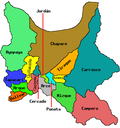
Quillacollo Municipality

Last updated
Quillacollo Municipality
Municipality
Vista de la ciudad de Quillacollo.JPG
Quillacollo
Bandera de Quillacollo.png
Flag
Bolivia adm location map.svg
Red pog.svg
Quillacollo Municipality
Location of the Quillacollo Municipality within Bolivia
Coordinates: 17°15′0″S66°20′0″W / 17.25000°S 66.33333°W / -17.25000; -66.33333 Coordinates: 17°15′0″S66°20′0″W / 17.25000°S 66.33333°W / -17.25000; -66.33333
Country Flag of Bolivia.svg Bolivia
Department Cochabamba Department
Province Quillacollo Province
Seat Quillacollo
Government
  MayorHugo Cesar Miguel Candia (2007)
  PresidentMarcelo Galindo Gómez (2007)
Area
  Total220 sq mi (560 km2)
Population
 (2001)
  Total104,206
Time zone UTC-4 (BOT)

Quillacollo Municipality is the first municipal section of the Quillacollo Province in the Cochabamba Department, Bolivia. Its capital is Quillacollo. At the time of census 2001 the municipality had 104,206 inhabitants. [1]

Contents

Geography

One of the highest peaks of the municipality is Tunari at 5,023 m (16,480 ft). Other mountains are listed below: [2] [3] [4]

Subdivision

Quillacollo Municipality is divided into cantons.

KantonInhabitants (2001) [5] SeatInhabitants (2001)
Quillacollo Canton99,276 Quillacollo 74,980
El Paso Canton4,930El Paso3,344

See also


Related Research Articles

Ayopaya Province

Ayopaya is a province in the Cochabamba Department, Bolivia. Its capital is Ayopaya.

Quillacollo Province Province in Cochabamba Department, Bolivia

Quillacollo is a province in the Cochabamba Department, Bolivia. It is known for its festival in August where people from all over Bolivia come and pay homage to the Virgin of Urqupiña. Quillacollo is said to be one of the fastest growing cities in Bolivia.

Tapacarí Province Province in Cochabamba Department, Bolivia

Tapacarí is a province in the Cochabamba Department, Bolivia. Its capital is Tapacarí. The province is located at a turnoff from the major highway that links Cochabamba and Oruro. It has traditionally been amongst the poorest in the department. Tapacarí Province and neighboring Arque Province are the two poorest of the 16 provinces that make up the department of Cochabamba.

Inquisivi Province Province in La Paz, Bolivia

Inquisivi is a province in the La Paz Department in Bolivia. During the presidency of José Ballivián it was created on November 2, 1844. The capital of the province is Inquisivi.

Nor Chichas Province Province in Potosí Department, Bolivia

Nor Chichas is a province in the Eastern parts of the Bolivian Potosí Department. Its seat is Cotagaita.

Nor Cinti Province Province in Chuquisaca Department, Bolivia

Nor Cinti is a province in the Bolivian department of Chuquisaca. Its capital is Camargo.

Chayanta Province Province in Potosí Department, Bolivia

Chayanta is a province in the northern parts of the Bolivian Potosí Department. Its capital is Colquechaca.

Pocona Municipality Municipality in Cochabamba Department, Bolivia

Pocona Municipality is the third municipal section of the Carrasco Province in the Cochabamba Department in Bolivia. Its seat is Pocona. At the time of census 2001 the municipality had 13,488 inhabitants.

Sipe Sipe Municipality Municipality in Cochabamba Department, Bolivia

Sipe Sipe Municipality is the second municipal section of the Quillacollo Province in the Cochabamba Department, Bolivia. Its seat is Sipe Sipe. At the time of census 2001 the municipality had 31,337 inhabitants.

Alalay Municipality Municipality in Cochabamba Department, Bolivia

Alalay Municipality is the third municipal section of the Mizque Province in the Cochabamba Department, Bolivia. Its seat is Alalay.

Mizque Municipality Municipality in Cochabamba Department, Bolivia

Mizque Municipality is the first municipal section of the Mizque Province in the Cochabamba Department, Bolivia. Its seat is Mizque.

Morochata Municipality is the second municipal section of the Ayopaya Province in the Cochabamba Department, Bolivia. Its seat is Morochata.

Vila Vila Municipality Municipality in Cochabamba Department, Bolivia

Vila Vila or Wila Wila (Aymara) is the second municipal section of the Mizque Province in the Cochabamba Department, Bolivia. Its seat is Vila Vila.

Villa Tunari Municipality Municipality in Cochabamba Department, Bolivia

Villa Tunari Municipality is the third municipal section of the Chapare Province in the Cochabamba Department, Bolivia. Its seat is Villa Tunari. The population grew from 52,886 to 71,146 during 2001 to 2012 according to the census. Only 8,692 of the population are urban and are concentrated in the small towns of Villa Tunari (3.213), Eterazama (3,359) and Villa 14 the Septiembre (2,123). The municipality is famous for tourist especially the Villa Tunari town where the tourist industry is concentrated with infrastructure, and also because of the closeness of the Machia Park.

Vinto Municipality Municipality in Cochabamba Department, Bolivia

Vinto Municipality is the fourth municipal section of the Quillacollo Province in the Cochabamba Department, Bolivia. Its seat is Vinto.

Jatun Qasa (Cochabamba) Mountain in Bolivia

Jatun Q'asa is a mountain in the Tunari mountain range of the Bolivian Andes, about 5,025 m (16,486 ft) high. It is situated north-west of Cochabamba in the Cochabamba Department, Quillacollo Province, in the west of the Quillacollo Municipality.

Puma Apachita

Puma Apachita is a mountain in the Tunari mountain range of the Bolivian Andes, about 4,920 m (16,142 ft) high. It is situated in the Cochabamba Department, Quillacollo Province, Quillacollo Municipality, northwest of Cochabamba. Puma Apachita lies southeast of Jatun Q'asa.

Tunari (Bolivia)

Tunari is a mountain in the Tunari mountain range of the Bolivian Andes, about 5,023 m (16,480 ft) high. It is situated in the Cochabamba Department, Quillacollo Province, Quillacollo Municipality, northwest of Quillacollo. Tunari lies southeast of Wayna Tunari.

Wayna Tunari

Wayna Tunari is a mountain in the Tunari mountain range of the Bolivian Andes which reaches a height of approximately 4,800 m (15,748 ft). It is situated in the Cochabamba Department, Ayopaya Province, Morochata Municipality, and in the Quillacollo Province, Vinto Municipality. It lies northwest of Tunari.

Jukumarini (Cochabamba)

Jukumarini is a mountain in the Tunari mountain range of the Bolivian Andes. It is situated in the Cochabamba Department, Quillacollo Province, Vinto Municipality, south of the mountain Tunari.

References

  1. (in Spanish) Instituto Nacional de Estadística Archived November 13, 2009, at the Wayback Machine
  2. Bolivian IGM map 1:50,000 Quillacollo 6341-IV
  3. Bolivian IGM map 1:100,000 Quillacollo 3636
  4. "Quillacollo". INE, Bolivia. Archived from the original on April 9, 2016. Retrieved April 1, 2016.
  5. (in Spanish) Instituto Nacional de Estadística Archived November 13, 2009, at the Wayback Machine