
Arque is a rural province in Cochabamba Department in the eastern cordillera of the South American state of Bolivia.
Puerto Suárez is an inland river port and municipality in Santa Cruz Department, Bolivia. It is located 10 km west of the border with Brazil.
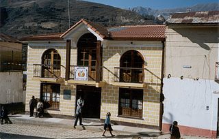
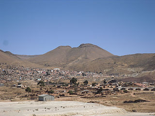
Ayopaya or Independencia is a town in the Cochabamba Department, Bolivia. It is the capital of the Ayopaya Province and Ayopaya Municipality. At the time of census 2001 it had a population of 2,014.

Mizque, Misk'i is a town in the Cochabamba Department, Bolivia. It is the capital of the Mizque Province. Mizque is located in the valley of the Mizque River, one of the main tributaries of the Río Grande.

Punata is the capital of Punata Province and Punata Municipality in Cochabamba Department, Bolivia. At the time of census 2012 it had a population of 19,559 inhabitants and at the census 2012 the populations rose to 28.707 inhabitants. People from Punata and surrounding areas used to be called “Vallunos” meaning coming from the valleys of Punata and other surrounding small towns. Punata is renowned for its wonderful agricultural market held every Tuesday where people from surrounding towns and rural villages come to sell and buy.
Tiraque is a location in the Cochabamba Department, Bolivia, and capital of the Tiraque Province. At the time of census 2001 it had a population of 1,906.

Sacaba is a capital city and a municipality in the Bolivian province of Chapare. The city, located 13 kilometers eastward from Cochabamba, is the second largest city in the Cochabamba Department after Cochabamba city. Post-colonial architecture may be seen in the inner part of Sacaba; however, some has been destroyed due to lack of municipal care.
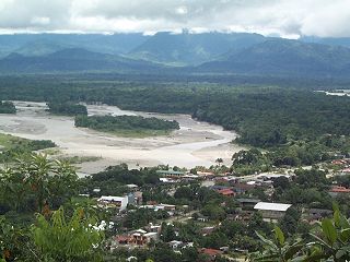
Villa Tunari or Tunari is a location in the department of Cochabamba, Bolivia. It is the seat of the Villa Tunari Municipality, the third municipal section of the Chapare Province. According to the census 2012 the population was 3,213 in the town which is an increment from 2,510 registered during the 2001 census.
Arque River is one of the headwaters of Río Grande and Mamoré River in Bolivia. The Arque has its source in the Kimsa Cruz mountain range on the western slope of the mountain Waylluma at 17°41′0″S66°43′30″W, 50 km northeast of the mining city Oruro, and 65 km southwest of Cochabamba.

Entre Ríos is a town in the Bolivian Tarija Department.
Santa Ana del Yacuma is a town in the Beni Department in north-eastern Bolivia.

Totora, Tutura or T'utura is a town in the Carrasco Province of the Cochabamba Department in Bolivia. It is the capital and most-populous place of the Totora Municipality. As of the 2012 census, the population is 1,925. The first settlers were the Inca. Totora was officially settled in 1876, and declared a town by the Government of Bolivia in 1894.
Aiquile is a town in the Cochabamba Department, Bolivia. It is the capital of the Narciso Campero Province and Aiquile Municipality. Most of its population is Quechua, and its residents are reputed to be the best charango makers in the country.
Anzaldo is a location in the Cochabamba Department in central Bolivia. It is the seat of the Anzaldo Municipality, the second municipal section of the Esteban Arce Province.
Colomi is a locality in the Cochabamba Department in central Bolivia. It is the seat of the Colomi Municipality, the second municipal section of the Chapare Province. At the time of census 2001 it had a population of 3,699.
Patacamaya or Patak Amaya (Aymara) is a city in Bolivia, situated in the La Paz Department. It is the seat of the Patacamaya Municipality, the fifth municipal section of the Aroma Province. Patacamaya lies in the Altiplano, approximately 100 km southeast of La Paz. It contains the intersection between 'Carretera 1' which goes from La Paz to Oruro, as well as Cochabamba, and the 'Carretera Arica-La Paz'. The 'Tambo Quemado' highway is one of the most important international roads that travels through Bolivia.
Pocona is a location in the Cochabamba Department in central Bolivia. It is the seat of the Pocona Municipality, the third municipal section of the Carrasco Province. At the time of census 2001 it had a population of 244.

Tiquipaya is a town in the Cochabamba Department in central Bolivia. It is the seat of the Tiquipaya Municipality, the third municipal section of the Quillacollo Province. It is known as the "city of flowers". The town hosts many dairy farmers and is known as a well visited and productive zone with surprising climatic diversity due to valleys, high plains, and sub-tropical regions. The town homes the Universidad del Valle (UNIVALLE) that helps in the economy of the region as a result of the services required. Around 2% of the population of Tiquipaya was born in a foreign country. Most of them are students from Brasil.
San Ramón is a small town in the Beni Department in Bolivia.
Llallagua or Llallawa is a town in the Potosí Department in Bolivia. It is the seat of the Llallagua Municipality, the third municipal section of the Rafael Bustillo Province.

