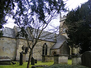
Combe Hay is a village and civil parish in the English county of Somerset. It falls within the Cotswolds Area of Outstanding Natural Beauty. The parish has a population of 147.

Bathampton is a village and civil parish 2 miles (3 km) east of Bath, England on the south bank of the River Avon. The parish has a population of 1,603.
Batheaston is a village and civil parish 2 miles (3.2 km) east of the English city of Bath, on the north bank of the River Avon. The parish had a population of 2,735 in 2011. The northern area of the parish, on the road to St Catherine, is an area known as Northend.
Camerton is a village and civil parish in Somerset, 6 miles (9.7 km) south west of Bath, lying on the Cam Brook. The parish has a population of 655.

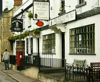
Freshford is a village and civil parish in the Avon valley 6 miles (10 km) south-east of Bath, in the county of Somerset, England. The parish has a population of 551. It is in the Cotswolds Area of Outstanding Natural Beauty (AONB), within the Green Belt and is in a conservation area.

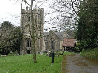
Wellow is a village and civil parish in Somerset, England, about 5 miles (8.0 km) south of Bath. The parish, which includes the hamlets of Twinhoe, White Ox Mead, Baggridge and part of Midford has a population of 529. The village itself falls within the southernmost boundary of the Cotswolds Area of Outstanding Natural Beauty and is recognised as having special architectural and historic interest, which led to it being designated as a Conservation Area in 1983.

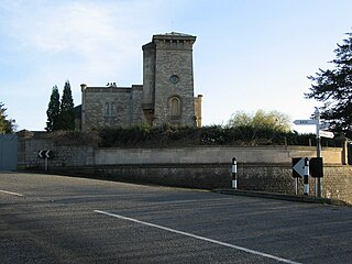
Newton St Loe is a small Somerset village and civil parish located close to the villages of Corston and Stanton Prior, between Bath and Bristol in England. The majority of the village is owned by the Duchy of Cornwall. The parish has a population of 681.
Kelston is a small village and civil parish in Somerset, 4 miles (6.4 km) north west of Bath, and 8 miles (12.9 km) east of Bristol, on the A431 road. It is situated just north of the River Avon, close to the Kelston and Saltford locks. The parish has a population of 248.

Priston is a civil parish and village 4 miles (6 km) south west of Bath in Bath and North East Somerset, which is within the English ceremonial county of Somerset. The parish includes the hamlet of Wilmington.
Compton Dando is a small village and civil parish on the River Chew in the affluent Chew Valley in England. It is in the Bath and North East Somerset council area and ceremonial county of Somerset, and lies 7 miles (11.3 km) from Bristol, 8 miles (12.9 km) from Bath, and 3 miles (4.8 km) from Keynsham.
Timsbury is a village and civil parish in England, in the Bath and North East Somerset unitary authority of the county of Somerset. It lies 8 miles (13 km) south-west of Bath, close to the Cam Brook river. The parish, which includes the hamlets of Radford and Wall Mead, and part of Meadgate hamlet, had a population of 2,624 in 2011.

Charlcombe is a civil parish and small village just north of Bath in the Bath and North East Somerset unitary authority, Somerset, England. The parish had a population of 422 in 2011, and includes the villages of Woolley and Langridge and the hamlet of Lansdown.

Dunkerton is a small village in the civil parish of Dunkerton and Tunley, 4 miles (6.4 km) north east of Radstock, and 5 miles (8.0 km) south west of Bath, in the Bath and North East Somerset unitary authority, Somerset, England. The parish has a population of 502.

Hinton Charterhouse is a small village and civil parish in the Bath and North East Somerset unitary authority, Somerset, England. The parish, which includes the village of Midford, has a population of 515.

Saltford is a large English village and civil parish in the Bath and North East Somerset unitary authority, Somerset. It lies between the cities of Bristol and Bath, and adjoins Keynsham on the same route. Saltford Manor House claims to be the oldest continuously occupied dwelling in England.

Shoscombe is a small village and civil parish in the valley of the Wellow Brook in north-east Somerset, about 7 miles (11 km) south of Bath, England. The parish has a population of 443.

Corston is a small village and civil parish close to the River Avon and situated on the A39 road in the Bath and North East Somerset unitary authority, Somerset, England. The parish has a population of 494.

Swainswick is a small village and civil parish, 3 miles (4.8 km) northeast of Bath, on the A46 in the Bath and North East Somerset unitary authority, Somerset, England. The parish has a population of 265. The village name was also spelled Sweyneswik and Sweyneswick in the early 13th to 14th Century.

North Stoke is a village within the civil parish of Kelston in the Bath and North East Somerset (BANES) unitary authority within the historic county of Somerset, England, and close to the border with South Gloucestershire. The parish has a population of 72.

The Grade I listed buildings in Somerset, England, demonstrate the history and diversity of its architecture. The ceremonial county of Somerset consists of a non-metropolitan county, administered by Somerset County Council, which is divided into five districts, and two unitary authorities. The districts of Somerset are West Somerset, South Somerset, Taunton Deane, Mendip and Sedgemoor. The two administratively independent unitary authorities, which were established on 1 April 1996 following the breakup of the county of Avon, are North Somerset and Bath and North East Somerset. These unitary authorities include areas that were once part of Somerset before the creation of Avon in 1974.


