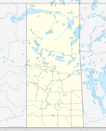
The Athabasca Basin is a region in the Canadian Shield of northern Saskatchewan and Alberta, Canada. It is best known as the world's leading source of high-grade uranium and currently supplies about 20% of the world's uranium.
Cigar Lake Airport is located 1 nautical mile south-west of Waterbury Lake, Saskatchewan, Canada in the Athabasca Basin. It serves the Cigar Lake Mine.
Collins Bay Airport is located on the west side of Wollaston Lake, on Collins Bay, near Collins Creek, Saskatchewan, Canada.
Davin Lake Airport, formerly TC LID: CKW6, was located adjacent to Davin Lake Lodge, a fly-in fishing lodge in northern Saskatchewan, Canada.
Dore Lake Airport is located adjacent to Dore Lake, Saskatchewan, Canada.
Key Lake Airport is a regional airport near the Key Lake mine in Saskatchewan, Canada.
Loon Lake Airport is located adjacent to Loon Lake, Saskatchewan, Canada. The airstrip is a grass runway suitable for small planes only, but the Saskatchewan Air Ambulance can land and take off there.
McArthur River Airport is located 1.5 nautical miles east of the McArthur River mine, Saskatchewan, Canada.
Wollaston Lake Airport is located adjacent to Wollaston Lake, Saskatchewan, Canada on the Hatchet Lake Dene Nation.
The Key Lake mine is a former uranium mine in Saskatchewan, Canada. It is 570 kilometres (350 mi) north of Saskatoon by air on the southern rim of the uranium-rich Athabasca Basin. Key Lake was initially developed to open-pit mine two nearby uranium ore deposits: the Gaertner deposit and the Deilmann deposit. Mining of this ore ceased in the late 1990s; the Key Lake mill now processes uranium ore from the McArthur River mine and from existing stockpiles on site. High-grade ore from McArthur river is blended with lower grade local rock before being passed through the mill. The mill has a permitted annual production capacity of 25 million pounds of U3O8. In addition, ammonium sulfate fertilizer is produced as a byproduct from used reagents. The pits of the mined out local deposits are being used as mill tailings management facilities.
Cluff Lake mine is decommissioned former uranium mine located in northern Saskatchewan, located 30 km east of the provincial border with Alberta and approximately 75 kilometres south of Lake Athabasca.

Regina Beach is a town in south central Saskatchewan, located on Highway 54, close to where Highway 11 intersects with the Qu'Appelle Valley.
Hatchet Lake Airport is located near Hatchet Lake, Saskatchewan, Canada.

Wollaston Lake is a lake in north-eastern Saskatchewan, Canada. It is 550 kilometres (340 mi) northeast of Prince Albert. With a surface area of 2,286 square kilometres (883 sq mi), it is the largest bifurcation lake in the world – that is, a lake that drains naturally in two directions.
Highway 995 is a provincial highway in the far north region of the Canadian province of Saskatchewan. It is one of the few highways in Saskatchewan that is completely isolated from the other highways. It is about 5 km (3 mi) long. Seasonal access is provided to Highway 905 by way of the Wollaston Lake Barge.

The Cigar Lake Mine is a large high-grade underground uranium mine, located in the uranium-rich Athabasca Basin of northern Saskatchewan, Canada, at the south-west corner of Waterbury Lake. The deposit, discovered in 1981, is second in size of high-grade deposits only to the nearby McArthur River mine. Other deposits, such as Olympic Dam in Australia, contain more uranium but at lower grades.
Axe Lake Aerodrome is located near the Axe Lake oil sands discovery in north-west Saskatchewan, Canada. The aerodrome is located near the border with Alberta, just south of Vande Veen Lake. The nearest highway is Highway 955 to the east. A gravel road connects the airport to the highway.
Orano Canada is a uranium mining, milling, and exploration company headquartered in Saskatoon, Saskatchewan, Canada. Orano is a subsidiary of the Orano Group, an international nuclear energy company headquartered in Paris, France with 16,000 employees worldwide.
Seabee Mine Aerodrome is located near Laonil Lake and serves the Seabee Gold Mine in Saskatchewan, Canada.


