The Mississippi River is the second-longest river and chief river of the second-largest drainage system on the North American continent, second only to the Hudson Bay drainage system. From its traditional source of Lake Itasca in northern Minnesota, it flows generally south for 2,320 miles (3,730 km) to the Mississippi River Delta in the Gulf of Mexico. With its many tributaries, the Mississippi's watershed drains all or parts of 32 U.S. states and two Canadian provinces between the Rocky and Appalachian mountains. The main stem is entirely within the United States; the total drainage basin is 1,151,000 sq mi (2,980,000 km2), of which only about one percent is in Canada. The Mississippi ranks as the fourth-longest river and fifteenth-largest river by discharge in the world. The river either borders or passes through the states of Minnesota, Wisconsin, Iowa, Illinois, Missouri, Kentucky, Tennessee, Arkansas, Mississippi, and Louisiana.

Saint Paul is the capital and second-most populous city of the U.S. state of Minnesota. As of 2018, the city's estimated population was 307,695. Saint Paul is the county seat of Ramsey County, the smallest and most densely populated county in Minnesota. The city lies mostly on the east bank of the Mississippi River in the area surrounding its point of confluence with the Minnesota River, and adjoins Minneapolis, the state's largest city. Known as the "Twin Cities", the two form the core of Minneapolis–Saint Paul, the 16th-largest metropolitan area in the United States, with about 3.6 million residents.
A county seat is an administrative center, seat of government, or capital city of a county or civil parish. The term is used in Canada, China, Romania, Taiwan and the United States. County towns have a similar function in the United Kingdom and Republic of Ireland, and historically in Jamaica.

Wabasha County is a county in the U.S. state of Minnesota. As of the 2010 United States Census, the population was 21,676. Its county seat is Wabasha.

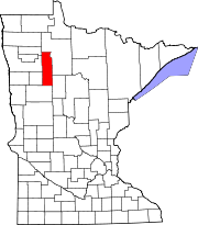
Clearwater County is a county in the state of Minnesota. As of the 2010 United States Census, the population was 8,695. Its county seat is Bagley.

Savage is a suburban city 15 miles (24 km) south-southwest of downtown Minneapolis in Scott County in the State of Minnesota. The city is situated on the south bank of the Minnesota River in a region commonly referred to as South of the River, comprising the southern portion of Minneapolis-St. Paul, the sixteenth largest metropolitan area in the United States. The population of Savage was 26,911 at the 2010 census.

La Crescent is a city in Houston and Winona counties in the U.S. state of Minnesota. The population was 4,830 at the 2010 census.

Jacobson is an unincorporated community in Ball Bluff Township, Aitkin County, Minnesota, United States.

Fort Snelling State Park is a state park of Minnesota, USA, at the confluence of the Mississippi and Minnesota rivers. Its most notable feature is the historic Fort Snelling, which dates from 1820. The fort itself is operated by the Minnesota Historical Society and requires a separate entrance fee. The bulk of the state park preserves the bottomland forest, rivers, and backwater lakes below the river bluffs. The park was opened in 1962. Both the State Park and Historic Fort are part of the Mississippi National River and Recreation Area, a National Park Service site.

John A. Latsch State Park is a 1,654-acre (7 km2) state park of Minnesota, USA, on the Mississippi River, 12 miles (19 km) northwest of Winona. The park contains three steep bluffs rising 500 feet (150 m) above the river which are named Mount Faith, Mount Hope, and Mount Charity. The park is nearly undeveloped, with a small walk-in campground and only one trail. It functions primarily as a wayside on U.S. Route 61, which runs between the river and the base of the bluffs. Lock and Dam No. 5 is adjacent to the park.

Walter Hughes Newton was a United States Representative from Minnesota; born in Minneapolis, Hennepin County, Minnesota; attended the public schools and was graduated from the law department of the University of Minnesota at Minneapolis in 1905; was admitted to the bar the same year and commenced practice in Minneapolis, Minnesota; first assistant prosecuting attorney of Hennepin County 1914 – 1918; elected as a Republican to the 66th, 67th, 68th, 69th, 70th, and 71st congresses, from March 4, 1919, until his resignation on June 30, 1929.

Coldwater Spring is a spring in Hennepin County, Minnesota, United States, that is considered a sacred site by the local Dakota, and was also the site of Camp Coldwater, an early European settlement in the state of Minnesota. Coldwater Spring is located adjacent to the Mississippi River directly south of Minnehaha Park, and is currently managed by the National Park Service as part of the Mississippi National River and Recreation Area.

The Christmas Kettle is The Salvation Army's most famous street campaign. It is most recognized during the Christmas season through its volunteers who stand outside of businesses and play or sing Christmas carols, or ring bells to inspire passersby to place donations of cash and checks inside the trademark red kettles.
Blanchard Dam is a dam across the Mississippi River, in Bellevue Township and Swan River Township, Morrison County, near the city of Royalton, Minnesota. Blanchard is a hydroelectric station owned and operated by Minnesota Power. The dam sits slightly upriver from the former Soo Line rail bridge. The bridge now carries a recreational trail.

The Saint Paul Municipal Grain Terminal, also known as the head house and sack house, sits on piers over the Mississippi River in Saint Paul, Minnesota, United States. It was built between 1927 and 1931 as part of the Equity Cooperative Exchange and is a remnant of Saint Paul's early history as a Mississippi River port city. The Saint Paul Municipal Grain Terminal was added to the National Register of Historic Places in 2004.

Maple Springs is an unincorporated community in Pepin Township, Wabasha County, Minnesota, United States, along the Mississippi River and Lake Pepin. The Mississippi River and King Creek meet at Maple Springs.
Reads Landing is an unincorporated community in Pepin Township, Wabasha County, Minnesota, United States, along the Mississippi River.
Camp Lacupolis is an unincorporated community in Pepin Township, Wabasha County, Minnesota, United States, along the Mississippi River and Lake Pepin.
The Mississippi River and its tributaries have flooded on numerous occasions. This is a list of major floods.

Mound Landing is a ghost town in Bolivar County, Mississippi, United States.