Coleharbor, North Dakota

Last updated

Coleharbor, North Dakota
Coleharbor, North Dakota 7-17-2009.jpg
The former 83 Cafe in Coleharbor (now gone)
ND McLean County Coleharbor.svg
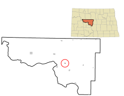
Location of Coleharbor, North Dakota
Coordinates: 47°32′33″N101°13′17″W / 47.54250°N 101.22139°W / 47.54250; -101.22139
CountryUnited States
State North Dakota
County McLean
Founded1904
Area
[1]
  Total
0.18 sq mi (0.47 km2)
  Land0.18 sq mi (0.47 km2)
  Water0.00 sq mi (0.00 km2)
Elevation
[2]
1,903 ft (580 m)
Population
 (2020) [3]
  Total
59
  Estimate 
(2022) [4]
65
  Density324.18/sq mi (124.88/km2)
Time zone UTC-6 (Central (CST))
  Summer (DST) UTC-5 (CDT)
ZIP code
58531
Area code 701
FIPS code 38-15140
GNIS feature ID1035974 [2]

Coleharbor is a city in McLean County, North Dakota, United States. The population was 59 at the 2020 census. [3] Coleharbor was founded in 1904.

Contents

History

Coleharbor was laid out in 1904 when the railroad was extended to that point. [5] The name combines that of a Soo Railroad official (W. A. Cole) and a reference to an older site on the Missouri River a few miles to the southwest (Coal Harbor). [6] In July 2006, three storms converged above the town, unleashing a derecho that resulted in significant damage around town, even blowing down part of the former school building (made of brick), while leaving the nearby grain elevator intact. [7]

Geography

According to the United States Census Bureau, the city has a total area of 0.19 square miles (0.49 km2), all land. [8]

Demographics

Historical population
CensusPop.Note
1950 315
1960 210−33.3%
1970 112−46.7%
1980 15033.9%
1990 88−41.3%
2000 10620.5%
2010 79−25.5%
2020 59−25.3%
2022 (est.)65 [4] 10.2%
U.S. Decennial Census [9]
2020 Census [3]

2010 census

As of the census of 2010, there were 79 people, 37 households, and 22 families residing in the city. The population density was 415.8 inhabitants per square mile (160.5/km2). There were 51 housing units at an average density of 268.4 per square mile (103.6/km2). The racial makeup of the city was 96.2% White, 2.5% from other races, and 1.3% from two or more races. Hispanic or Latino of any race were 5.1% of the population.

There were 37 households, of which 27.0% had children under the age of 18 living with them, 51.4% were married couples living together, 8.1% had a female householder with no husband present, and 40.5% were non-families. 32.4% of all households were made up of individuals, and 8.1% had someone living alone who was 65 years of age or older. The average household size was 2.14 and the average family size was 2.77.

The median age in the city was 47.5 years. 20.3% of residents were under the age of 18; 3.8% were between the ages of 18 and 24; 20.3% were from 25 to 44; 35.4% were from 45 to 64; and 20.3% were 65 years of age or older. The gender makeup of the city was 55.7% male and 44.3% female.

2000 census

As of the census of 2000, there were 106 people, 42 households, and 30 families residing in the city. The population density was 581.2 inhabitants per square mile (224.4/km2). There were 56 housing units at an average density of 307.0 per square mile (118.5/km2). The racial makeup of the city was 98.11% White, 0.94% Native American, and 0.94% from two or more races.

There were 42 households, out of which 31.0% had children under the age of 18 living with them, 64.3% were married couples living together, 9.5% had a female householder with no husband present, and 26.2% were non-families. 21.4% of all households were made up of individuals, and 9.5% had someone living alone who was 65 years of age or older. The average household size was 2.52 and the average family size was 2.94.

In the city, the population was spread out, with 25.5% under the age of 18, 7.5% from 18 to 24, 24.5% from 25 to 44, 26.4% from 45 to 64, and 16.0% who were 65 years of age or older. The median age was 43 years. For every 100 females, there were 130.4 males. For every 100 females age 18 and over, there were 113.5 males.

The median income for a household in the city was $33,750, and the median income for a family was $40,313. Males had a median income of $27,000 versus $13,750 for females. The per capita income for the city was $13,845. There were 6.9% of families and 12.1% of the population living below the poverty line, including 15.4% of under eighteens and none of those over 64.

Climate

This climatic region is typified by large seasonal temperature differences, with warm to hot (and often humid) summers and cold (sometimes severely cold) winters. According to the Köppen Climate Classification system, Coleharbor has a humid continental climate, abbreviated "Dfb" on climate maps. [10]

Education

It is within the Underwood Public School District 8. [11]

Related Research Articles

<span class="mw-page-title-main">Hettinger, North Dakota</span> City in North Dakota, United States

Hettinger is a city in and the county seat of Adams County, North Dakota, United States. The population was 1,074 at the 2020 census.

<span class="mw-page-title-main">Bowman, North Dakota</span> City in North Dakota, United States

Bowman is a city in and the county seat of Bowman County, North Dakota, United States. The population was 1,470 at the 2020 census.

<span class="mw-page-title-main">Flaxton, North Dakota</span> City in North Dakota, United States

Flaxton is a city in Burke County, North Dakota, United States. The population was 60 at the 2020 census. Flaxton was founded in 1900 and was named because the predominant crop in the area is flax.

<span class="mw-page-title-main">Ambrose, North Dakota</span> City in North Dakota, United States

Ambrose is a city in Divide County, North Dakota, United States. The population was 24 at the 2020 census. Ambrose was founded in 1906.

<span class="mw-page-title-main">Napoleon, North Dakota</span> City in North Dakota, United States

Napoleon is a city in Logan County, North Dakota, United States. It is the county seat of Logan County. The population was 749 at the 2020 census.

<span class="mw-page-title-main">Drake, North Dakota</span> City in North Dakota, United States

Drake is a city in McHenry County, North Dakota, United States. The population was 292 at the 2020 census. It is part of the Minot Micropolitan Statistical Area. Drake was founded in 1902 and named after Herman Drake, a settler.

<span class="mw-page-title-main">Upham, North Dakota</span> City in North Dakota, United States

Upham is a city in McHenry County, North Dakota, United States. The population was 135 at the 2020 census. It is part of the Minot Micropolitan Statistical Area. Upham was founded in 1905.

<span class="mw-page-title-main">Alexander, North Dakota</span> City in North Dakota, United States

Alexander is a city in McKenzie County, North Dakota, United States. The population was 319 at the 2020 census. Alexander was founded in 1905 and is named after early North Dakota politician Alexander McKenzie.

<span class="mw-page-title-main">McVille, North Dakota</span> City in North Dakota, United States

McVille is a city in Nelson County, North Dakota, United States. The population was 392 at the 2020 census. McVille was founded in 1906.

<span class="mw-page-title-main">Edmore, North Dakota</span> City in North Dakota, United States

Edmore is a city in Ramsey County, North Dakota, United States. The population was 139 at the 2020 census. Edmore was founded in 1901.

<span class="mw-page-title-main">Courtenay, North Dakota</span> City in North Dakota, United States

Courtenay is a city in Stutsman County, North Dakota, United States. The population was 36 at the 2020 census. Courtenay was founded in 1893.

<span class="mw-page-title-main">Montpelier, North Dakota</span> City in North Dakota, United States

Montpelier is a city in Stutsman County, North Dakota, United States. The population was 85 at the 2020 census. Montpelier was founded in 1885.

<span class="mw-page-title-main">Woodworth, North Dakota</span> City in North Dakota, United States

Woodworth is a city in Stutsman County, North Dakota, United States. The population was 44 at the 2020 census.

<span class="mw-page-title-main">Adams, North Dakota</span> City in North Dakota, United States

Adams is a city in Walsh County, North Dakota, United States. The population was 127 at the 2020 census. Adams was founded in 1905.

<span class="mw-page-title-main">Kenmare, North Dakota</span> City in North Dakota, United States

Kenmare is a city in Ward County, North Dakota, United States. The population was 961 at the 2020 census. Kenmare is part of the Minot Micropolitan Statistical Area.

<span class="mw-page-title-main">Wildrose, North Dakota</span> City in North Dakota, United States

Wildrose is a city in Williams County, North Dakota, United States. The population was 115 at the 2020 census. Wildrose was founded in 1910.

<span class="mw-page-title-main">Wagner, South Dakota</span> City in South Dakota, United States

Wagner is a city in Charles Mix County, South Dakota, United States. The population was 1,490 at the 2020 census. The city is served by Wagner Municipal Airport as well as YST Transit buses.

<span class="mw-page-title-main">Clear Lake, South Dakota</span> City in South Dakota, United States

Clear Lake is a city in and the county seat of Deuel County, South Dakota, United States. The population was 1,218 at the 2020 census.

<span class="mw-page-title-main">Menno, South Dakota</span> City in South Dakota, United States

Menno is a city in Hutchinson County, South Dakota, United States. The population was 614 at the 2020 census.

<span class="mw-page-title-main">Parkston, South Dakota</span> City in South Dakota, United States

Parkston is a city in Hutchinson County, South Dakota, United States. The population was 1,567 at the 2020 census.

References

  1. "ArcGIS REST Services Directory". United States Census Bureau. Retrieved September 20, 2022.
  2. 1 2 U.S. Geological Survey Geographic Names Information System: Coleharbor, North Dakota
  3. 1 2 3 "Explore Census Data". United States Census Bureau . Retrieved December 6, 2023.
  4. 1 2 "City and Town Population Totals: 2020-2022". United States Census Bureau. December 6, 2023. Retrieved December 6, 2023.
  5. Gavett, Joseph L. (January 1, 2007). North Dakota Immigrants: Coming to America. Watchmaker Publishing, Ltd. p. 44. ISBN   978-1-929148-74-5.
  6. "Coleharbor (Mclean County)".
  7. "Storm shatters tranquil ColeharborTown determined to rebuild from devastating wind". July 12, 2006.
  8. "US Gazetteer files 2010". United States Census Bureau. Archived from the original on July 2, 2012. Retrieved June 14, 2012.
  9. United States Census Bureau. "Census of Population and Housing" . Retrieved July 19, 2013.
  10. Climate Summary for Coleharbor, North Dakota
  11. "2020 CENSUS - SCHOOL DISTRICT REFERENCE MAP: McLean County, ND" (PDF). U.S. Census Bureau . Retrieved November 28, 2024. - Text list