
Malappuram, is one of the 14 districts in the Indian state of Kerala, with a coastline of 70 km (43 mi). The most populous district of Kerala, Malappuram is home to around 13% of the total population of the state. The district was formed on 16 June 1969, spanning an area of about 3,554 km2 (1,372 sq mi). It is the third-largest district of Kerala by area. It is bounded by Western Ghats and the Arabian Sea on either side. The district is divided into seven Taluks: Eranad, Kondotty, Nilambur, Perinthalmanna, Ponnani, Tirur, and Tirurangadi.
Nilambur is a major town, a municipality and a Taluk in the Malappuram district of the Indian state of Kerala. It is located close to the Nilgiris range of the Western Ghats on the banks of the Chaliyar River. This place is also known as 'Teak Town' because of the abundance of Nilambur teaks, which is a variety of a large, deciduous tree that occurs in mixed hardwood forests. Unlike many Municipalities of India; Nilambur is covered with large amounts of vegetation, making it very scenic.

Chaliyar River is the fourth longest river in Kerala at 169 km in length. The Chaliyar is also known as Chulika River, Nilambur River or Beypore River as it is near the sea. Pothukal, Chungathara, Nilambur, Mampad, Edavanna, Kavanoor, Perakamanna, Areekode, Kizhuparamba, Elamaram, Cheekkode, Vazhakkad, Vazhayur, Cheruvadi, Edavannappara, Mavoor, Peruvayal, Perumanna, Feroke and Beypore are some of the towns/villages situated along the banks of the Chaliyar. It mainly flows through Malappuram district. Its tributaries flow through both the districts of Malappuram and Kozhikode. The bank of river Chaliyar in the Nilambur region is also known for its natural Gold fields. Explorations done at the valley of the river Chaliyar in Nilambur have shown reserves of the order of 2.5 million cubic meters of placers with 0.1 gram per cubic meter of gold. It originates at the Ilambaleri hills of Nilgiri Mountains in Nilgiris district, which is also near Wayanad-Malappuram district border. It flows mainly through the erstwhile region of Eranad, and finally empties into the Arabian Sea at Beypore port, opposite to Chaliyam harbour.

The Kerala backwaters are a network of brackish lagoons and canals lying parallel to the Arabian Sea of the Malabar coast of Kerala state in south-western India. It also includes interconnected lakes, rivers, and inlets, a labyrinthine system formed by more than 900 km (560 mi) of waterways, and sometimes compared to bayous. The network includes five large lakes linked by canals, both man made and natural, fed by 38 rivers, and extending virtually half the length of Kerala state. The backwaters were formed by the action of waves and shore currents creating low barrier islands across the mouths of the many rivers flowing down from the Western Ghats range. In the midst of this landscape there are a number of towns and cities, which serve as the starting and end points of backwater cruises. There are 34 backwaters in Kerala. Out of it, 27 are located either closer to Arabian Sea or parallel to the sea. The remaining 7 are inland navigation routes.
Beypore or Beypur is an ancient port town and a locality town in Kozhikode district in the state of Kerala, India. It is located opposite to Chaliyam, the estuary where the river Chaliyar empties into Arabian Sea. Beypore is part of Kozhikode Municipal Corporation. The place was formerly known as Vaypura / Vadaparappanad and also as Beydary. Tippu Sultan, ruler of Mysore, named the town "Sultan Pattanam". There is a marina and a beach while Beypore port is one of the oldest ports in Kerala, which historically traded with the Middle East. Beypore is noted for building wooden ships, known as dhows or urus in the Malayalam language. These ships were usually bought by Arab merchants for trading and fishing but are now used as tourist ships. According to Captain Iwata, founder member of the Association of Sumerian ships in Japan, Sumerian ships might have been built in Beypore. There is evidence to prove that Beypore had direct trade links with Mesopotamia and was a prominent link on the maritime silk route. The first railway line of Kerala was laid in 1861 from Tirur to Beypore (Chaliyam) passing through Tanur, Parappanangadi, Vallikkunnu, and Kadalundi.

Palayūr, also called Palayoor and historically as Palur, is a town near Chavakkad, Thrissur district, India. It is famous for its ancient church, Palayur Mar Thoma Church, which is believed to be one of the seven major churches founded by Saint Thomas the Apostle in Malabar in 52 AD. It is the assumed to be first Christian Church in India.

Kallai is a small town on the banks of Kallai River which links with the Chaliyar river on the south by a man-made canal. It is in the Kozhikode district of Kerala in south India and is noted for timber trading.
Feroke is a Municipality and a part of Kozhikode metropolitan area under Kozhikode Development Authority (K.D.A) in the Kozhikode district of the Indian state of Kerala.

Ramanattukara is a municipality census town in Kozhikode district in the Indian state of Kerala. The town was formerly called Kadungan Chira village. Ramanattukara is located 15 km away from Kozhikode city.

Kallayi is one of the rivers in Kerala, India. It originates in Cherikkulathur in the Western Ghats, at an elevation of 45 metres (148 ft) and is 22 km (13.7 mi) long. It is linked to the Chaliyar by a man-made canal on the south side of the small timber village of Kallayi lying on its banks. The Kallayi was known for its timber businesses, but now many of these have been closed down.

Kadalundi is a village in Kozhikode district, Kerala, India. It is a coastal village close to the Arabian Sea. Kadalundi is famous for its bird sanctuary, which is home to various migratory birds during certain seasons and has been recently declared as a bio-reserve. The Kadalundi–Vallikkunnu Community Reserve is the first community reserve in Kerala. The Kadalundi River and the Chaliyar river, two of the longest rivers of Kerala, merges with the Arabian Sea at Kadalundi. The first railway line in Kerala was laid in 1861 from Tirur to Chaliyam through Tanur, Parappanangadi, Vallikkunnu, and Kadalundi.

Akalapuzha is a lake situated in the Kozhikode, Kerala. Flowing as a distributary of Korapuzha from Kanayankodu in Koyilandy, Akalapuzha flows northwest to meet the Kuttiyadipuzha at Payyoli Chirp.
Elathur is a part of Calicut corporation in Kozhikode district in the Indian state of Kerala. It is located about 12 km north of Kozhikode city on the National Highway 66. It is bounded by the Arabian Sea at the west and Korapuzha River at the north. The Elathur River is generally considered to be the boundary between the North Malabar and South Malabar in the erstwhile district of Malabar.
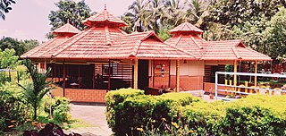
Eranad also known as Ernad refers to the erstwhile province in the midland area of Malabar, consisting of Malappuram and nearby regions such as Anakkayam, Manjeri, Kondotty, Nilambur, etc. Currently Eranad Taluk is a Taluk in Malappuram district. Eranad was ruled by a Samanthan Nair clan known as Eradis, similar to the Vellodis of neighbouring Valluvanad and Nedungadis of Nedunganad. The rulers of Eranad were known by the title Eralppad/Eradi. They also used the title Thirumulpad.

Thrissur-Ponnani Kole Wetlands is a wetland lying in Thrissur and Malappuram districts in Kerala, India. It gives 40 per cent of the Kerala’s rice requirement and acts as a natural drainage system for Ponnani city, Thrissur city, Thrissur District, and Malappuram district. The Kole Wetlands is one of largest, highly productive and threatened wetlands in Kerala and lie on the Central Asian Flyway of migratory birds.
Chaliyam is a village situated at the estuary of Chaliyar in Kozhikode district of Kerala, India. Chaliyam forms an island, bounded by the Chaliyar in the north, and River Kadalundi in south, and the Conolly Canal in the east. It is located just opposite to Beypore port. Chaliyam was the former terminus of the South-West Line of the Madras Railway. Chaliyam is also famous for the Guinness World Records holder Muhammed Adil, a P.M who covered around seven km in the Chaliyar River with his hand and legs tied with ropes.

Pavangad is a suburb included in Kozhikode corporation in the Kozhikode district of Kerala, India. It is located about 6.5 km north of Calicut on the Calicut-Kannur National Highway 66 (India) and is bounded by the Arabian Sea at the west, Canoli Canal at east and Korapuzha River at the north. State Highway 54 (Kerala) starts from Pavangad and ends in Kalpetta. Late Mr. K. T. Muhammed was a resident in Pavangad, popularly known as KT, was a Malayalam playwright and screenwriter. He died on 25 March 2008 at his residence. Pavangad is a fast-growing residential area towards the northern city limits of Kozhikode. Sneha Residence association is one of the major residential associations in this locality which consists of around 237 houses.
Eranhikkal or Eranjikkal is a place in Kozhikode District, Kerala India. It is covered in the Elathur division Of Calicut Municipal Corporation. Conolly Canal meets with the Korapuhha River in Eranhikkal. It is situated just 8 km from Calicut City.
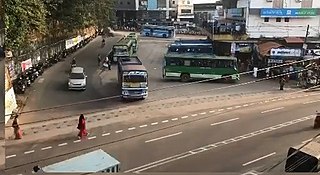
Waterways have always been an important mode of transport in Kerala. The total length of navigable route in Kerala was 1,900 kilometres and the navigable rivers constitute about 54 per cent of the waterways. The 41 West-flowing rivers together with the backwaters are an integrated part of the inland navigation system in Kerala. In Kerala water transportation through these channels are mainly small distant passenger services, informal country boats, freight transportation to PSU's such as Fertilisers and Chemicals Travancore, Kochi etc.

South Malabar refers to a geographical area of the southwestern coast of India covering some parts of the present-day Kerala state. South Malabar covers the regions included in present-day Kozhikode taluk of Kozhikode district, Wayanad district excluding Mananthavady taluk, the whole area of Malappuram district, Chavakkad taluk of Thrissur district, and Palakkad district, excluding parts of Chittur taluk. The Fort Kochi region of Kochi city also historically belongs to South Malabar. The term South Malabar refers to the region of the erstwhile Malabar District south to the river Korapuzha, and bears a high cultural similarity to both the Cochin and the North Malabar regions.
