
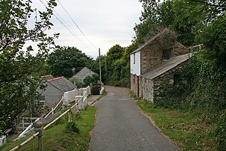
Crimp is a hamlet in the parish of Morwenstow, Cornwall, England. [1] [2]
Crimp is a hamlet in the parish of Morwenstow, Cornwall, England. [1] [2]

Virginstow is a village and civil parish in the Torridge district of Devon, England. It is situated about 7 miles north of Launceston in Cornwall. According to the 2001 census it had a population of 115.

The River Allen in north Cornwall is one of two rivers in Cornwall which share this name. In this case the name is the result of a mistake made in 1888 by Ordnance Survey, replacing the name Layne with Allen which is the old name for the lower reaches of the Camel. The other River Allen runs through Truro.

The De Lank River is a small river in north Cornwall, England. It is a tributary of the River Camel and is approximately nine miles (14.5 km) long from its source on Bodmin Moor to its confluence with the Camel two miles (3 km) south of St Breward.

Churchbridge is a hamlet in Cornwall, England. It is a mile west of Duloe, and is situated on the West Looe River. Both banks of the river are wooded, and to the north of the bridge is a disused quarry and Tremadart Mills, marked as a corn mill on the 1882 map.

Coxpark is a hamlet in the parish of Calstock, Cornwall, England.
Cross Coombe is a hamlet in the parish of St Agnes, Cornwall, England, UK.

Dimson is a small village in Cornwall, England. It is situated in the Tamar Valley approximately 10+1⁄2 miles (16.9 km) north of Plymouth and around two-thirds of a mile (1.1 km) north of Gunnislake. According to the Post Office, at the 2011 census population details were included in the civil parish of Calstock.

Goonvrea is a hamlet in the parish of St Agnes, Cornwall, England.

Harrowbarrow is a village in the parish of Calstock in east Cornwall, England.
Higher Bal is a hamlet in the parish of St Agnes, Cornwall, England.
Higher Boscaswell is a hamlet near Pendeen in west Cornwall, England. It is east of Pendeen and on the B road from St Ives to St Just. Higher Boscaswell is included in the St Just in Penwith division on Cornwall Council.
Highertown is a hamlet in Cornwall, England. It is on the western edge of Bodmin Moor in the parish of Advent.
Lockengate is a hamlet in Cornwall, England, UK. It is two miles south of Lanivet on the A391 road. It is in the civil parish of Luxulyan
Lower Croan is a farmstead in Cornwall, England, UK. It is in the parish of Egloshayle and Croan house and Croanford are to the east. Croan House is a manor house of two storeys and seven bays which was built in the 1690s for a prosperous attorney.

Lower Porthpean is a coastal hamlet in Cornwall, England, UK. It is close to Higher Porthpean and one mile south of St Austell.
Milltown is a hamlet in Cornwall, England. It is about a mile south of Lostwithiel. There is another hamlet called Milltown in the parish of Cardinham.
Norris Green is a village in Cornwall, England, UK. It was enlarged from a farming hamlet so that it now adjoins the neighbouring village of Higher Metherell. Both settlements are within the civil parish of Calstock which borders the River Tamar, the county boundary with Devon in south-east Cornwall.

Rising Sun is a hamlet near Calstock in Cornwall, England.

Trencreek is a hamlet in the parish of Jacobstow, north Cornwall, England, United Kingdom.

The River Kensey is a river in east Cornwall, England, UK which is a tributary of the River Tamar.
| Unitary authorities | |
|---|---|
| Major settlements |
|
| Rivers | |
| Topics | |
| | This Cornwall location article is a stub. You can help Wikipedia by expanding it. |