
Crystal Palace railway station is a Network Rail and London Overground station in the London Borough of Bromley in south London. It is located in the Anerley area between the town centres of Crystal Palace and Penge, 8 miles 56 chains (14.0 km) from London Victoria. It is one of two stations built to serve the site of the 1851 exhibition building, the Crystal Palace, when it was moved from Hyde Park to Sydenham Hill after 1851.
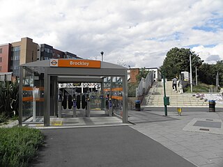
Brockley railway station serves the south-east London district of Brockley and is on the main railway line between London Bridge and Brighton. It is 3 miles 56 chains down the line from London Bridge.

East Croydon is a railway station and tram stop in Croydon, Greater London, England, and is located in Travelcard Zone 5. At 10 miles 28 chains from London Bridge, it is the 20th busiest station in Britain, was the 10th busiest in 2020–21, is the busiest national rail station in London outside of fare zones 1 and 2 and is one of the busiest non-terminal stations in the country. It is one of three railway stations in the London Borough of Croydon with Croydon in their name, the others being West Croydon and South Croydon. A Tramlink tram stop is located immediately outside the main station entrance.

Birkbeck is a railway station and light rail stop in the London Borough of Bromley in the southern suburbs of London. On the rail network it is 10 miles 26 chains (16.6 km) measured from London Victoria. It is located on Elmers End Road (A214) and alongside Beckenham Crematorium.

Beckenham Junction is the main railway and tram station in Beckenham in the London Borough of Bromley, south London. The railway stop is on the Chatham Main Line, 8 miles 53 chains (13.9 km) down the line from London Victoria and situated between Kent House and Shortlands. The tram stop is one of the eastern termini of Tramlink.

Elmers End is a railway station and tram terminus in Elmers End, south London, England. It is in the London Borough of Bromley and on the railway it is 11 miles 7 chains (17.8 km) down the line from London Charing Cross.

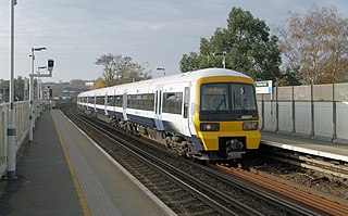
The Brighton Main Line is a major railway line in the United Kingdom that links Brighton, on the south coast of England, with central London. In London the line has two branches, out of London Victoria and London Bridge stations respectively, which join up in Croydon and continue towards Brighton as one line. The line is electrified throughout using the third rail system.
The Catford Loop Line is a railway line in southeast London. It carries a suburban stopping passenger service from central London to Sevenoaks, and is also a relief route for the Chatham Main Line carrying passenger trains from London Victoria to the Kent coast. There is also much freight activity as this is the main route to Willesden and the north via Latchmere Junction. Freight traffic includes aggregates trains to and from locations along the Thames estuary, and Kent, aviation fuel running between Colnbrook and the Isle of Grain, and a small number of international workings from the Channel Tunnel via the yard at Dollands Moor. Until around 2013, a significant quantity of intermodal traffic from Thamesport used the line - however, the opening of London Gateway meant that the larger container ships stopped serving Thamesport and this traffic then ceased.
Norwood Junction railway station is a National Rail station in South Norwood in the London Borough of Croydon, south London, and is in Travelcard Zone 4. It is 8 miles 55 chains down the line from London Bridge.

West Norwood railway station is in the London Borough of Lambeth in West Norwood, South London. It is 7 miles 2 chains (11.3 km) measured from London Victoria. The station, and all trains serving it, are operated by Southern, and it lies in Travelcard Zone 3. Services from Platform 1 go to London Victoria and London Bridge via Tulse Hill. Services from Platform 2 operate to more varied destinations, including West Croydon and London Bridge via Crystal Palace.

Tulse Hill railway station is in the Tulse Hill area of the London Borough of Lambeth in south London, between railway bridges over the A205, South Circular Road and the A215, Norwood Road. It is 5 miles 2 chains (8.1 km) measured from London Victoria. At the moment, there are 4 platforms, each long enough for 8 coaches.

Shortlands railway station is in Shortlands, in the London Borough of Bromley in south London. It serves the southwest part of Bromley, and is 10 miles 3 chains (16.2 km) down the line from London Victoria. The station is located on the A222 road. Shortlands Junction, just west of the station, is where the Catford Loop Line joins the Chatham Main Line: the two lines are split into slow and fast pairs through the station, which consists of two island platforms on an embankment. The station is in London Travelcard Zone 4, and the station is managed by Southeastern and trains are operated by Southeastern and Thameslink.
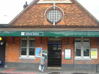
Selhurst railway station is in the London Borough of Croydon in south London, 9 miles 31 chains (15.1 km) along the line from London Victoria. It is operated by Southern, which also provides all the train services. The station is in Travelcard Zone 4.

The Sutton and Mole Valley lines were constructed between 1847 and 1868 by the London, Brighton and South Coast Railway, the London and South Western Railway and the LBSCR-sponsored Horsham, Dorking and Leatherhead Railway.

The Chatham Main Line is a railway line in England that links London Victoria and Dover Priory / Ramsgate, travelling via Medway.
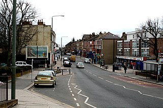
Anerley is an area of south east London, England, within the London Borough of Bromley. It is located 7 miles (11 km) south south-east of Charing Cross, to the south of Crystal Palace and Upper Norwood, west of Penge, north of Elmers End and South Norwood.
The West End of London and Crystal Palace Railway (WELCPR) was an early railway company in south London between Crystal Palace station and Wandsworth, which was opened in 1856. The line was extended in 1858 to a station at Battersea Wharf near the bridge to Pimlico. Throughout its brief existence the railway was operated by the London Brighton and South Coast Railway (LB&SCR) to which it was leased in 1858 and sold in 1859. This relatively short line was of considerable importance to the history of railways of south London as it was the first line to create a corridor from the south and east towards Westminster and led to the development of London Victoria railway station.

Harrington Road tram stop is a light rail stop in South Norwood in the London Borough of Croydon in the southern suburbs of London. Harrington Road is in a residential area, and along with Woodside tram stop is the nearest tram stop to the town of South Norwood. Beckenham Cemetery lies immediately to the east and there is an entrance immediately adjacent to the tramstop.

Beckenham Road tram stop is a light rail stop in the London Borough of Bromley in the southern suburbs of London. The stop is located on an embankment above Beckenham Road (A234) which connects Beckenham with Crystal Palace and Penge on the site of the short-lived (1858–1860) West End of London & Crystal Palace Railway Penge station.

Elmers End is an area of south-east London, England, within the London Borough of Bromley, Greater London and formerly part of the historic county of Kent. It is located south of Beckenham, west of Eden Park, north of Monks Orchard and east of Anerley.


