Bromley North Line

Last updated • 3 min readFrom Wikipedia, The Free Encyclopedia

Bromley North Line
465001 to Bromley North.jpg
Southeastern Class 465 unit 465001 at Bromley North.
Overview
StatusOperational
Owner Network Rail
Locale Greater London
Termini
Stations3
Service
Type Suburban rail, Heavy rail
System National Rail
Services1
Operator(s) Southeastern
Depot(s) Hither Green
Rolling stock Class 465 "Networker"
Technical
Number of tracks2
Character Branch line
Track gauge 1,435 mm (4 ft 8+12 in) standard gauge
Electrification 750 V DC third rail
Operating speed40 mph (64 km/h)
Route map
Bromley North Line
Bromley North Line
BSicon vCONTg.svg
BSicon SHI3+l.svg
BSicon vSHI3gr-STR.svg
BSicon XBHF-L.svg
BSicon vBHF.svg
BSicon XPLTeq.svg
Grove Park
BSicon STR.svg
BSicon exSHI3+l.svg
BSicon veSHI3gr-STR.svg
BSicon STR.svg
BSicon vCONTf.svg
BSicon HST.svg
Sundridge Park
BSicon eSPLa.svg
BSicon exdKBSTe.svg
BSicon dKHSTe.svg
Bromley North

The Bromley North line is a less than 2-mile (3.2 km) long branch line in Greater London that connects at Grove Park with the South Eastern Main Line operated by Southeastern. Since the 1990s, the line which has two stations of its own has been served almost exclusively by shuttle services to and from Grove Park railway station in the London Borough of Lewisham, where passengers can change trains for onward journeys towards Central London, as well as towards Kent. Network Rail records the line as route SO350.

Contents

History

The line was built by the 'Bromley Direct Railway Company', in co-operation with the South Eastern Railway (SER), to compete with the London, Chatham and Dover Railway, which owned the other Bromley station, Bromley South. It opened on 1 January 1878 and was worked by the SER from the outset. The two companies merged later in the same year. [1]

The line was electrified at 750 V DC (third rail) with the other SECR urban routes from 1926 by Southern Railway.

Services

A shuttle service operates, known by the staff as "the popper".[ citation needed ] The service is two trains per hour in each direction. This service increases to three trains per hour during morning peak time. There are no services on Sundays and public holidays on the branch line. [2]

Through services were originally operated from Bromley North to Holborn Viaduct, Victoria, Cannon Street and Charing Cross. These were cut to a peak-hours only service in 1976, and were then withdrawn completely in 1990, [3] except during engineering works.

Trains

Class 465 rolling stock primarily operates on this route. Until 2010 this was the only 'true branch', that is branch-only service, in Greater London for trains to be worked with a driver and a guard. Since 2010 this is now driver-only, as mirrors and monitors have been provided on the platforms to allow the driver to look back.

Future proposals

The Southeastern Main Line into central London is at full capacity. Service patterns have begun to entrench all longer distance service destinations as direct, many trains per hour, stations. Therefore, Southeastern consider that it is not economically justifiable to reinstate direct services from Bromley North into central London, and consequently all (non-contingency Bromley South backup) services must terminate at Grove Park for the foreseeable future.

Various proposals have been put forward to convert the Bromley North Line to an alternative mode of transport to make better use of this isolated piece of rail infrastructure. In the 1980s, a plan to partially convert the line into a heritage railway using retired London Underground rolling stock was considered, but did not ultimately come to fruition. [4]

Transport for London have indicated that they are considering a number of possible options for connecting the Bromley North Line to one of the other public transport systems in London, including: [5]

These schemes have not been taken beyond the proposal stage and recommendations are expected to be published around 2017[ needs update ]. In a report published by the London Borough of Bromley in 2012, proposals to extend Tramlink beyond Beckenham Junction into Bromley town centre are outlined, with a further option to continue this route along the Bromley North Line to Grove Park. The report also considers the Bakerloo line extension favourably, but notes difficulties with tunnelling between Lewisham and Grove Park, and with the provision of a depot. [7] The Tramlink proposal also features in the Rail Utilisation Strategy report by Network Rail. [8]

Bromley North Line
Bromley north line.png
The Bromley North Line in south-east London
Bromley north line connections.png
Nearby transport lines which have been proposed to be connected to the Bromley North Line in the future

Related Research Articles

<span class="mw-page-title-main">Docklands Light Railway</span> Automated light metro system in the Docklands area of London, England

The Docklands Light Railway (DLR) is an automated light metro system primarily serving the redeveloped Docklands area of London and providing a direct connection between London's two major financial districts, Canary Wharf and the City of London. First opened on 31 August 1987, the DLR has been extended multiple times, giving a total route length of 38 km. Lines now reach north to Stratford, south to Lewisham, west to Tower Gateway and Bank in the City of London financial district, and east to Beckton, London City Airport and Woolwich Arsenal. An extension to Thamesmead is currently being proposed.

<span class="mw-page-title-main">Bakerloo line</span> London Underground line

The Bakerloo line is a London Underground line that runs from Harrow & Wealdstone in suburban north-west London to Elephant & Castle in south London, via the West End. Printed in brown on the Tube map, it serves 25 stations, 15 of which are underground, over 23.2 kilometres (14.4 mi). It runs partly on the surface and partly through deep-level tube tunnels.

<span class="mw-page-title-main">Lewisham</span> Area of London

Lewisham is an area of southeast London, England, six miles south of Charing Cross. It is the principal area of the London Borough of Lewisham, and was within the historic county of Kent until 1889. It is identified in the London Plan as one of 35 major centres in Greater London, with a large shopping centre and street market. Lewisham had a population of 60,573 in 2011.
<span class="mw-page-title-main">Elephant & Castle tube station</span> London Underground station

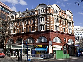
Elephant & Castle is a London Underground station in the London Borough of Southwark in south London. It is on the Bank branch of the Northern line between Borough and Kennington stations. It is also the southern terminus of the Bakerloo line and the next station towards north is Lambeth North. The station is in both Travelcard Zones 1 and 2. The Northern line station was opened in 1890 by the City and South London Railway (C&SLR) while the Bakerloo line station was opened sixteen years later by the Baker Street and Waterloo Railway (BS&WR). There is an out-of-station interchange with the nearby Elephant & Castle National Rail station.

<span class="mw-page-title-main">Lewisham station</span> Docklands Light Railway and National Rail station

Lewisham is an interchange station in Lewisham, south-east London, for Docklands Light Railway (DLR) and National Rail services.

<span class="mw-page-title-main">Birkbeck station</span> National Railway station and Tramlink tram stop in London, England

Birkbeck is a railway station and light rail stop in the London Borough of Bromley in the southern suburbs of London. On the rail network it is 10 miles 26 chains (16.6 km) measured from London Victoria. It is located on Elmers End Road (A214) and alongside Beckenham Crematorium.

<span class="mw-page-title-main">Beckenham Junction station</span> National Rail station and Tramlink tram stop in London, England

Beckenham Junction is the main railway and tram station in Beckenham in the London Borough of Bromley, south London. The railway stop is on the Chatham Main Line, 8 miles 53 chains (13.9 km) down the line from London Victoria and situated between Kent House and Shortlands. The tram stop is one of the eastern termini of Tramlink.

<span class="mw-page-title-main">Grove Park railway station</span> National Rail station in London, England

Grove Park is a railway station in southeast London, England. It is located on Baring Road within Travelcard Zone 4, and serves the areas of Grove Park and Downham in the London Borough of Lewisham. It is 8 miles 78 chains (14.4 km) down the line from London Charing Cross.

<span class="mw-page-title-main">Elmers End station</span> British railway station

Elmers End is a railway station and tram terminus in Elmers End, south London, England. It is in the London Borough of Bromley and on the railway it is 11 miles 7 chains (17.8 km) down the line from London Charing Cross.

<span class="mw-page-title-main">Hayes railway station</span> National Rail station in London, England

Hayes railway station is a railway station located in Hayes in the London Borough of Bromley, south east London, England. It is 14 miles 32 chains (23.2 km) from London Charing Cross.

<span class="mw-page-title-main">St Johns railway station</span> National Rail station in London, England

St Johns railway station is in the London Borough of Lewisham. It lies 5 miles 47 chains (9.0 km) down the South Eastern Main Line from London Charing Cross, and is situated between New Cross and Lewisham.
<span class="mw-page-title-main">Clock House railway station</span> National Rail station in London, England

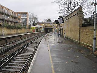
Clock House railway station is in the London Borough of Bromley in south east London, in Travelcard Zone 4 between Beckenham and Penge. It is 10 miles 23 chains (16.6 km) down the line from London Charing Cross. The station and all trains serving it are operated by Southeastern on the Hayes line.

<span class="mw-page-title-main">Chislehurst railway station</span> National Rail station in London, England

Chislehurst railway station is on the South Eastern Main Line, serving the neighbourhood of Chislehurst in the London Borough of Bromley. It is 11 miles 19 chains (18.1 km) down the line from London Charing Cross and is situated between Elmstead Woods and Petts Wood stations.

<span class="mw-page-title-main">Elmstead Woods railway station</span> National Rail station in London, England

Elmstead Woods railway station is on the South Eastern Main Line, serving the district of Elmstead in the London Borough of Bromley. It is 10 miles 21 chains (16.5 km) down the line from Charing Cross and is situated between Grove Park and Chislehurst stations.

<span class="mw-page-title-main">Hither Green railway station</span> National Rail station in London, England

Hither Green is a railway station located in Hither Green in the London Borough of Lewisham, south-east London. It is 7 miles 16 chains (11.6 km) down the line from London Charing Cross and is situated between Lewisham and either Grove Park or Lee depending on the route.

<span class="mw-page-title-main">Sundridge Park railway station</span> National Rail station in London, England

Sundridge Park railway station serves Sundridge and Plaistow in the London Borough of Bromley in Greater London, in Travelcard Zone 4. It is 10 miles 12 chains (16.3 km) down the line from Charing Cross.

<span class="mw-page-title-main">Bromley North railway station</span> National Rail station in London, England

Bromley North railway station is in the London Borough of Bromley in south-east London, in Travelcard Zone 4. It is 10 miles 47 chains (17.0 km) down the line from London Charing Cross. The station and all trains serving it are operated by Southeastern. It is the terminus of the short Bromley North Branch Line from Grove Park.
<span class="mw-page-title-main">Chelsfield railway station</span> National Rail station in London, England

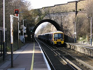
Chelsfield railway station is on the South Eastern Main Line, serving the Chelsfield and Green Street Green areas south of Orpington, in the London Borough of Bromley, south-east London. It is 15 miles 25 chains (24.6 km) down the line from London Charing Cross and is situated between Orpington and Knockholt stations. It is in Travelcard Zone 6.

<span class="mw-page-title-main">Bakerloo line extension</span> Proposed southern extension of the London Underground

The Bakerloo line extension is a proposed extension of the London Underground Bakerloo line in South London from its current terminus at Elephant & Castle to Lewisham station.

<span class="mw-page-title-main">Mid-Kent line</span> Railway line in the UK

The Mid-Kent line is a British railway line running from Courthill Loop North junction to Hayes railway station in the London Borough of Bromley. Despite its name, none of the line is in the present-day county of Kent.

References

  1. Body (1989), p.57.
  2. "Timetable 6 - London to Catford Bridge, Elmers End and Hayes. London to Bromley North, Orpington and Sevenoaks via Grove Park" (PDF).
  3. "The Past and Future of the Bromley North Branch". 25 January 2013.
  4. "Bromley North". KentRail.
  5. "Could the DLR or Bakerloo line be coming to Bromley?". This is Local London. 23 January 2012. Retrieved 26 January 2013.
  6. "The Past and Future of the Bromley North Branch". London Reconnections. 25 January 2013. Retrieved 26 January 2013.
  7. "Future Rail and Tram Links to Bromley" (PDF). Report No. ES12004. London Borough of Bromley. 18 January 2012. Archived from the original (PDF) on 4 June 2013. Retrieved 26 January 2013.
  8. "8.10 Gap Q – Tramlink extensions" (PDF). London and South East Route Utilisation Strategy. Network Rail. July 2011. p. 159. Archived from the original (PDF) on 13 December 2013. Retrieved 26 January 2013.

Sources

Geoffrey Body, Railways of Southern Region, (1978), Patrick Stephens Ltd. 1-85260-297-X.