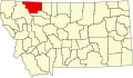
Cut Bank Municipal Airport(IATA: CTB, ICAO: KCTB, FAALID: CTB) is three miles southwest of Cut Bank, in Glacier County, Montana, United States. It is owned by Cut Bank and Glacier County.[1]
The airport's website calls it Cut Bank International Airport. Its first flight was on 1 June 1941.[2]
Facilities
Cut Bank Municipal Airport covers 1,730 acres (700ha) at an elevation of 3,858 feet (1,176 m). It has two asphaltrunways: 5/23 is 5,300 by 75 feet (1,615 x 23 m) and 14/32 is 5,300 by 75 feet (1,615 x 23 m).[1]
In the year ending July 27, 2023, the airport had 8,250 aircraft operations, average 23 per day: 93% general aviation, 6% air taxi and 2% military. 18 aircraft were then based at the airport: 17 single-engine, and 1 multi-engine.[1]
During World War II Cut Bank Army Air Field was used by the Second Air Force as an auxiliary heavy bomber training airfield, being controlled by Great Falls Army Air Base. Several squadrons of groups training at Great Falls in B-17 Flying Fortresses trained at Cut Bank. Known squadrons were:
2nd Bombardment Group, 429th Bomb Squadron, November 1942-March 1943
During the Cold War Cut Bank AFB was an interceptor base, part of Air Defense Command.
The Cut Bank Municipal Airport and Army Air Force Base, on Valier Highway in Cut Bank, Montana was built in 1942. It was listed on the National Register of Historic Places in 2008. The listing included eight contributing buildings, 27 contributing structures, and four contributing sites on 1,460 acres (5.9km2).[4]
It was built by the Army Corps of Engineers and includes World War II temporary buildings. It has also been known as Cut Bank International Airport.[5]
This page is based on this Wikipedia article Text is available under the CC BY-SA 4.0 license; additional terms may apply. Images, videos and audio are available under their respective licenses.