
Pierce County is a county in the U.S. state of Washington. As of the 2020 census, the population was 921,130, up from 795,225 in 2010, making it the second-most populous county in Washington, behind King County, and the 59th-most populous in the United States. The county seat and largest city is Tacoma. Formed out of Thurston County on December 22, 1852, by the legislature of Oregon Territory, it was named for U.S. President Franklin Pierce. Pierce County is in the Seattle metropolitan area.
DuPont is a city in Pierce County, Washington, United States. The population was 10,151 at the 2020 census. Originally a company town, the city is named after the DuPont chemical company which operated an explosives manufacturing plant in the area from 1909 to 1975.

Edgewood is a city in Pierce County, Washington, United States. The population was 12,327 at the 2020 census. Neighboring towns include Fife to the west, Milton to the northwest, Federal Way to the north, Sumner to the east, and Puyallup to the south.

Fircrest is a city in Pierce County, Washington, United States. The population was 7,156 at the 2020 census.
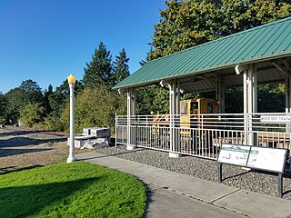
Lakewood is a city in Pierce County, Washington, United States. The population was 63,612 at the 2020 census.

Parkland is a census-designated place (CDP) in Pierce County, Washington. The population was 35,803 at the time of the 2010 census and had grown to 38,623 as of the 2020 census. It is an unincorporated suburb of the city of Tacoma and is home to Pacific Lutheran University.

Ruston is a city in Pierce County, Washington, United States. The population was 1,055 at the 2020 census.

South Hill is a census-designated place (CDP) in Pierce County, Washington, immediately south of Puyallup. The population was 64,708 at time of the 2020 census, up from 52,431 in 2010. The area primarily consists of suburban housing and shopping with several retail shopping centers, residential neighborhoods, and apartment/condo complexes throughout. Because South Hill is unincorporated, its addresses are part of the Puyallup "postal city" or ZCTA.

Steilacoom is a town in Pierce County, Washington, United States. The population was 6,727 at the 2020 census. Steilacoom incorporated in 1854 and became the first incorporated town in what is now the state of Washington. It has also become a bedroom community for service members stationed at Joint Base Lewis–McChord, aka McChord AFB and Fort Lewis.
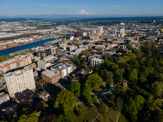
Tacoma is the county seat of Pierce County, Washington, United States. A port city, it is situated along Washington's Puget Sound, 32 miles (51 km) southwest of Seattle, 36 miles (58 km) southwest of Bellevue, 31 miles (50 km) northeast of the state capital, Olympia, 58 miles (93 km) northwest of Mount Rainier National Park, and 80 miles (130 km) east of Olympic National Park. The city's population was 219,346 at the time of the 2020 census. Tacoma is the second-largest city in the Puget Sound area and the third-most populous in the state. Tacoma also serves as the center of business activity for the South Sound region, which has a population of about 1 million.
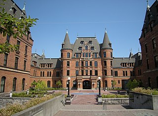
Stadium High School is a public high school in Tacoma, Washington, and a historic landmark. It is part of Tacoma Public Schools, or Tacoma School District No. 10 and is located in the Stadium District, near downtown Tacoma. The original building was severely damaged by a fire in 1898 while it was still a partially-constructed hotel designed by Hewitt & Hewitt being used for storage. It was reconstructed for use as a school beginning in 1906 according to designs by Frederick Heath, and a "bowl" stadium was added in 1910.

The Key Peninsula lies along Puget Sound to the south of Kitsap Peninsula in the U.S. state of Washington. It is part of Pierce County and is bordered to the west by Case Inlet and to the east by Carr Inlet. The peninsula is approximately 16 miles (26 km) long and has two Washington State Parks.
Browns Point is a census-designated place (CDP) in Pierce County, Washington, United States, bordered by Tacoma on the east and Puget Sound on all other sides. The population was 1,198 at the 2010 census. The Tacoma neighborhood immediately adjacent to Browns Point is also referred to locally as "Browns Point".

The Clover Park School District (CPSD) is the fourth largest school district in Pierce County, Washington, United States, and the 28th largest public school district in the state.
Fife Public Schools is a school district comprising parts of the Washington state cities of Fife, Milton, Edgewood, Tacoma, Pacific as well as unincorporated census-designated places Lakeland South and Fife Heights. The district was established on December 22, 1899.

Dash Point State Park is a 398-acre (161 ha) Washington state park on Puget Sound that straddles the line between King and Pierce counties. The park has over 3,300 feet (1,000 m) of shoreline, 140 campsites, 11 miles of trails for hiking and mountain biking, and offers beachcombing, fishing, swimming, birdwatching, windsurfing, skimboarding, and wildlife viewing.
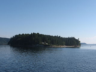
Ketron Island is an island and a census-designated place (CDP) in Pierce County, Washington, United States. The island had a population of 24 persons according to the 2000 census, and 17 persons at the 2010 census.
Boulevard Park is a census-designated place (CDP) in King County, Washington, United States. The population was 5,287 at the 2010 census. Boulevard Park was part of the Riverton-Boulevard Park CDP in 2000 but was split for the 2010 census into its own CDP.
Fife Heights is a census-designated place (CDP) in Pierce County, Washington, United States. The population was 1,919 at the 2020 census. The community is bordered by Federal Way on the north, Milton on the east, Fife on the south, and Tacoma on the west. It is contained within the Puyallup Indian Reservation.
Clover Creek is a census-designated place (CDP) located in Pierce County, Washington.

