
Pierce County is a county in the U.S. state of Washington. As of the 2020 census, the population was 921,130, up from 795,225 in 2010, making it the second-most populous county in Washington, behind King County, and the 59th-most populous in the United States. The county seat and largest city is Tacoma. Formed out of Thurston County on December 22, 1852, by the legislature of Oregon Territory, it was named for U.S. President Franklin Pierce. Pierce County is in the Seattle metropolitan area.

Franklin County is located in the U.S. state of Missouri. At the 2020 census, the population was 104,682. Its county seat is Union. The county was organized in 1818 and is named after Founding Father Benjamin Franklin. Franklin County is part of the St. Louis, MO-IL Metropolitan Statistical Area and contains some of the city's exurbs. It is located along the south side of the Missouri River. The county has wineries that are included in the Hermann AVA and is part of the region known as the Missouri Rhineland, which extends on both sides of the Missouri River.

Johnson is a city in Washington County, Arkansas, United States. The community is located in the Ozark Mountains and is surrounded by valleys and natural springs. Early settlers took advantage of these natural features and formed an economy based on mining lime, the Johnson Mill and trout. Although a post office was opened in the community in 1887, Johnson did not incorporate until it required the development of a city government to provide utility services in 1961. Located between Fayetteville and Springdale in the heart of the rapidly growing Northwest Arkansas metropolitan statistical area, Johnson has been experiencing a population and building boom in recent years, as indicated by a 46% growth in population between the 2000 and 2010 censuses.

Columbine is a census-designated place (CDP) in and governed by Jefferson and Arapahoe counties in Colorado, United States. The CDP is a part of the Denver metropolitan area. Located primarily in Jefferson County, Columbine lies immediately south of Denver. The population of the Columbine CDP was 25,229 at the 2020 census. The community lies in ZIP code 80123.

Braselton is a town in Barrow, Gwinnett, Hall, and Jackson counties in the U.S. state of Georgia, approximately 43 miles (69 km) northeast of Atlanta. As of the 2020 census, the town had a population of 13,403, and in 2023 the estimated population was 15,538.

West Haven-Sylvan is a census-designated place (CDP) in Washington and Multnomah counties, Oregon, United States, north of U.S. Route 26. As of the 2020 census, the CDP population was 9,299.

Midland is a census-designated place (CDP) in Pierce County, Washington. The population was 9,962 at the time of the 2020 census.

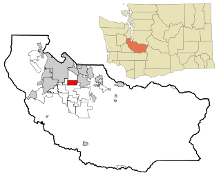
Parkland is a census-designated place (CDP) in Pierce County, Washington. The population was 35,803 at the time of the 2010 census and had grown to 38,623 as of the 2020 census. It is an unincorporated suburb of the city of Tacoma and is home to Pacific Lutheran University.
Summit is a census-designated place (CDP) in Pierce County, Washington, United States. The population was 8,270 at the 2020 census.

Waller is a rural census-designated place (CDP) in Pierce County, Washington, United States. The population was 8,189 at the 2020 census. The population has seen significant growth in the last decade.
Dash Point is an unincorporated community in Pierce County, Washington, United States. Because it is not incorporated, no census population figures are available. Dash Point is a residential area surrounded by Puget Sound to the north, Dash Point State Park to the east, and the city of Tacoma to the south and west. Dash Point is located across Commencement Bay from downtown Tacoma.
The Gwinnett County Public Schools is a school district operating in Gwinnett County, Georgia, United States. GCPS is the largest school system in Georgia, with over 140 school buildings and an estimated enrollment of over 182,000 students for the 2023–2024 school year. GCPS is estimated to be the 14th largest school district in the U.S. The district has its headquarters near Suwanee.

Conroe Independent School District (CISD) is a school district in Montgomery County, Texas. The current superintendent has been Dr. Curtis Null since June 2018. As of April 2024, Conroe ISD was the 9th largest school district in Texas and 60th largest in the United States.
Bethel School District No. 403 is a public school district in Pierce County, Washington, USA and serves 200 square miles (520 km2) of unincorporated Pierce County including Spanaway, Graham, Kapowsin and the city of Roy. Bethel was unique in the way that its high schools served grades 10-12 as opposed to the traditional grades of 9-12 of many other districts. In September 2011, Bethel School District planned to switch to a traditional 9-12 district, which occurred in the 2012-2013 school year.

The Clover Park School District (CPSD) is the fourth largest school district in Pierce County, Washington, United States, and the 28th largest public school district in the state.

Franklin Pierce High School is a public high school in Clover Creek, Washington. It is named after the fourteenth US President, Franklin Pierce, who was president when the Washington Territory was formed in 1853. It is a part of the Franklin Pierce School District.
Paloma Creek South is a census-designated place (CDP) in eastern Denton County, Texas, United States. It is part of the Paloma Creek master-planned community. As of the 2010 census, Paloma Creek South had a population of 2,753.
Clover Creek is a census-designated place (CDP) located in Pierce County, Washington.
Franklin Pierce School District No. 402 or Franklin Pierce Schools is a school district headquartered in Parkland, Washington.
Reynoldsburg City School District, or Reynoldsburg City Schools, is a school district headquartered in Reynoldsburg, Ohio.

