
Sichuan, is a province in southwest China occupying most of the Sichuan Basin and the easternmost part of the Tibetan Plateau between the Jinsha River on the west, the Daba Mountains in the north, and the Yungui Plateau to the south. Sichuan's capital city is Chengdu. The population of Sichuan stands at 81 million.

Mount Emei is a mountain in Sichuan Province, China, and is one of the Four Sacred Buddhist Mountains of China. Mt. Emei sits at the western rim of the Sichuan Basin. The mountains west of it are known as Daxiangling. A large surrounding area of countryside is geologically known as the Permian Emeishan Large Igneous Province, a large igneous province generated by the Emeishan Traps volcanic eruptions during the Permian Period. At 3,099 metres (10,167 ft), Mt. Emei is the highest of the Four Sacred Buddhist Mountains of China.

Sichuan University is a university in Chengdu, the capital of Sichuan Province, China. It has a long history and many predecessors, of which the earliest one was founded in 1740 with the origin in BCE 141. It was transformed to be a modern university in 1920s and the name National Sichuan University (國立四川大學) was adopted in 1931.

The Sichuan Basin, formerly transliterated as the Szechwan Basin, sometimes called the Red Basin, is a lowland region in southwestern China. It is surrounded by mountains on all sides and is drained by the Yangtze River and its tributaries. The basin is anchored by Chengdu, capital of Sichuan province, in the west, and the independent municipality of Chongqing in the east. Due to its relative flatness and fertile soils, it is able to support a population of more than 100 million. In addition to being a dominant geographical feature of the region, the Sichuan Basin also constitutes a cultural sphere that is distinguished by its own unique customs, cuisine, and dialects. It is famous for its rice cultivation and is often considered the breadbasket of China. In the 21st century its industrial base is expanding with growth in the high-tech, aerospace, and petroleum industries.

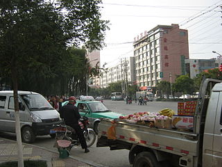
Guang'an is a prefecture-level city in eastern Sichuan province. It is most famous as the birthplace of China's former paramount leader Deng Xiaoping. Guang'an lies between the hills of central Sichuan and the gorges area of the east.Guang'an is the only "Sichuan Chongqing Cooperation Demonstration Zone" in Sichuan and the nearest prefecture level city from the main city of Chongqing. It has been incorporated into the 1 hour economic circle of Chongqing. Because of its strategic location, it is called the "Gateway to Eastern Sichuan". Its population as of 2010 census was 3,205,476. whom 858,159 lived in the built-up area made of 2 urban districts.
Haidong is a prefecture-level city of Qinghai province in Western China. Its name literally means "east of the (Qinghai) Lake." On 8 February 2013 Haidong was upgraded from a prefecture (海东地区) into a prefecture-level city. Haidong is the second largest city in Qinghai after Xining.

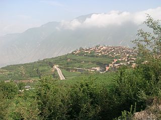
The Hengduan Mountains are a group of mountain ranges in southwest China that connect the southeast portions of the Tibetan Plateau with the Yunnan–Guizhou Plateau. The Hengduan Mountains are primarily large north-south mountain ranges that effectively separate lowlands in northern Myanmar from the lowlands of the Sichuan Basin. These ranges are characterized by significant vertical relief originating from the Indian subcontinent's collision with the Eurasian Plate, and further carved out by the major rivers draining the eastern Tibetan Plateau. These rivers, the Yangtze, Mekong, and Salween, are recognized today as the Three Parallel Rivers UNESCO World Heritage Site.

Bijie is a prefecture-level city in northwestern Guizhou Province, China, bordering Sichuan to the north and Yunnan to the west.
The Dadu Plateau, also known as Dadu Mountain or Dadushan, stretches across Taichung City in central-western Taiwan. It faces the Taichung Basin on the east and the seacoast of Taichung on the west, and lies between the Dajia River and Dadu River. The plateau is long and narrow, has a length of about 20 km, and a width of about 5 to 7 km. It average height is about 151 m, with a highest peak which has a height of 310 m.
Qionglai Mountains is a mountain range in the Sichuan Province of China. It runs in the general north-south direction, and is located mostly within the Ngawa Tibetan and Qiang Autonomous Prefecture, in the north-central part of the province.

The Daba Mountains, also known by their Chinese name as the Dabashan, are a mountain range in Central China between the watersheds of the Yellow and Yangtze Rivers. Part of the larger Qinling mountain range, it cuts through four provinces: Sichuan, Chongqing, Shaanxi, and Hubei. It is about 1,000 kilometers (620 mi) long.

Min Mountains or Minshan are a mountain range in central China. It runs in the general north-south direction through northern Sichuan and southernmost borderlands of Gansu. The highest elevation is Mount Xuebaoding, 5588 m and the second highest is Mt Little Xuebaoding, 5443m.

The Xiaoxiang Range is a mountain range in Sichuan Province, China. It is part of a complicated system of mountains in south-central Sichuan, and runs in the general north-south direction within Liangshan Yi Autonomous Prefecture and the adjacent parts of Ya'an prefecture-level city.

The Shuangjiangkou Dam(Chinese: 双江口大坝/双江口水电站), also referred to as Shuang Jiang Kou(Chinese: 双江口), is an embankment dam currently being constructed on the Dadu River in Sichuan Province, China. When completed, the 312 metres (1,024 ft) tall dam will be the tallest dam in the world. Preliminary construction began in 2008 and the entire project is expected to be complete in 2018. By April 2011, over 200,000,000 m3 (261,590,124 cu yd) of material had been excavated from the construction site. In March 2013 the China's Ministry of Environmental Protection approved construction on the dam's superstructure and associated facilities. The government acknowledged that the dam would have negative impacts on the environment but that developers were working to mitigate them. The dam is being built by the Guodian Group at a cost of US$4.02 billion. The entire construction period is expected to last 10 years.

The Daliang Mountains are in the southern part of the province of Sichuan in China. The Daliang rises above the left bank of the Jinsha River, opposite the Wulian Feng in Yunnan Province. This part of the Jinsha River is the last portion to flow through mountainous terrain before entering the Sichuan Basin where the river becomes known as the Yangtze at Yibin. The Daliang are located within eastern Liangshan Prefecture, southern Leshan Prefecture, and western Yibin Prefecture.
The Renzonghai Dam is a rock-fill embankment dam on the Tianwanhe River, a tributary of the Dadu River, in Shimian County of Sichuan Province, China. The primary purpose of the dam is hydroelectric power generation and it supports three power stations downstream, the Renzonghai, Jinwo and Dafa Hydropower Stations. Water from the dam is sent via penstock first to the 246 MW Renzonghai then the 287.2 MW Jinwo and finally, the 246 MW Dafa Hydropower Station. The total installed capacity of the power stations is 779.2 MW Construction on the project began in August 2004 and the Jinwo power station was commissioned in 2007, the Dafa in 2008 and the Renzonghai in 2009. The Jinwo station contains the largest Pelton turbines in Asia, two at 146.3 MW each.
Qingyi River is a major river in western Sichuan. Qingyi means blueish-colored clothes. This name came from the local ancient kingdom Qingyi Qiang Kingdom, in which notable people preferred to wear blue clothes. Qingyi River is the longest tributary of Dadu River, and it is also a major river in upper Yangtze River system. The elevation difference between its source and mouth is more than 5000 meters.

The Qionglai-Minshan conifer forests are a World Wildlife Fund ecoregion in Southwest China. These forests are classified as temperate coniferous forests and are part of the Palearctic realm. The Qionglai-Minshan conifer forests cover the mountains along the easternmost edge of the Tibetan Plateau including the Min Mountains, Qionglai Mountains, Daxue Mountains, and Daliang Mountains. In addition to these mountain ranges, the lower reaches of the Dadu River valley support significant portions of the forests. The Qionglai-Minshan conifer forests are found almost entirely within western Sichuan, but small portions can also be found in southern Gansu and extreme northeast Yunnan.


