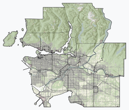
Burnaby is a city in the Lower Mainland region of British Columbia, Canada. Located in the centre of the Burrard Peninsula, it neighbours the City of Vancouver to the west, the District of North Vancouver across the confluence of the Burrard Inlet with its Indian Arm to the north, Port Moody and Coquitlam to the east, New Westminster and Surrey across the Fraser River to the southeast, and Richmond on the Lulu Island to the southwest.

Prince Albert National Park encompasses 3,874 square kilometres (1,496 sq mi) in central Saskatchewan, Canada and is about 200 kilometres (120 mi) north of Saskatoon. Though declared a national park March 24, 1927, official opening ceremonies weren't performed by Prime Minister William Lyon Mackenzie King until August 10, 1928. This park is open all year but the most visited period is from May to September. Although named for the city of Prince Albert, the park's main entrance is actually 80 kilometres (50 mi) north of that city via Highways 2 and 263, which enters the park at its southeast corner. Two additional secondary highways enter the park, Highway 264, which branches off Highway 2 just east of the Waskesiu townsite, and Highway 240, which enters the park from the south and links with 263 just outside the entry fee-collection gates. Prince Albert National Park is not located within any rural municipality, and is politically separate from the adjacent Northern Saskatchewan Administration District (NSAD). Until the establishment of Grasslands National Park in 1981, it was the province's only national park.
Jack Leonard Shadbolt, was a Canadian painter.

Crimson Lake Provincial Park is a provincial park located in Alberta, Canada, 14 kilometres (8.7 mi) west of Rocky Mountain House, off the David Thompson Highway along secondary highway 756.

Sakatah Lake State Park is an 842-acre (341 ha) state park of Minnesota, USA, on a natural widening of the Cannon River near the town of Waterville. The Dakota native to the area called it "Sakatah" which means "singing hills". To honor this native heritage, some of the trails in the park have been given Dakota names. The Sakatah Singing Hills State Trail, which connects Faribault and Mankato, runs through this park.
Kikomun Creek Provincial Park is a provincial park in British Columbia, Canada.

Burnaby Mountain, elev. 370 m (1,214 ft), is a low, forested mountain in the city of Burnaby, British Columbia, overlooking the upper arms of Burrard Inlet. It is the location of Simon Fraser University Burnaby Campus, the Discovery Park research community, and the System Control Tower of BC Hydro and a residential neighbourhood with retail shops development called UniverCity. In November 1995, the Province of British Columbia and Simon Fraser University reached an agreement to transfer 330 hectares of university land to the City of Burnaby for inclusion into Burnaby Mountain Conservation Area.

Indian Arm is a steep-sided glacial fjord adjacent to the city of Vancouver in southwestern British Columbia. Formed during the last Ice Age, it extends due north from Burrard Inlet, between the communities of Belcarra and the District of North Vancouver, then on into mountainous wilderness. Burrard Inlet and the opening of Indian Arm was mapped by Captain George Vancouver and fully explored days later by Dionisio Alcalá Galiano in June 1792.

The Forest Preserve District of Cook County is a governmental commission in Cook County, Illinois, that owns and manages land containing forest, prairie, wetland, streams, and lakes. These land holdings are primarily managed as undeveloped natural areas and for outdoor recreation. The Forest Preserve District encompasses approximately 70,000 acres of land or approximately 11% of the land in Cook County, which contains the city of Chicago and is the most densely populated urban metropolitan area in the Midwest. The Forest Preserves also owns the lands on which the Brookfield Zoo and the Chicago Botanic Garden operate, and its Chicago Portage area preserve is also affiliated with the United States National Park Service.

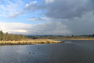
Burnaby Lake is a lake located in Burnaby, British Columbia and is the focal geographic feature and namesake of Burnaby Lake Regional Park. The lake occupies 3.11 square kilometres of land, and is home to a large variety of wildlife. At least 70 species of birds make the lake and surrounding areas their home, and about 214 species of birds visit the lake throughout the year. The park has been managed by the Metro Vancouver Parks Department since 1977.

Prince Gallitzin State Park is a 6,249-acre (2,529 ha) Pennsylvania state park with acreage in both Chest and White Townships in Cambria County of West Central Pennsylvania in the United States, near both Gallitzin Borough, & Gallitzin Township in the greater Altoona, Pennsylvania area.

Little Buffalo State Park is a Pennsylvania state park on 923 acres (3.7 km2) in Centre and Juniata Townships, Perry County, Pennsylvania in the United States. The park is a historical destination as well as a recreational destination. Visitors to the park can cross a covered bridge and observe a restored and operating grist mill. The park is also home to Holman Lake a popular fishing lake in Perry County and several hundred acres are open to hunting. Little Buffalo State Park is a mile southwest of Newport just off Pennsylvania Route 34.

The Current River Greenway is a 263 hectare greenway located in Current River neighbourhood in the north end of Thunder Bay, Ontario along the Current River.

Deer Creek State Park a state park in south western Wasatch County, Utah, United States, featuring large Deer Creek Dam and Reservoir. The park is located near the town of Charleston in the southwest corner of the Heber Valley.

Kanaka Creek Regional Park is a regional park of the Greater Vancouver Regional District, located in the city of Maple Ridge, British Columbia, flanking both sides of Kanaka Creek from its confluence with the Fraser River just east of Haney and extending approximately 11 km up the creek to just south of the community of Webster's Corners. The Maple Ridge Fairgrounds are just east of the lower regions of the park, beyond them is the community of Albion. Derby Reach Regional Park is just across the Fraser in Langley.

Farhad Sadeghi Amini, born in Isfahan, Iran, 1963 is an Iranian painter.
Muriel Agnes Yewdale (1908–2000) was a 20th-century Canadian artist.

Central Park is a 90-hectare (220-acre) urban park in Burnaby, British Columbia, founded in 1891.

The Burnaby Art Gallery is an art museum in Burnaby, British Columbia, Canada. The museum is located on the northern periphery of Deer Lake Park, situated off of Deer Lake Avenue. The museum occupies Fairacres Mansion, designated as a historic site by the municipal and provincial governments.


