Denali Park (CDP), Alaska

Last updated

Denali Park, Alaska
Denali Borough Alaska incorporated and unincorporated areas McKinley Park highlighted.svg
Location in Denali Borough and the state of Alaska.
Coordinates: 63°39′5″N148°49′20″W / 63.65139°N 148.82222°W / 63.65139; -148.82222
CountryUnited States
State Alaska
Borough Denali
Government
  Borough mayor Clay Walker [1]
   State senator Mike Shower (R)
   State rep. Kevin McCabe (R)
Area
[2]
  Total176.54 sq mi (457.23 km2)
  Land176.30 sq mi (456.60 km2)
  Water0.24 sq mi (0.62 km2)
Elevation
1,749 ft (533 m)
Population
 (2020)
  Total163
  Density0.92/sq mi (0.36/km2)
Time zone UTC-9 (Alaska (AKST))
  Summer (DST) UTC-8 (AKDT)
Area code 907
FIPS code 02-18805
GNIS feature ID1423625

Denali Park, formerly McKinley Park, is a census-designated place (CDP) in Denali Borough, in the U.S. state of Alaska. As of the 2020 census, the population of the CDP was 163, down from 185 at the 2010 census.

Contents

Geography

The train station in Denali Park, Alaska Alaska McKinley Park train station 1972 01.jpg
The train station in Denali Park, Alaska
The banks of the Nenana River in Denali Park Nenana River near Denali, Alaska.jpg
The banks of the Nenana River in Denali Park
George Parks Highway at the Nenana River in Denali Park McKinley Park, AK, USA - panoramio - Roger Sylvia (2).jpg
George Parks Highway at the Nenana River in Denali Park
Milepost 238 in Denali Park Milepost238.jpg
Milepost 238 in Denali Park

Denali Park is located at 63°39′5″N148°49′20″W / 63.65139°N 148.82222°W / 63.65139; -148.82222 (63.651444, -148.822322). [3] It is in the valley of the Nenana River along the eastern edge of Denali National Park and Preserve. The park's main visitor center is located along the main road into the park, just to the west of the CDP's limits. The George Parks Highway (Alaska Route 3) is the main road through the CDP: Anchorage is 231 miles (372 km) to the south, and Fairbanks is 128 miles (206 km) to the north.

According to the United States Census Bureau, the Denali Park CDP has a total area of 176.5 square miles (457.2 km2), of which 176.3 square miles (456.6 km2) is land and 0.2 square miles (0.6 km2), or 0.14%, is water. [4]

Climate

Denali Park has a subarctic climate (Dfc) like most of Alaska. Summer days are mild with nights being brisk. Winters are severely cold with extremely heavy annual snowfall averaging 76.7 inches (195 cm). Most of Denali Park's precipitation occurs during the months of June - September. [5]

Climate data for Denali Park HQ, Alaska, 1991–2020 normals, extremes 1921–present
MonthJanFebMarAprMayJunJulAugSepOctNovDecYear
Record high °F (°C)52
(11)
52
(11)
56
(13)
67
(19)
81
(27)
91
(33)
88
(31)
88
(31)
82
(28)
69
(21)
56
(13)
52
(11)
91
(33)
Mean maximum °F (°C)38.6
(3.7)
41.1
(5.1)
41.9
(5.5)
55.1
(12.8)
70.5
(21.4)
79.7
(26.5)
80.0
(26.7)
75.7
(24.3)
64.0
(17.8)
52.1
(11.2)
38.2
(3.4)
38.3
(3.5)
82.6
(28.1)
Mean daily maximum °F (°C)11.1
(−11.6)
17.3
(−8.2)
25.6
(−3.6)
39.4
(4.1)
54.4
(12.4)
65.0
(18.3)
66.7
(19.3)
60.9
(16.1)
50.2
(10.1)
31.6
(−0.2)
16.5
(−8.6)
14.9
(−9.5)
37.8
(3.2)
Daily mean °F (°C)3.1
(−16.1)
7.6
(−13.6)
13.4
(−10.3)
27.9
(−2.3)
42.8
(6.0)
52.8
(11.6)
55.6
(13.1)
50.6
(10.3)
40.4
(4.7)
22.9
(−5.1)
8.9
(−12.8)
6.9
(−13.9)
27.7
(−2.4)
Mean daily minimum °F (°C)−4.9
(−20.5)
−2.1
(−18.9)
1.2
(−17.1)
16.4
(−8.7)
31.2
(−0.4)
40.6
(4.8)
44.6
(7.0)
40.4
(4.7)
30.6
(−0.8)
14.2
(−9.9)
1.3
(−17.1)
−1.2
(−18.4)
17.7
(−7.9)
Mean minimum °F (°C)−33.5
(−36.4)
−27.1
(−32.8)
−21.9
(−29.9)
−3.9
(−19.9)
19.3
(−7.1)
31.4
(−0.3)
35.8
(2.1)
29.8
(−1.2)
16.1
(−8.8)
−3.0
(−19.4)
−18.5
(−28.1)
−26.2
(−32.3)
−36.2
(−37.9)
Record low °F (°C)−52
(−47)
−54
(−48)
−47
(−44)
−33
(−36)
−14
(−26)
19
(−7)
23
(−5)
17
(−8)
−6
(−21)
−24
(−31)
−37
(−38)
−54
(−48)
−54
(−48)
Average precipitation inches (mm)0.61
(15)
0.71
(18)
0.51
(13)
0.43
(11)
0.84
(21)
2.42
(61)
3.12
(79)
3.01
(76)
1.74
(44)
0.84
(21)
0.84
(21)
0.83
(21)
15.90
(404)
Average snowfall inches (cm)9.0
(23)
8.4
(21)
6.8
(17)
6.1
(15)
3.1
(7.9)
0.1
(0.25)
0.0
(0.0)
0.0
(0.0)
4.7
(12)
9.9
(25)
13.2
(34)
15.4
(39)
76.7
(194.15)
Average extreme snow depth inches (cm)20.0
(51)
23.4
(59)
24.7
(63)
23.5
(60)
10.4
(26)
0.0
(0.0)
0.0
(0.0)
0.0
(0.0)
3.6
(9.1)
6.6
(17)
12.4
(31)
17.0
(43)
29.8
(76)
Average precipitation days (≥ 0.01 in)7.66.04.94.06.512.615.615.611.89.79.89.3113.4
Average snowy days (≥ 0.1 in)9.17.36.24.61.70.00.00.72.18.311.410.561.9
Source 1: NOAA [6]
Source 2: National Weather Service [7]

Demographics

Historical population
CensusPop.Note
1930 49
1940 11−77.6%
1950 59436.4%
1960 28−52.5%
1980 60
1990 171185.0%
2000 142−17.0%
2010 18530.3%
2020 163−11.9%
U.S. Decennial Census [8]

Denali Park, then known as McKinley Park, first reported on the 1930 U.S. Census as an unincorporated village. It continued to report until 1960. It did not report in 1970. It has returned in every census since 1980, when it was made a census-designated place (CDP). With the restoration of the name of Mount McKinley to Denali made official in 2015, McKinley Park's name was changed to Denali Park. [9]

As of the census [10] of 2000, there were 142 people, 72 households, and 31 families residing in the CDP. The population density was 0.8 inhabitants per square mile (0.31/km2). There were 167 housing units at an average density of 1 per square mile (0.4/km2). The racial makeup of the CDP was 92.96% White, 0.70% Native American, 2.82% from other races, and 3.52% from two or more races. Hispanic or Latino of any race were 1.41% of the population.

There were 72 households, out of which 15.3% had children under the age of 18 living with them, 40.3% were married couples living together, 2.8% had a female householder with no husband present, and 55.6% were non-families. 41.7% of all households were made up of individuals, and 1.4% had someone living alone who was 65 years of age or older. The average household size was 1.97 and the average family size was 2.78.

In the CDP, the population was spread out, with 16.9% under the age of 18, 3.5% from 18 to 24, 43.0% from 25 to 44, 33.1% from 45 to 64, and 3.5% who were 65 years of age or older. The median age was 41 years. For every 100 females, there were 153.6 males. For every 100 females age 18 and over, there were 145.8 males.

The median income for a household in the CDP was $53,750, and the median income for a family was $64,583. Males had a median income of $56,250 versus $31,250 for females. The per capita income for the CDP was $27,255. About 8.6% of families and 11.5% of the population and 8.6% of families were below the poverty line, including 32.0% of those under the age of 18 and none of those 65 and older.

Related Research Articles

<span class="mw-page-title-main">Denali Borough, Alaska</span> Borough in Alaska, United States

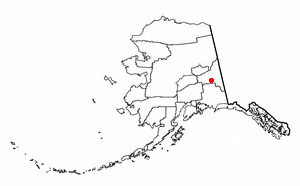
The Denali Borough is a borough located in the U.S. state of Alaska. As of the 2020 census the population of the borough was 1,619, down from 1,826 in 2010. The borough seat and most populated community is Healy, and its only incorporated place is Anderson. The borough was incorporated in December 1990.

<span class="mw-page-title-main">Cantwell, Alaska</span> Census-designated place in Alaska, United States

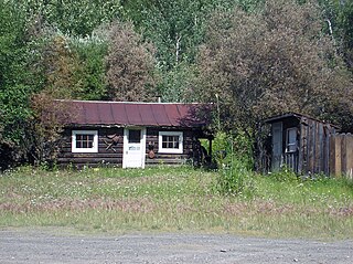
Cantwell is a census-designated place (CDP) in Denali Borough, Alaska, United States. As of the 2020 census, the population of the CDP was 200.

<span class="mw-page-title-main">Ferry, Alaska</span> Census-designated place in Alaska, United States

Ferry is a census-designated place (CDP) in Denali Borough, Alaska, United States. The population was 17 at the 2020 census, down from 33 in 2010.

<span class="mw-page-title-main">Healy, Alaska</span> Census-designated place in Alaska

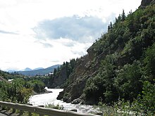
Healy is a census-designated place (CDP) and the borough seat of Denali Borough in the U.S. state of Alaska. The population was 966 at the time of the 2020 census, down from 1,021 in 2010.

<span class="mw-page-title-main">Moose Creek, Alaska</span> CDP in Alaska, United States

Moose Creek is a census-designated place (CDP) in Fairbanks North Star Borough in the U.S. state of Alaska. As of the 2010 census, the population of the CDP was 747, up from 542 in 2000. It is part of the Fairbanks, Alaska Metropolitan Statistical Area. Moose Creek is located south of Fairbanks, Alaska along the Richardson Highway. Moose Creek is bordered by Eielson Air Force Base to the south, the Tanana River to the west, and the Chena River Flood Control Project to the north.

<span class="mw-page-title-main">Chickaloon, Alaska</span> Census-designated place in Matanuska-Susitna Borough, Alaska, United States

Chickaloon is a census-designated place (CDP) in Matanuska-Susitna Borough, Alaska, United States. It is part of the Anchorage, Alaska Metropolitan Statistical Area. The population was 254 at the 2020 census, down from 272 in 2010.

<span class="mw-page-title-main">Petersville, Alaska</span> Census-designated place in Alaska, United States

Petersville is a census-designated place (CDP) in Matanuska-Susitna Borough, Alaska, United States. It is part of the Anchorage Metropolitan Area. The population was 27 at the 2020 census.

<span class="mw-page-title-main">Point MacKenzie, Alaska</span> CDP in Alaska, United States

Point MacKenzie is a census-designated place (CDP) in Matanuska-Susitna Borough, Alaska, United States. It is part of the Anchorage, Alaska Metropolitan Statistical Area. At the 2020 census the population was 1,852, up from 529 in 2010.

<span class="mw-page-title-main">Sutton-Alpine, Alaska</span> Census-designated place in Alaska, United States

Sutton is a census-designated place (CDP) in the Matanuska-Susitna Borough in the U.S. state of Alaska. At the 2020 census the population was 1,038, down from 1,447 in 2010. The CDP includes the former coal mining community and road construction camp of Sutton, as well as the former mining camps of Eska and Jonesville.

<span class="mw-page-title-main">Trapper Creek, Alaska</span> Census-designated place in Alaska, United States

Trapper Creek is a census-designated place (CDP) in Matanuska-Susitna Borough, Alaska, United States. It is part of the Anchorage Metropolitan Area and is known as the southern gateway to Denali State Park. According to the 2020 census the population of Trapper Creek was 499.

Deltana is a census-designated place (CDP) in the Southeast Fairbanks Census Area, Alaska, United States. At the 2020 census, the population was 2,359, up from 2,251 in 2010. Native inhabitants are Tanana Athabaskans.

<span class="mw-page-title-main">Dot Lake, Alaska</span> CDP in Alaska, United States

Dot Lake is a census-designated place (CDP) in Southeast Fairbanks Census Area, Alaska, United States. It is located on the Alaska Highway between Delta Junction and Tok. The population was 13 at the 2010 census, down from 19 in 2000.

<span class="mw-page-title-main">Healy Lake, Alaska</span> CDP in Alaska, United States

Healy Lake is a census-designated place (CDP) in Southeast Fairbanks Census Area, Alaska, United States. The population was 13 at the 2010 census, down from 37 in 2000.

Paxson is a census-designated place (CDP) in Copper River Census Area, Alaska, United States. As of the 2020 census, its population was 26, down from 40 in 2010. It is located on the Richardson Highway at the junction with the Denali Highway.

<span class="mw-page-title-main">Livengood, Alaska</span> CDP in Alaska, United States

Livengood is a census-designated place (CDP) in Yukon-Koyukuk Census Area, Alaska, United States. The population was 16 at the 2020 census, compared to 13 in 2010 and 29 in 2000.

<span class="mw-page-title-main">Twin Lakes, New Mexico</span> CDP in New Mexico, United States

Twin Lakes is a census-designated place (CDP) in McKinley County, New Mexico, United States. The population was 1,069 at the 2000 census.

Fort McKinley is an unincorporated community and census designated place in Harrison Township in Montgomery County, Ohio, United States. It was delineated as a census-designated place (CDP) at the 2000 census, when its population was 3,989. It was not delineated as a CDP for the 2010 census.

<span class="mw-page-title-main">Hometown, Pennsylvania</span> CDP in Pennsylvania, United States

Hometown is a village in Rush Township, Schuylkill County, Pennsylvania, United States that sits astride a crossing point between important transportation corridors. The population was 1,399 at the 2000 census, and excepting for the area near the east–west PA 54 running mostly parallel to the tracks of the Reading, Blue Mountain, and Northern Railroad — once the important east-west shortline Nesquehoning & Mahanoy Railroad — and the PA 54 junction with PA 309.

<span class="mw-page-title-main">Welcome, South Carolina</span> Census-designated place in South Carolina, United States

Welcome is a census-designated place (CDP) in Greenville County, South Carolina, United States. The population was 6,668 at the 2010 census. It is part of the Greenville–Mauldin–Easley Metropolitan Statistical Area. Welcome has been noted for its colorful place name.

<span class="mw-page-title-main">Elmwood Park, Wisconsin</span> Village in Wisconsin, United States

Elmwood Park is a village in Racine County, Wisconsin, United States. The population was 510 at the 2020 census.

References

  1. 2015 Alaska Municipal Officials Directory. Juneau: Alaska Municipal League. 2015. p. 5.
  2. "2020 U.S. Gazetteer Files". United States Census Bureau. Retrieved October 29, 2021.
  3. "US Gazetteer files: 2010, 2000, and 1990". United States Census Bureau. February 12, 2011. Retrieved April 23, 2011.
  4. "Geographic Identifiers: 2010 Demographic Profile Data (G001): McKinley Park CDP, Alaska". U.S. Census Bureau, American Factfinder. Retrieved October 8, 2015.[ dead link ]
  5. "MCKINLEY PARK, ALASKA - Climate Summary". wrcc.dri.edu. Retrieved June 10, 2020.
  6. "U.S. Climate Normals Quick Access". National Oceanic and Atmospheric Administration. Retrieved September 1, 2022.
  7. "NOAA Online Weather Data". National Weather Service. Retrieved September 1, 2022.
  8. "U.S. Decennial Census". Census.gov. Retrieved June 6, 2013.
  9. http://live.laborstats.alaska.gov/pop/estimates/pub/chap4.pdf [ bare URL PDF ]
  10. "U.S. Census website". United States Census Bureau . Retrieved January 31, 2008.

63°39′05″N148°49′20″W / 63.651444°N 148.822322°W / 63.651444; -148.822322