
Van Buren County is a county located in the U.S. state of Arkansas. As of the 2020 census, the population was 15,796. The county seat is Clinton. The county was formed on November 11, 1833, and named for Martin Van Buren, President of the United States, who was Vice President at the time of the county's formation. Van Buren County was a dry county until November 3, 2020, as the county residents voted to make it a wet county.
Fairfield Bay is a city in Cleburne and Van Buren counties in the northern part of the U.S. state of Arkansas. The population was 2,108 at the 2020 census. The population in its portion in Van Buren County, which accounts for the bulk of the city limits, made the city the most populous in Van Buren County as of the 2000 census, but with a slight decline in population, lost the distinction to Clinton as of 2010.

Greers Ferry is a city in Cleburne County, Arkansas, United States. The population was 891 at the 2010 census. It was founded in 1968.

Cedarville is a city in Crawford County, Arkansas, United States. It is part of the Fort Smith, Arkansas-Oklahoma Metropolitan Statistical Area. The population was 1,410 at the 2020 census.
Kibler is a city in Crawford County, Arkansas, United States. It is part of the Fort Smith, Arkansas-Oklahoma Metropolitan Statistical Area. As of the 2010 Census the population was 961.

Van Buren is the second-largest city in the Fort Smith, Arkansas–Oklahoma Metropolitan Statistical Area and the county seat of Crawford County, Arkansas, United States. The city is located directly northeast of Fort Smith at the Interstate 40 – Interstate 540 junction. The city was incorporated in 1845 and as of the 2020 census had a population of 23,218, ranking it as the state's 21st largest city. According to 2023 population estimates from the U.S. Census Bureau, Van Buren’s population is 24,138. With a 4% growth rate from 2020 to 2023, Van Buren is Arkansas’s eighth-fastest growing city.

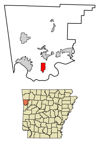
Grannis is a city in Polk County, Arkansas, United States. The population was 554 at the 2010 census.

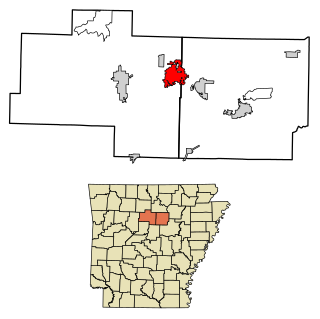
London is a city in Pope County, Arkansas, United States. The population was 1,039 at the 2010 census. It is part of the Russellville Micropolitan Statistical Area.

Shirley is a town in northeast Van Buren County, Arkansas, United States, along the Middle Fork of the Little Red River. A one-time railroad outpost, the community today is oriented toward agriculture and recreational activities due to the river and Greers Ferry Lake. The population was 223 at the 2010 census.

Van Buren is a town in Van Buren Township, Grant County, Indiana, United States. The population was 864 at the 2010 census.

Birmingham is a city in Van Buren County, Iowa, United States. The population was 367 at the 2020 census.

Cantril is a city in Van Buren County, Iowa, United States. The population was 224 at the 2020 census.

Douds is a census-designated place (CDP) in Van Buren County, Iowa, United States. The population was 156 at the 2020 census.
Farmington is a city in Van Buren County, Iowa, United States. The population was 579 at the time of the 2020 census.

Leando is a census-designated place (CDP) in Van Buren County, Iowa, United States. The population was 121 at the 2020 census.

Milton is a city in Van Buren County, Iowa, United States. The population was 380 at the time of the 2020 census.
Stockport is a city in Van Buren County, Iowa, United States. The population was 272 at the time of the 2020 census.

Lake Winnebago is a city in Cass County, Missouri, United States. The population was 1,131 at the 2010 census. It is part of the Kansas City metropolitan area.

Van Buren is a village in Hancock County, Ohio, United States. The population was 396 at the 2020 census.

Van Buren is a town on the Saint John River in Aroostook County, Maine, United States; located across from Saint-Leonard, New Brunswick, Canada. The population was 2,038 at the 2020 census. It is named after U.S. President Martin Van Buren.


