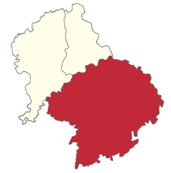
Nakur is a town, tehsil and a municipal board in Saharanpur district in the Indian state of Uttar Pradesh.

Jind is one of the largest and oldest city in Jind district in the Indian state of Haryana. It is administrative headquarter of Jind district. Rani Talab is the main destination for tourists while Pandu Pindara and Ramrai are the main religious spots, attracting devotees for the holy bath during Amavasya.
Jhajjar is a town in Jhajjar district in the Indian state of Haryana. It is situated on the road connecting Rewari to Rohtak (NH-352), Loharu to Meerut (NH334B), Charkhi Dadri to Delhi and Gurgaon to Bhiwani. Jhajjar is located 55 km (34 mi) west of Delhi.
Hamirpur is a town and a municipal board in Hamirpur district in the Indian state of Uttar Pradesh. Located just above the confluence of the Yamuna and Betwa rivers, it is the administrative headquarters of Hamirpur district.
Betma is a town and a nagar panchayat in Indore district in the state of Madhya Pradesh, India.
Budhana is a town, block, tehsil, nagar panchayat, and one of the constituencies of the Uttar Pradesh Legislative Assembly in Muzaffarnagar district in Uttar Pradesh, India.
Chhaprauli is a town and a nagar panchayat in Baghpat district in the state of Uttar Pradesh, India.
Chhibramau is a nagar palika parishad and a subdivision (tehsil) of Kannauj district in the northern state of Uttar Pradesh, India.
Dhariawad is a census town in Pratapgarh district in the state of Rajasthan, India. It is the administrative headquarters for Dhariawad Tehsil.
Gogapur is a census town in tehsil Mehidpur City and Ujjain district in the Indian state of Madhya Pradesh.This town is commonly known as Mehidpur Road and Mehidpur Mandi.
Hatod is a town and a nagar parishad in Indore district in the Indian state of Madhya Pradesh.
Jhinjhana is a town and a nagar panchayat in Shamli district in the Indian state of Uttar Pradesh.
Narauli is a town and a nagar panchayat in Sambhal district in the Indian state of Uttar Pradesh.
Sunam is a town and a tehsil, near city of Sangrur in Sangrur district in the Indian state of Punjab. The Railway Station of Sunam was renamed as Sunam Udham Singh Wala.
Tijara is a city and a municipality in Khairthal-Tijara district of the Indian state of Rajasthan. Tijara comes under the NCR area and is situated 55 km to the northeast of Alwar. The nearest railway station to Tijara is Khairthal. Bhiwadi is a census town in Tijara. It is the biggest industrial area of Rajasthan and part of the historical Ahirwal Mewat region. Tijara is dominated by Yadav and Meo community. The new political map has not erased the ancient Ahirwal-Mewat boundaries. Ahirwal was a post-Mughal principality ruled by Ahirs or Yadavs.
Tilpat is a census town in Faridabad district in the Indian state of Haryana that comes under the Capital Region. It is famous for the revolt against Mughals. It also has the Tilpat 1 & 2 ranges of Indian Air Force on the banks of Yamuna. Tilpat is the largest village of Brahmins in Ballabgarh tehsil. Brahmins are the majority and the largest zamindars, and other castes like Jats and Gurjars are sprinkled minority.

Mirpur is an upazila of Kushtia District in the Division of Khulna, Bangladesh. Mirpur Thana was formed in 1885 and it was turned into an upazila in 1983.
Shahi is a town and a nagar panchayat in Bareilly district in the Indian state of Uttar Pradesh.Shahi is the one of most old British town areas First Chairman of Town Shahi is Haji Nadir Shah khan in 1868 after him his Son Khan bahadur Mohammed Raza Khan is Chairman and M.L.A of bareilly he is also Chairman of district Board Bareilly, after Mohammed Raza Khan death his son Hamid Raza Khan is also became Chairman and M.L.A of Bhojipura Constituency he is a Famous politician after his death in 1989 Son of Hamid Raza Khan, Shahid Raza khan Became Chairman of Town Area Shahi for Almost 50 years
Phaphund is a town and a nagar panchayat in Auraiya district in the Indian state of Uttar Pradesh.

Barwala is a town situated 30 km northeast of Hisar city. It is one of the 4 sub-division of Hisar district in the state of Haryana, India.


