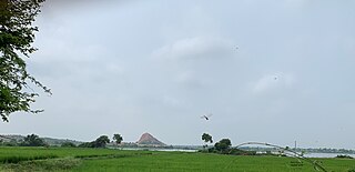
Kalaburagi, formerly known as Gulbarga, is a city in the Indian state of Karnataka. It is the administrative headquarters of the Kalaburagi district and is the largest city in the region of North Karnataka (Kalyana-Karnataka). Kalaburagi is 568 km north of the state capital city of Bangalore. It was incorporated into the newly formed Mysore State through the States Reorganisation Act in 1956.

Bijapur, officially known as Vijayapura, is the district headquarters of Bijapur district of the Karnataka state of India. It is also the headquarters for Bijapur Taluk. Bijapur city is well known for its historical monuments of architectural importance built during the rule of the Adil Shahi dynasty. It is also well known for the popular Karnataka premier league team, the Bijapur Bulls. Bijapur is located 519 km (322 mi) northwest of the state capital Bangalore and about 550 km (340 mi) from Mumbai and 210 km (130 mi) north east of the city of Belgaum.

Kalaburagi district, formerly known as Gulbarga district, is one of the 31 districts of Karnataka state in southern India. Kalaburagi city is the administrative headquarters of the district. The district is the headquarters of Kalaburagi division.
Chincholi is a panchayat town and a taluka in Kalaburagi district in the state of Karnataka, India.

Gurmitkal, or Gurumithakal, is a panchayat town in the northeast of Yadgir district in the Indian state of Karnataka. Administratively, it is under Gurumitkal Taluka.

Lingasugur is a municipal town in Raichur district in the Indian state of Karnataka. There are many Temples, hills and forts (Quila). The festivals of Muharram and Maha Shivaratri are important here. Mudgal in Lingasugur taluk has a very ancient fort. It has often been mentioned in the autobiography of Philip Meadows Taylor. Lingasugur, then known as Chavani was the site of a major British cantonment in the region.
Sedam or Seram is a town in Kalaburagi district in the Indian state of Karnataka. It is also the headquarters of the Sedam Taluka.
Joida is a town located in the Uttara Kannada district in the Indian state of Karnataka. The town is the headquarters of the eponymous taluk. Earlier it was known as Supa taluka but as Supa village got submerged due to dam built across river Kali, Joida taluka came into existence. Joida town has a Post office, branch of nationalised banks and a Police station.

Kalagi is a new taluk in Kalaburagi, earlier it was a Hobli and Village in Chittapur Taluka in the southern state of Karnataka, India. It is located in the Chitapur taluk of Kalaburagi district in Karnataka.
Madan Hipparga is a village in the southern state of Karnataka, India. It is located in the Aland taluk of Kalaburagi district in Karnataka.
Arehalli is a village in the state of Karnataka in southern India.As per census 2011, the location code number of Arehalli is 615144. It is located in the Belur taluk of Hassan district in Karnataka, and is about 230 kilometres from the state capital Bangalore, and 146 kilometres from the chief port city of Mangalore. It is well connected by road through the city of Hassan. The nearest airport is Mangalore International Airport at 160 km, and the nearest major railway station is Hassan Junction railway station located at a distance of 46 km; Sakleshpura railway station is 17 km away.
Adwadgi is a village in the southern state of Karnataka, India. Administratively, Adwadgi is under Sugooru gram panchayat, Shorapur Taluka of Yadgir district in Karnataka. The village of Adwadgi is 3 km by road northeast of the village of Sugur and 7.5 km by road south of the village of Hemnoor. The nearest railhead is in Yadgir.
Ratkal is a village in the Indian state of Karnataka.It is located in Northern Karnataka, in Chincholi taluk of Kalburgi district.
Kanakpur, is a grampanchayat headquarter village in the southern state of Karnataka, India, this village previously called with name Karakmukli. It is located in the Chincholi taluk of Kalaburagi district.
Garampalli is a village in the southern state of Karnataka, India It is located in Chincholi taluk of Kalaburagi district. It belongs to karakmukli grampanchayat.And one of the basaveshwara temple is their,And yearly one time village festival takes place .In time of April–May. And in front of the basaveshwara temple,Mullamari river is passed and reach to chincholi. And this river is came from Nagaral dam(village).
Khudavandpur is a village in the southern state of Karnataka, India It is located in Chincholi taluk of Kalaburagi district. It belongs to karakmukli grampanchayat.
Hudadalli is a village in the southern state of Karnataka, India It is located in Chincholi taluk of Kalaburagi district.
Hasargundgi is a village and Grampanchayat headquarter of Hasargundgi grampanchayat, in the southern state of Karnataka, India It is located in Chincholi taluk of Kalburgi district. The nearest village is Chimmanchod.
Tajlapur is a village in the southern state of Karnataka, India. It is located in Chincholi taluk of Kalburgi district. The nearest villages are Kanakpur and Chimmanchod
Chimmaidlai is a village in the southern state of Karnataka, India. It is located in Chincholi taluk of Kalburgi district. According to the 2011 census of India, this village has population of 3071, where 1555 are males and 1516 are females.


