Dodson, Montana | |
---|---|
Coordinates: 48°23′45″N108°14′58″W / 48.39583°N 108.24944°W | |
Country | United States |
State | Montana |
County | Phillips |
Area | |
• Total | 0.17 sq mi (0.43 km2) |
• Land | 0.17 sq mi (0.43 km2) |
• Water | 0.00 sq mi (0.00 km2) |
Elevation | 2,284 ft (696 m) |
Population (2020) | |
• Total | 125 |
• Density | 753.01/sq mi (290.51/km2) |
Time zone | UTC-7 (Mountain (MST)) |
• Summer (DST) | UTC-6 (MDT) |
ZIP code | 59524 |
Area code | 406 |
FIPS code | 30-21025 |
GNIS feature ID | 2412438 [2] |
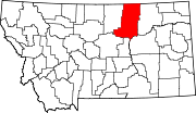
Dodson is a town in Phillips County, Montana, United States. The population was 125 at the 2020 census. [3]
Dodson was named after a merchant who operated a trading post and saloon there before the Great Northern Railway came through. The first post office was established in 1891. [4]
According to the United States Census Bureau, the town has a total area of 0.19 square miles (0.49 km2), all land. [5] Dodson is near Fort Belknap Indian Reservation, located between the Milk River and Little Rocky Mountains. It is home to the Gros Ventre and Assiniboine tribes. [6]
According to the Köppen Climate Classification system, Dodson has a semi-arid climate, abbreviated "BSk" on climate maps. [7]
Census | Pop. | Note | %± |
---|---|---|---|
1920 | 365 | — | |
1930 | 249 | −31.8% | |
1940 | 397 | 59.4% | |
1950 | 330 | −16.9% | |
1960 | 313 | −5.2% | |
1970 | 196 | −37.4% | |
1980 | 158 | −19.4% | |
1990 | 137 | −13.3% | |
2000 | 122 | −10.9% | |
2010 | 124 | 1.6% | |
2020 | 125 | 0.8% | |
U.S. Decennial Census [8] [3] |
As of the census [9] of 2010, there were 124 people, 49 households, and 32 families residing in the town. The population density was 652.6 inhabitants per square mile (252.0/km2). There were 71 housing units at an average density of 373.7 per square mile (144.3/km2). The racial makeup of the town was 41.9% White, 49.2% Native American, 2.4% from other races, and 6.5% from two or more races. Hispanic or Latino of any race were 6.5% of the population.
There were 49 households, of which 38.8% had children under the age of 18 living with them, 40.8% were married couples living together, 16.3% had a female householder with no husband present, 8.2% had a male householder with no wife present, and 34.7% were non-families. 32.7% of all households were made up of individuals, and 12.3% had someone living alone who was 65 years of age or older. The average household size was 2.53 and the average family size was 3.16.
The median age in the town was 35.5 years. 32.3% of residents were under the age of 18; 6.4% were between the ages of 18 and 24; 21.7% were from 25 to 44; 15.2% were from 45 to 64; and 24.2% were 65 years of age or older. The gender makeup of the town was 54.8% male and 45.2% female.
As of the census [10] of 2000, there were 122 people, 49 households, and 34 families residing in the town. The population density was 648.4 inhabitants per square mile (250.3/km2). There were 66 housing units at an average density of 350.8 per square mile (135.4/km2). The racial makeup of the town was 50.00% White, 45.08% Native American, 0.82% Asian, and 4.10% from two or more races. Hispanic or Latino of any race were 2.46% of the population.
There were 49 households, out of which 40.8% had children under the age of 18 living with them, 49.0% were married couples living together, 14.3% had a female householder with no husband present, and 28.6% were non-families. 28.6% of all households were made up of individuals, and 20.4% had someone living alone who was 65 years of age or older. The average household size was 2.49 and the average family size was 2.97.
In the town, the population was spread out, with 33.6% under the age of 18, 4.9% from 18 to 24, 20.5% from 25 to 44, 19.7% from 45 to 64, and 21.3% who were 65 years of age or older. The median age was 39 years. For every 100 females, there were 87.7 males. For every 100 females age 18 and over, there were 76.1 males.
The median income for a household in the town was $19,464, and the median income for a family was $33,750. Males had a median income of $21,250 versus $33,125 for females. The per capita income for the town was $10,187. There were 23.7% of families and 28.9% of the population living below the poverty line, including 44.7% of under eighteens and 11.1% of those over 64.
Dodson School District educates students from kindergarten through 12th grade. [11] Dodson High School's team name is the Coyotes. [12]
Phillips County Library has a branch location in Dodson. [13]
Dodson is the location of the Phillips County Fair, which claims to be the longest-running fair in Montana. [14]
The Phillips County News is a weekly local newspaper. [15] They provide a printed paper as well as news online.
Amtrak’s Empire Builder, which operates between Seattle/Portland and Chicago, passes through the town on BNSF tracks, but makes no stop. The nearest station is located in Malta, 18 miles (29 km) to the east.
Wibaux County is a county in the U.S. state of Montana. As of the 2020 census, the population was 937, making it the fourth-least populous county in Montana. Its county seat is Wibaux.
Phillips County is a county in the U.S. state of Montana. As of the 2020 census, the population was 4,217. Its county seat is Malta. Before February 5, 1915, Phillips County was part of Blaine County, and before 1912 both were part of Chouteau County. It was named for rancher and state senator Benjamin D. Phillips.
Mooreland is a town in Blue River Township, Henry County, Indiana, United States. The population was 375 at the 2010 census.
Alexander is a town in Washington County, Maine, United States. The population was 525 at the 2020 census. The town is named for Alexander Baring, 1st Baron Ashburton, the British negotiator of the Webster–Ashburton Treaty which ended the Aroostook War in 1838–1839.
Fair Plain is an unincorporated community in Berrien County in the U.S. state of Michigan. It is a census-designated place (CDP) for statistical purposes and has no legal status as a municipality. The population was 7,402 at the 2020 census.
Ekalaka is a town in and the county seat of Carter County, Montana, United States. The population was 399 at the 2020 census.
Sun Prairie is a census-designated place (CDP) in Cascade County, Montana, United States. The population was 1,630 at the 2010 census. It is part of the Great Falls Metropolitan Statistical Area and may have evolved as a remote suburb of Great Falls.
Moore is a town in Fergus County, Montana, United States. The population was 194 at the 2020 census.
Ryegate is a town in, and the county seat of, Golden Valley County, Montana, United States. The population was 223 at the 2020 census. Ryegate is situated on the north bank of the Musselshell River.
Sheridan is a town in Madison County, Montana, United States named after the Civil War general Philip Sheridan. The population was 694 at the 2020 census. Sheridan is known as the "heart of the Ruby Valley." Seven mountain ranges surround the town: Tobacco Root Mountains, Highland Mountains, McCartney Mountain, The Pioneers, The Ruby Range, The Gravelly Range and the Snowcrest Range. The Ruby River winds through the valley just west of the town.
Circle is a town in and the county seat of McCone County, Montana, United States. The population was 591 at the 2020 census.
Superior is a town in, and the county seat of, Mineral County, Montana, United States. The population was 830 at the 2020 census.
Malta is a city in, and the county seat of, Phillips County, Montana, United States, located at the intersection of U.S. Routes 2 and 191. The population was 1,860 at the 2020 census.
Saco is a town in Phillips County, Montana, United States. The population was 159 at the 2020 census.
Terry, incorporated in 1910, is a town and the county seat of Prairie County, Montana, United States. The population was 562 at the 2020 census.
Bainville is a town in Roosevelt County, Montana, United States. The population was 271 at the 2020 census. It is named for Charles M. Bain, an early resident and the town's first postmaster. Bainville celebrated its centennial on July 4, 2006.
Westby is a town in Sheridan County, Montana, United States. The population was 167 at the 2020 census.
Nashua is a town in Valley County, Montana, United States. The population was 301 at the 2020 census.
Plevna is a town in Fallon County, Montana, United States. The population was 179 at the 2020 census.
Fair Oaks is a town in Rogers and Wagoner counties in the U.S. state of Oklahoma. The population was 103 at the 2010 census, a 15.6 percent decline from the figure of 122 recorded in 2000. It is a suburb of Tulsa.