Dongan Hills station

Last updated

Dongan Hills
MTA NYC logo.svg Staten Island Railway station (rapid transit)
Dongan Hills station - September 2020.jpg
Dongan Hills station in September 2020
General information
LocationSeaview Avenue & North Railroad Avenue
Dongan Hills, Staten Island
Coordinates 40°35′20″N74°05′45″W / 40.5890°N 74.0959°W / 40.5890; -74.0959
Platforms2 side platforms
Tracks2
Construction
Structure type Embankment
AccessibleYes
Other information
Station code507
History
OpenedApril 23, 1860 [1]
Rebuilt1933
Previous namesGarretson's
Services
Preceding station MTA NYC logo.svg Staten Island Railway Following station
Old Town
toward St. George
NYCS-bull-trans-SIR-Std.svg Jefferson Avenue
toward Tottenville

The Dongan Hills station is a Staten Island Railway station in the neighborhood of Dongan Hills, Staten Island, New York.

Contents

History

The station opened on April 23, 1860, with the opening of the Staten Island Railway from Vanderbilt's Landing to Eltingville. [1] [2]

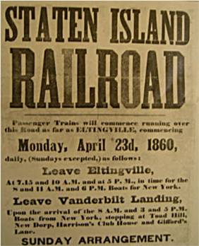
The station's original name was Garretson's, named after the original name of the neighborhood of the same name. The station's name changed after the neighborhood was renamed Dongan Hills. The name Garretson still can be found as there is a street that passes under the station. [3] [4] Both names appeared on the October 16, 1921 timetable. [5] On February 21, 1907, the Staten Island Railway petitioned the Public Service Commission (PSC) to get permission to move the Dongan Hills stop from its location south of Seaview Avenue to a location 100 feet (30 m) to the north in between Seaview Avenue and Garretson Avenue. On March 12, 1907, the PSC granted its permission. [6]

Station layout

Parking lot and station house Dongan Hills SIRT parking jeh.jpg
Parking lot and station house

The station is located on an embankment at Seaview Avenue and Railroad Avenue on the main line. It has two side platforms and beige canopies.

The marble wall at street level on the south end is a legacy of when the line was converted from grade level to the current embankment level today. The grade separation took place in 1933. Free parking is available on a small lot adjacent to the northbound platform, which is owned by the MTA, the agency that controls the rail line. The brick station house is unusually positioned on the northbound side at platform level, unlike other SIR station houses, which are usually located on street level. The Dongan Hills station house had a ticket booth and benches until 1987, and then a vending machine for tokens until July 4, 1997 when the fare was eliminated for all stations south of St. George.

South of this station, there is an additional third track that once served a coal distributor. Grates between the rails led to chutes which now open into the backyards of homes that run alongside the embankment.

Platform
level
Side platform
Southbound NYCS-bull-trans-SIR-Std.svg toward Tottenville (Jefferson Avenue)
NYCS-bull-trans-SIR-Std.svg rush hour express does not stop here
Northbound NYCS-bull-trans-SIR-Std.svg toward St. George (Old Town)
NYCS-bull-trans-SIR-Std.svg AM rush express does not stop here →
Side platform
GroundStreet levelExit/entrance, buses, station house, parking
Wheelchair symbol.svg Ramps on both sides of the station

Exits

There are staircases at the north end that lead to Garretson Avenue. The Dongan Hills station is handicapped accessible in compliance with the Americans with Disabilities Act of 1990, with ramps at the south end that lead to the southern side of Seaview Avenue. Stairs also lead from each platform to the northern side of Seaview Avenue. [7]

Related Research Articles

<span class="mw-page-title-main">Dongan Hills, Staten Island</span> Neighborhood of Staten Island in New York City

Dongan Hills is a neighborhood located within the New York City borough of Staten Island. It is on the Island's East Shore. Dongan Hills is bounded by Laconia Avenue on the southeast, Jefferson Avenue on the southwest, Richmond Road on the northwest, and Old Town Road to the north. It is adjacent to New Dorp and Grant City to the southwest, Todt Hill to the northwest, Old Town/Concord to the northeast, and South Beach and Midland Beach to the southeast.

<span class="mw-page-title-main">Marble Hill–225th Street station</span> New York City Subway station in Manhattan

The Marble Hill–225th Street station is a local station on the IRT Broadway–Seventh Avenue Line of the New York City Subway. Located at the intersection of Broadway and 225th Street in the Marble Hill neighborhood of Manhattan, it is served by the 1 train at all times.

<span class="mw-page-title-main">Avenue H station</span> New York City Subway station in Brooklyn

The Avenue H station is a local station on the BMT Brighton Line of the New York City Subway. It is located at Avenue H between East 15th and East 16th Streets near the border of Midwood and Flatbush, Brooklyn. The station is served by the Q train at all times.

<span class="mw-page-title-main">Aqueduct–North Conduit Avenue station</span> New York City Subway station in Queens

The Aqueduct–North Conduit Avenue station is a station on the IND Rockaway Line of the New York City Subway. Located at North Conduit Avenue near the intersection of Cohancy Street in Ozone Park, Queens, it is served at all times by the A train.

<span class="mw-page-title-main">Bryn Mawr station (CTA)</span> Rapid transit station in Chicago

Bryn Mawr is an 'L' station on the CTA's Red Line. It is located at 1119 West Bryn Mawr Avenue in the Bryn Mawr Historic District of the Edgewater neighborhood of Chicago, Illinois. The adjacent stations are Thorndale, located about one half mile to the north, and Berwyn, about three eighths of a mile to the south. Four tracks pass through the station, but the two western tracks are currently out of service for reconstruction. There is an island platform in the center of the tracks which currently only serves southbound trains; Purple Line weekday rush hour express service pass through the station on the same tracks used by the Red Line but do not stop. The name "Bryn Mawr" comes from the SEPTA Regional Rail station located northwest of Philadelphia in the community of the same name. The name came to the area in the 1880s by Edgewater developer John Lewis Cochran, and is Welsh for "Big Hill."

<span class="mw-page-title-main">Atlantic station (Staten Island Railway)</span>

Atlantic was a Staten Island Railway station in the neighborhood of Tottenville, Staten Island, New York. With the condition of the station having deteriorated after the 1990s, this station, and the Nassau station to the north, were replaced by a new station at Arthur Kill Road. When that station opened in January 2017, Atlantic station closed and subsequently demolished.

<span class="mw-page-title-main">Richmond Valley station</span> Staten Island Railway station

The Richmond Valley station is a Staten Island Railway station in the neighborhood of Richmond Valley, Staten Island, New York. Located at Richmond Valley Road and Amboy Road on the main line, the station is a mixture of open cut at the north end and grade level at the south end.

<span class="mw-page-title-main">Prince's Bay station</span> Staten Island Railway station

The Prince's Bay station is a Staten Island Railway station in the neighborhood of Prince's Bay, Staten Island, New York.

<span class="mw-page-title-main">Huguenot station</span> Staten Island Railway station

The Huguenot station is a Staten Island Railway station in the neighborhood of Huguenot, Staten Island, New York.

<span class="mw-page-title-main">Annadale station</span> Staten Island Railway station

The Annadale station is a Staten Island Railway station in the neighborhood of Annadale, Staten Island, New York.

<span class="mw-page-title-main">Great Kills station</span> Staten Island Railway station

The Great Kills station is a Staten Island Railway station in the neighborhood of Great Kills, Staten Island, New York. It is located on an open cut west of Giffords Lane and Amboy Road on the main line. It has two side platforms and turquoise blue canopies and walls.

<span class="mw-page-title-main">Bay Terrace station</span> Staten Island Railway station

The Bay Terrace station is a Staten Island Railway station in the neighborhood of Bay Terrace, Staten Island, New York.

<span class="mw-page-title-main">Oakwood Heights station</span> Staten Island Railway station

The Oakwood Heights station is a Staten Island Railway station in the neighborhood of Oakwood, Staten Island, New York.

<span class="mw-page-title-main">New Dorp station</span> Staten Island Railway station

The New Dorp station is a Staten Island Railway station in the neighborhood of New Dorp, Staten Island, New York. The station became fully compliant with the Americans with Disabilities Act of 1990 in 2023.

<span class="mw-page-title-main">Grant City station</span> Staten Island Railway station

The Grant City station is a Staten Island Railway station in the neighborhood of Grant City, Staten Island, New York.

<span class="mw-page-title-main">Jefferson Avenue station</span> Staten Island Railway station

The Jefferson Avenue station is a Staten Island Railway station between the neighborhoods of Grant City and Dongan Hills, in Staten Island, New York.

<span class="mw-page-title-main">Old Town station (Staten Island Railway)</span> Staten Island Railway station

The Old Town station is a Staten Island Railway station in the neighborhood of Old Town, Staten Island, New York.

<span class="mw-page-title-main">Clifton station (Staten Island Railway)</span> Staten Island Railway station

The Clifton station is a Staten Island Railway station in the neighborhood of Clifton, Staten Island, New York. This station was the original terminal of the Staten Island Railway from 1860 until 1886. The station was known as Vanderbilt's Landing, and was used as a transfer point for passengers going to Manhattan via ferries to South Ferry.

<span class="mw-page-title-main">Hylan Boulevard</span> Boulevard in Staten Island, New York

Hylan Boulevard is a major northeast-southwest boulevard in the New York City borough of Staten Island, and the longest street in a single borough in the city. It is approximately 14 miles (23 km) long, and runs from the North Shore neighborhood of Rosebank, then along the entire East Shore, to the South Shore neighborhood of Tottenville. It was renamed in 1923 for New York City mayor John F. Hylan, before which it was known as Southfield Boulevard and the northern segment as Pennsylvania Avenue.

<span class="mw-page-title-main">History of the Staten Island Railway</span>

The Staten Island Railway (SIR) is the only rapid transit line in the New York City borough of Staten Island and is operated by the Staten Island Rapid Transit Operating Authority, a unit of the Metropolitan Transportation Authority. The railway was historically considered a standard railroad line, but today only the western portion of the North Shore Branch, which is disconnected from the rest of the SIR, is used by freight and is connected to the national railway system.

References

  1. 1 2 Irvin Leigh and Paul Matus (December 23, 2001). "SIRT The Essential History". p. 4. Retrieved March 3, 2009.
  2. Poster for opening of Staten Island Railway
  3. Sciences, Staten Island Institute of Arts and; Davis, William Thompson (1907). Proceedings - Staten Island Institute of Arts and Sciences. Staten Island Institute of Arts and Sciences.
  4. Company, Baltimore and Ohio Railroad (1869). Miscellaneous Documents of the Baltimore and Ohio Railroad Company and Subsidiary Companies.
  5. "Time-Table No. 8 October 16, 1921 Staten Island Rapid Transit Railway". gretschviking.net. Staten Island Rapid Transit Railway Company. Retrieved December 24, 2017.
  6. District, New York (State) Public Service Commission Second (1908). Annual Report of the Public Service Commission, Second District. J.B. Lyon Company. pp.  625–626. garretson's staten island dongan hills.
  7. "Map of NYC Subway Entrances". NYC Open Data. City of New York . Retrieved July 10, 2018.

Commons-logo.svg Media related to Dongan Hills (Staten Island Railway station) at Wikimedia Commons