
Virginstow is a village and civil parish in the Torridge district of Devon, England. It is situated about 7 miles north of Launceston in Cornwall. According to the 2001 census it had a population of 115.

Budge's Shop is a hamlet in Cornwall, England. It is half a mile northwest of Trerulefoot. According to the Post Office the 2011 census population was included in the civil parish of St. Germans

Churchbridge is a hamlet in Cornwall, England. It is a mile west of Duloe, and is situated on the West Looe River. Both banks of the river are wooded, and to the north of the bridge is a disused quarry and Tremadart Mills, marked as a corn mill on the 1882 map.

Congdon's Shop is a hamlet in the parish of North Hill, Cornwall, England. It is at the junction of the B3254 Launceston to Liskeard road and the B3257 road from Plusha to Callington.
Coxpark is a hamlet in the parish of Calstock, Cornwall, England.
Croanford is a hamlet in Cornwall, England. It is in the parish of Egloshayle.
Eggbeare is a hamlet 2 miles (3.2 km) north-east of Launceston in east Cornwall, England. Eggbeare lies at around 94 metres (308 ft) above sea level and is in the civil parish of Werrington.
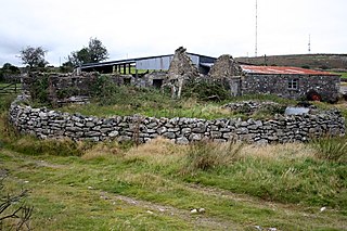
Gonamena is a site of disused mines in Cornwall, England. It is half a mile south of Minions.
Hallworthy is a hamlet in the parish of Treneglos, Cornwall, England. It is at a crossroads on the A395 road from Davidstow to Launceston. To the east is a plantation called Wilsey Down Forest. It is in the civil parish of Davidstow

Horningtops is a hamlet south-southeast of Liskeard in east Cornwall, England in National Grid grid square SX2760. It is in the civil parish of Dobwalls and Trewidland.

Little Comfort is a hamlet in the parish of Lezant in east Cornwall, England, UK. Little Comfort is on the A388 road approximately 2.5 miles (4.0 km) south of Launceston.

Lower Porthpean is a coastal hamlet in Cornwall, England, UK. It is close to Higher Porthpean and one mile south of St Austell.
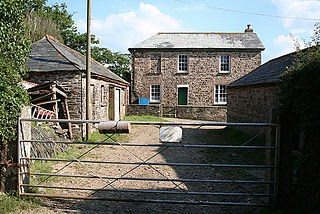
Middlewood is a small village in the parish of North Hill, Cornwall, England, UK. Middlewood is in the valley of the River Lynher and on the B3254 road between Launceston and Liskeard. There was formerly a Bible Christian chapel at Middlewood.
Milltown is a hamlet in Cornwall, England. It is about a mile south of Lostwithiel. There is another hamlet called Milltown in the parish of Cardinham.
Muchlarnick is a hamlet in Cornwall, England. It is about two miles east of Lanreath in the civil parish of Pelynt.
Narkurs is a hamlet in the south east of Cornwall, England. It is part of the civil parish of Deviock. It is about 2 km southeast of Hessenford. Historically an agricultural settlement, Narkurs has become smaller as this industry has declined, and in 2007 consisted of only 20 homes.
Palmersbridge is a hamlet on the A30 main road northeast of Bolventor in Cornwall, England, UK.

Pantersbridge is a hamlet in the parish of St Neot, Cornwall, England, UK. It is about one mile south of Warleggan on the road from St Neot to Cardinham and on the River Warleggan.

Rising Sun is a hamlet near Calstock in Cornwall, England.

The River Kensey is a river in east Cornwall, England, UK which is a tributary of the River Tamar.

