Duke, Texas

Last updated
Duke, Texas
Ghost town
Relief map of Texas.png
Red pog.svg
Duke
Location within the state of Texas
Usa edcp relief location map.png
Red pog.svg
Duke
Duke (the US)
Coordinates: 29°30′17″N95°29′10″W / 29.50472°N 95.48611°W / 29.50472; -95.48611 Coordinates: 29°30′17″N95°29′10″W / 29.50472°N 95.48611°W / 29.50472; -95.48611
Country United States
State Texas
County Fort Bend
Elevation 62 ft (19 m)
Time zone Central (CST) (UTC-6)
  Summer (DST) CDT (UTC-5)
ZIP code 77583
Area code(s) 281, 713, 832
GNIS feature ID 1378234 [1]

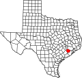
Duke is a ghost town in Fort Bend County, in the U.S. state of Texas. The former settlement's location was west of Arcola along the BNSF Railway near Houston Southwest Airport. In 2014 the town site was no longer accessible by public roads.

Ghost town city depopulated of inhabitants and that stays practically intact

A ghost town is an abandoned village, town, or city, usually one that contains substantial visible remains. A town often becomes a ghost town because the economic activity that supported it has failed, or due to natural or human-caused disasters such as floods, prolonged droughts, government actions, uncontrolled lawlessness, war, pollution, or nuclear disasters. The term can sometimes refer to cities, towns, and neighbourhoods that are still populated, but significantly less so than in past years; for example, those affected by high levels of unemployment and dereliction.

Fort Bend County, Texas County in the United States

Fort Bend County is a county in the U.S. state of Texas. As of the 2010 census, its population was 585,375, making it the 10th-most populous county in Texas. In 2015 Fort Bend County had become the wealthiest county in Texas, with a median household income of $95,389 and a median family income of $105,944, having surpassed Collin and Rockwall Counties since the 2000 census. The county seat is Richmond, and its largest city is Sugar Land.

U.S. state constituent political entity of the United States

In the United States, a state is a constituent political entity, of which there are currently 50. Bound together in a political union, each state holds governmental jurisdiction over a separate and defined geographic territory and shares its sovereignty with the federal government. Due to this shared sovereignty, Americans are citizens both of the federal republic and of the state in which they reside. State citizenship and residency are flexible, and no government approval is required to move between states, except for persons restricted by certain types of court orders. Four states use the term commonwealth rather than state in their full official names.

Contents

History

The town of Duke grew up on the Sugar Land Railroad as a shipping point for sugar cane. Water from conveniently nearby Clear Lake was used to service the railroad locomotives. Postal service began in 1883 with John R. Fenn as postmaster. The bustling community consisted of a hotel, stock yard, store and sugar mills. The town was named after Duke Hessey, who operated the store. [2] On October 19, 1888 there was a political rally at Duke that nearly resulted in violence between the contending factions. During the tense political struggle which later erupted in the Jaybird-Woodpecker War there was an attempt at civil debate. However, when Woodpecker candidate Kyle Terry took the stage at Duke, he had harsh words for his opponent Ned Gibson, a Jaybird. Though Gibson was not there, one of his brothers took vigorous offense. Terry brandished a pistol but was prevented from using it by an elderly African-American man, a former slave of the Terry family. The organizers of the event had taken the precaution of asking participants to leave their weapons at Fenn's store or in their buggies. So the flash point waited another ten months. [3] Postal service ended at Duke in 1922. [2]

Horse and buggy two wheeled convertible carraige with one bench for two passengers, controlled from the seat. Primarily for casual rides and leisure

A horse and buggy or horse and carriage refers to a light, simple, two-person carriage of the late 18th, 19th and early 20th centuries, drawn usually by one or sometimes by two horses. Also called a roadster or a trap, it was made with two wheels in England and the United States, and with four wheels in the United States as well. It had a folding or falling top.

Geography

On the 1955 Almeda, Tex. United States Geological Survey 1:24,000 scale map, Duke was located on the Gulf, Colorado and Santa Fe Railroad west of Arcola on the northern side of Clear Lake. On the map, the town was connected by road to what is now McKeever Road to the north. [4] Duke Road crosses Southwest Houston Airport property a few yards from the western end of the runway. Public use was blocked by a fence in January 2014. [5]

United States Geological Survey scientific agency of the United States government

The United States Geological Survey is a scientific agency of the United States government. The scientists of the USGS study the landscape of the United States, its natural resources, and the natural hazards that threaten it. The organization has four major science disciplines, concerning biology, geography, geology, and hydrology. The USGS is a fact-finding research organization with no regulatory responsibility.

Related Research Articles

Arcola, Texas City in Texas, United States

Arcola is a city in Fort Bend County, Texas, United States, within the Houston–Sugar Land–Baytown metropolitan area. The population was 1,642 at the 2010 census, up from 1,048 at the 2000 census.

Fresno, Texas Census-designated place in Texas, United States

Fresno is an unincorporated community and census-designated place (CDP) in Fort Bend County, Texas, United States. The population was 19,069 at the 2010 census, up from 6,603 at the 2000 census.

Kendleton, Texas City in Texas, United States

Kendleton is a city in western Fort Bend County, Texas, United States, within the Houston–Sugar Land–Baytown metropolitan area. The population was 380 at the 2010 census, down from 466 at the 2000 census. As of 2011 Darryl Humphrey was the mayor of the city.

Meadows Place, Texas City in Texas, United States

Meadows Place is a city located in Fort Bend County in the U.S. state of Texas within the Houston–Sugar Land–Baytown metropolitan area. As of the 2010 U.S. Census, the city population was 4,660.

Needville, Texas City in Texas, United States

Needville is a city in Fort Bend County, Texas, United States. It is within the Houston–Sugar Land metropolitan area. The population was 2,823 at the 2010 census.

Orchard, Texas City in Texas, United States

Orchard is a city in western Fort Bend County, Texas, United States, within the Houston–Sugar Land–Baytown metropolitan area. The community is located along State Highway 36 (SH 36) and the BNSF Railway between Rosenberg in Fort Bend County and Wallis in Austin County. The population was 352 at the 2010 census, down from 408 at the 2000 census.

Richmond, Texas City in Texas, United States

Richmond is a city in Fort Bend County, Texas, United States. It is the county seat, and is located within the Houston–The Woodlands–Sugar Land metropolitan area. As of the 2010 U.S. census, the city population was 11,679.

Sugar Land, Texas City in Texas, United States

Sugar Land is a city in Fort Bend County, Texas, United States, located in the southwestern part of the Houston–The Woodlands–Sugar Land metropolitan area. Located about 19 miles (31 km) southwest of downtown Houston, Sugar Land is a populous suburban municipality centered around the junction of Texas State Highway 6 and U.S. Route 59. Beginning in the 19th century, the present-day Sugar Land area was home to a large sugar plantation situated in the fertile floodplain of the Brazos River. Following the consolidation of local plantations into Imperial Sugar Company in 1908, Sugar Land grew steadily as a company town and incorporated as a city in 1959. Since then, Sugar Land has grown rapidly alongside other edge cities around Houston, with large-scale development of master-planned communities contributing to population swells since the 1980s.

Missouri City, Texas City in Texas, United States

Missouri City is a city in the U.S. state of Texas, within the Houston–The Woodlands–Sugar Land metropolitan area. The city is mostly in Fort Bend County, with a small portion in Harris County. As of the 2010 census, the city had a population of 67,358, up from 52,913 in 2000. The population was estimated at 74,139 in 2015.

Stafford, Texas City in Texas, United States

Stafford is a city in the U.S. state of Texas, within the Houston–The Woodlands–Sugar Land metropolitan area. The city is mostly in Fort Bend County, with a small portion in Harris County. As of the 2010 census, Stafford's population was 17,693, up from 15,681 at the 2000 census. As of 2018 the population had risen to an estimated 21,265.

Genoa is an area in Houston, Texas, United States located about 15 miles (24 km) southeast of Downtown Houston; it was formerly a distinct unincorporated area in Harris County.

Fort Bend Independent School District

The Fort Bend Independent School District, also known as Fort Bend ISD or FBISD, is a school district system in the U.S. state of Texas based in the city of Sugar Land.

The Jaybird–Woodpecker War (1888–89) was a feud between two United States Democratic Party factions fighting for political control of Fort Bend County, Texas, in the southeast part of the state. The Woodpeckers included a number of whites and virtually the entire African-American population of the county. The Woodpeckers had controlled the county government by winning elections since the Reconstruction Era. The Jaybird faction, which included a majority of the white population in the county, wanted to oust blacks and their white allies from the county administration. Murders were committed against persons in each faction in 1888 and 1889.

Juliff, Texas Unincorporated community in Texas, United States

Juliff is an unincorporated community situated along Farm to Market Road 521 (FM 521) in eastern Fort Bend County, Texas, United States. The settlement was founded in the 1850s as a shipping point along the Brazos River and the railroad reached there in the same decade. The community received postal service in 1891, and except for a brief closure, retained it until the late 1950s. Starting in the 1930s, Juliff enjoyed a heyday as a place of raucous entertainment after local residents opened several taverns and dance halls. This era ended in the 1960s when the bars relocated to Houston. Sometime later, the railroad that ran alongside FM 521 was discontinued. In December 2013 the community was a collection of homes along the east side of FM 521.

Almeda, Houston human settlement in United States of America

Almeda is an area located along Texas State Highway 288 and the Missouri Pacific Railroad in Southwest Houston, Texas, United States that used to be a distinct unincorporated community in Harris County. Almeda is 11 miles (18 km) from Downtown Houston.

Benjamin Franklin Terry Confederate army officer

Benjamin Franklin Terry raised and commanded the 8th Texas Cavalry Regiment, popularly known as Terry's Texas Rangers, during the American Civil War. A planter and prominent citizen of Fort Bend County, he organized the regiment for the Confederate States Army. Terry was killed in the regiment's first action at Rowlett's Station near Woodsonville, Kentucky.

Howellville, Texas Unincorporated area in Texas, United States

Howellville or Howell is an unincorporated community in Harris County, Texas, United States, which has been absorbed by Greater Houston. The site is located at the intersection of Alief Clodine Road and Sugar Land Howell Road on the west side of Houston, approximately halfway between the original settlements of Clodine and Alief. There are no road signs identifying the place. The community began as a stop on a railroad line that no longer exists.

The Houston Tap and Brazoria Railway was chartered in September 1856 to extend southward from Houston to West Columbia in Brazoria County. The railroad's nicknames were the Columbia Tap and the Sugar Road. The railway absorbed track from an earlier short-lived line and reached West Columbia in 1860. After the American Civil War, the railroad ran into serious financial difficulties and was sold to the Houston and Great Northern Railroad. It was the only railroad that failed to repay money borrowed from the Special School Fund and the only railroad that could trace its title to the State of Texas. The line operated as part of the Missouri Pacific Railroad until 1980 when it was bought by the Union Pacific Railroad. In 2014, the part of the line closest to downtown Houston existed only as the Columbia Tap Rail-Trail, the portion of the line between Houston and Arcola was still in service and the section between Arcola and West Columbia was abandoned.

Arizona Fleming was an African-American small business owner from Richmond, Texas who became part of the Civil Rights Movement by joining a lawsuit against an all-white political club that prevented black voters from participating in the Democratic Party Primary in Fort Bend County. While John Terry's name headed the legal petition, Fleming and Willie Melton provided much of the financial support and work behind the lawsuit. The case was won in United States District Court in 1950 and overturned on appeal in 1952. The case went before the United States Supreme Court in 1953 and African-Americans won full voting rights in the county. In 1994 Arizona Fleming Elementary School was opened in Fort Bend Independent School District.

References

  1. U.S. Geological Survey Geographic Names Information System: Duke, Texas
  2. 1 2 See historical marker photo.
  3. Wharton, Clarence R. (2001). History of Fort Bend County. Austin, Tex.: Fort Bend Museum Association and Eakin Press. p. 207.
  4. USGS Almeda, Tex. Quadrangle (1955)
  5. See Duke Road photo.