
Lamont is a census-designated place (CDP) in Kern County, California, United States. Lamont is located 9 miles (14 km) south-southeast of downtown Bakersfield, at an elevation of 404 feet (123 m). The population was 15,120 at the 2010 census, up from 13,296 at the 2000 census.
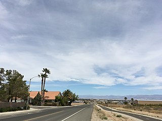
Ridgecrest is a city in Kern County, California, United States, along U.S. Route 395 in the Indian Wells Valley in northeastern Kern County, adjacent to the Naval Air Weapons Station China Lake. It was incorporated as a city in 1963. The population was 27,959 at the 2020 census, up slightly from 27,616 at the 2010 census.
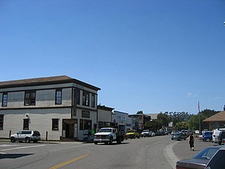
Point Reyes Station is a small unincorporated town in western Marin County, California, United States. Point Reyes Station is located 13 miles (21 km) south-southeast of Tomales, at an elevation of 39 feet (12 m). Point Reyes Station is located along State Route 1 and is a gateway to the Point Reyes National Seashore, an extremely popular national preserve. The Point Reyes Station census-designated place (CDP) covers the unincorporated town and adjacent development to the north, with a total population of 895 as of the 2020 census.

Chester is a census-designated place (CDP) in Plumas County, California, United States. Chester is located on Lake Almanor, 30 miles (48.3 km) north-northwest of Quincy. The town is located along State Route 36. The US Postal Service ZIP code for the community is 96020. The population was 2,144 at the 2010 census, down from 2,316 at the 2000 census.

Kenansville is a town in Duplin County, North Carolina, United States. Its population was 770 at the 2020 census. It is the county seat of Duplin County. The town was named for James Kenan, a member of the North Carolina Senate. Liberty Hall, his early 1800s era historic home, is located within Kenansville.

Amargosa Valley is an unincorporated town located on U.S. Route 95 in Nye County, in the U.S. state of Nevada.
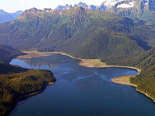
Admiralty Island is an island in the Alexander Archipelago in Southeast Alaska, at 57°44′N134°20′W. It is 145 km (90 mi) long and 56 km (35 mi) wide with an area of 4,264.1 km2 (1,646.4 sq mi), making it the seventh-largest island in the United States and the 132nd largest island in the world. It is one of the ABC islands in Alaska. The island is nearly cut in two by the Seymour Canal; to its east is the long, narrow Glass Peninsula. Most of Admiralty Island—955,747 acres (3,868 km2)—is protected as the Admiralty Island National Monument administered by the Tongass National Forest. The Kootznoowoo Wilderness encompasses vast stands of old-growth temperate rainforest. These forests provide some of the best habitat available to species such as brown bears, bald eagles, and Sitka black-tailed deer.

Canadian Forces Station Alert, often shortened to CFS Alert, is a signals intelligence intercept facility of the Canadian Armed Forces at Alert, in the Qikiqtaaluk Region of Nunavut, Canada.

Campo is an unincorporated community in the Mountain Empire area of southeastern San Diego County, California, United States. The population was 2,955 at the 2020 United States census, up from 2,684 at the 2010 census. For statistical purposes, the United States Census Bureau has defined Campo as a census-designated place (CDP). The census definition of the area may not precisely correspond to local understanding of the area with the same name.
Cowan Station may refer to:
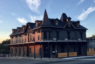
Hopland is a census-designated place in Mendocino County, California, United States. It is located on the west bank of the Russian River 13 miles (21 km) south-southeast of Ukiah, in the Sanel Valley, at an elevation of 502 feet (153 m). The population was 661 at the 2020 census, down from 756 at the 2010 census.

Janesville is a census-designated place in Lassen County, California. It is located 11 miles (18 km) southeast of Susanville, at an elevation of 4239 feet. Janesville is located on the eastern slopes of the Sierra Nevada Mountain range. Its population is 2,461 as of the 2020 census, up from 1,408 from the 2010 census.

Berry Creek is a census-designated place about 25 miles (40 km) northeast of Oroville, California in hilly terrain at 2,000 feet (610 m) above mean sea level. The community is located along the Oroville-Quincy Highway on the shore of Madrone Lake. The community is home to Berry Creek Elementary School (K-8), 2 small mountain churches, 1 mini mart w/ gas, 1 small community park. Berry Creek is home to the annual Berry Festival which is held during August.
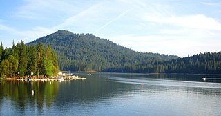
Bass Lake is a census-designated place in Madera County, California, United States. It is located 4.5 miles (7.2 km) southeast of Yosemite Forks, at an elevation of 3,415 feet (1,041 m). The population was 575 at the 2020 census.

Ocotillo Wells is an unincorporated community in San Diego County, California, United States. It is 3 miles (4.8 km) west of the Imperial County line on California State Route 78 at an elevation of 163 feet (50 m). The name became official in 1962 when it was adopted for federal use by the US Board on Geographic Names. A federally recognized variant name, Ocotillo, can cause confusion with the community of Ocotillo, California in Imperial County, 29 mi (47 km) to the south on Interstate 8.
Big River is a town located on the southern end of Cowan Lake in north central Saskatchewan, Canada. It is just north of Saskatchewan's extensive grain belt on Highway 55 and about 16 kilometres (10 mi) west of Prince Albert National Park. Delaronde Lake is accessed east of the town. Big River is approximately 132 kilometres (82 mi) from Prince Albert.

Leggett is a census-designated place in Mendocino County, California, United States. It is located on the South Fork of the Eel River, 21 miles (34 km) by road northwest of Laytonville, at an elevation of 984 ft (300 m). It is home to some of the largest trees in the world. The nearby Smithe Redwoods State Natural Reserve and Standish-Hickey State Recreation Area are noted for their forests of coastal redwoods. The population of Leggett was 77 at the 2020 census, down from 122 at the 2010 census.
Coso Junction is an unincorporated community in Inyo County, California. It is located in Rose Valley, 4.8 km (3 mi) south of Dunmovin and 11.2 km (7 mi) west of Sugarloaf Mountain, near to the US Navy's China Lake Weapons Station, at an elevation of 3386 feet.
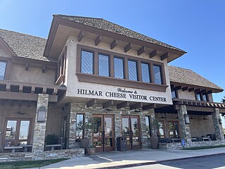
Hilmar is an unincorporated community in Merced County, California, United States. It is located 4.25 miles (6.8 km) west-southwest of Delhi, spanning 3.9 sq mi (10 km2) and at an elevation of 92 ft (28 m) above sea level. For census purposes, Hilmar is aggregated with a nearby community into the Hilmar-Irwin census-designated place, which had 5,164 residents as of the 2020 census.

The Benton Hot Spring is a spring in Mono County, California around which grew the town of Benton. It is located 3 miles (4.8 km) west-southwest of Benton and 31 miles (50 km) north-northwest of Bishop, at an elevation of 5630 feet. It is part of the Benton census-designated place for statistical purposes.


