
Inyo County is a county in the eastern central part of the U.S. state of California, located between the Sierra Nevada mountains and the state of Nevada. In the 2020 census, the population was 19,016. The county seat is Independence. Inyo County is on the east side of the Sierra Nevada and southeast of Yosemite National Park in Central California. It contains the Owens River Valley; it is flanked to the west by the Sierra Nevada and to the east by the White Mountains and the Inyo Mountains. With an area of 10,192 square miles (26,397 km2), Inyo County is the second-largest county by area in California, after San Bernardino County. Almost one-half of that area is within Death Valley National Park. However, with a population density of 1.8 people per square mile, it also has the second-lowest population density in California, after Alpine County.

Gila Bend, founded in 1872, is a town in Maricopa County, Arizona, United States. The town is named for an approximately 90-degree bend in the Gila River, which is near the community's current location. According to the 2010 census, the population of the town is 1,922.
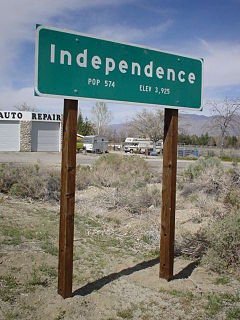
Independence is a census-designated place in Inyo County, California. Independence is located 41 miles (66 km) south-southeast of Bishop, at an elevation of 3930 feet. It is the county seat of Inyo County, California. The population of this census-designated place was 669 at the 2010 census, up from 574 at the 2000 census.
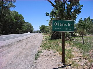
Olancha is a census designated place in Inyo County of the U.S. state of California. Olancha is located on U.S. Route 395 in California, 37 miles (60 km) south-southeast of Independence, at an elevation of 3658 feet. As of the 2010 census, the population was 192, up from 134 at the 2000 census.

Owens Valley is an arid valley of the Owens River in eastern California in the United States. It is located to the east of the Sierra Nevada, west of the White Mountains and Inyo Mountains, and north of the Mojave Desert. It sits on the west edge of the Great Basin. The mountain peaks on the West side reach above 14,000 feet (4,300 m) in elevation, while the floor of the Owens Valley is about 4,000 feet (1,200 m), making the valley the deepest in the United States. The Sierra Nevada casts the valley in a rain shadow, which makes Owens Valley "the Land of Little Rain." The bed of Owens Lake, now a predominantly dry endorheic alkali flat, sits on the southern end of the valley.

The 1872 Owens Valley earthquake – also known as the Lone Pine earthquake – struck on March 26 at in the Owens Valley, with the epicenter near the town of Lone Pine. Its magnitude has been estimated at 7.4 to 7.9, with a maximum Mercalli Intensity of X (Extreme). It was one of the largest earthquakes to hit California in recorded history and was similar in size to the 1906 San Francisco earthquake. Twenty-seven people were killed and fifty-six were injured.

Owens Lake is a mostly dry lake in the Owens Valley on the eastern side of the Sierra Nevada in Inyo County, California. It is about 5 miles (8.0 km) south of Lone Pine, California. Unlike most dry lakes in the Basin and Range Province that have been dry for thousands of years, Owens held significant water until 1913, when much of the Owens River was diverted into the Los Angeles Aqueduct, causing Owens Lake to desiccate by 1926. Today, some of the flow of the river has been restored, and the lake now contains some water. Nevertheless, as of 2013, it is the largest single source of dust pollution in the United States. The lake was the epicenter of a magnitude 5.8 earthquake that occurred on June 24, 2020.

Swansea is a former settlement and unincorporated community in Inyo County, California. It is located 8.5 miles (14 km) south of New York Butte, at an elevation of 3,661 ft (1,116 m).
Kingston is a former town that was originally in Fresno County, until 1909 when that territory south of Kings River was transferred to Kings County, California. It was located on the south bank of the Kings River 8.5 miles (13.7 km) northwest of Hanford at Whitmore's Ferry.
Manzanar was a town in Inyo County, California, founded by water engineer and land developer George Chaffey.

Laws is an unincorporated community in Inyo County, California. Laws is located 4 miles (6.4 km) northeast of Bishop on U.S. Route 6, towards the Nevada state line.

Pío Pico State Historic Park is the site of El Ranchito, also known as the Pío Pico Adobe or Pío Pico Mansion, the final home of Pío Pico, the last Governor of Alta California under Mexican rule and a pivotal figure in early California history. Located in Whittier, California, at 6003 Pioneer Blvd. near Whittier Blvd. and Interstate 605, it is California Historical Landmark No. 127, listed as "Casa de Governor Pío Pico". Just west of the park is the San Gabriel River. Across the river is the city that bears his name—Pico Rivera. The park consists of the adobe and about three acres of surrounding land.
U.S. Route 395 (US 395) is a United States Numbered Highway, stretching from Hesperia, California to the Canadian border in Laurier, Washington. The California portion of US 395 is a 557-mile (896 km) route which traverses from Interstate 15 (I-15) in Hesperia, north to the Oregon state line in Modoc County near Goose Lake. The route clips into Nevada, serving the cities Carson City and Reno, before returning to California.
Fresno City is a former settlement in Fresno County, California. It was located at the head of navigation on Fresno Slough 2 miles (3.2 km) northwest of Tranquillity, at an elevation of 164 feet. The city was named after the Spanish word for the Oregon Ash trees that commonly grew along the river banks.

Burnt Wagons is a former settlement in Inyo County, California, near Stovepipe Wells. It was located in Death Valley 7 miles (11 km) northwest of Death Valley Junction. The name recalls the emigrants of 1849 who abandoned and burnt their wagons at the site. The site is now registered as California Historical Landmark #441. The monument's plaque reads:
BURNED WAGONS POINT Near this monument, the Jayhawker group of Death Valley Forty-Niners, gold seekers from Middle West, who entered Death Valley in 1849 seeking short route to the mines of central California, burned their wagons, dried the meat of some oxen and, with surviving animals, struggled westward on foot.
STATE REGISTERED LANDMARK NO.441
Marker placed by California Centennials Commission.
Base furnished by Death Valley '49ers, Inc.
Dedicated December 3rd, 1949
Owensville is a former settlement in Inyo County, California. It was located west of the future site of the modern-day town of Laws. Owensville was started as a mining camp in 1863. By 1871 it had been abandoned. The former settlement site is on U.S. Route 6 north of Bishop, California.
San Carlos is a former settlement in Inyo County, California. It was founded in 1863 and was located on the east bank of the Owens River 4 miles (6.4 km) east of Independence, close by to the west of the later site of Kearsarge, California.

Fort Independence, originally named Camp Independence, was a fort located in the Owens Valley, 3 miles (4.8 km) north of present-day Independence, Inyo County, eastern California. The U.S. Army post was active from 1862 to 1877.

San Francis Ranch was the ranch of Owens Valley pioneer Samuel A. Bishop and his wife, located on a creek later named for him southwest of modern Bishop, California also named after him. Bishop founded the ranch here in August 1861, after he and his wife drove 500 cattle and 50 horses from Fort Tejon to this spot in the Owens Valley, intending to sell cattle to the miners in the boomtown of Aurora and other mining camps in the area.

The Superior Court of California, County of Inyo, also known as the Inyo County Superior Court or Inyo Superior Court, is the branch of the California superior court with jurisdiction over Inyo County.


