Stovepipe Wells, California

Last updated

Stovepipe Wells
Stovepipe Wells, Death Valley National Park, CA (28222558218).jpg
General store and sign at Stovepipe Wells, December 2017
USA California location map.svg
Red pog.svg
Stovepipe Wells
Location in California
Usa edcp location map.svg
Red pog.svg
Stovepipe Wells
Location within the United States
Coordinates: 36°36′22″N117°08′47″W / 36.60611°N 117.14639°W / 36.60611; -117.14639
Country United States
State California
County Inyo County
Elevation
[1]
10 ft (3 m)
Reference no.826

Stovepipe Wells is a way-station in the northern part of Death Valley, in unincorporated Inyo County, California.

Contents

Geography and names

Stovepipe Wells is located at 36°36′22″N117°08′47″W / 36.60611°N 117.14639°W / 36.60611; -117.14639 and is US Geological Survey (USGS) feature ID 235564. [1] It is entirely inside Death Valley National Park and along State Route 190 (SR 190) at less than 10 feet (3.0 m) above sea level. West on SR 190 is Towne Pass at about 4,950 feet (1,510 m) above sea level. Eventually, the road meets Panamint Valley Road at Panamint Junction in the Panamint Valley. East on SR 190 the road leads to Furnace Creek and Death Valley Junction.

Variant names listed for the Inyo County location by USGS include Stove Pipe Wells Hotel and Stovepipe Wells Hotel. The US Postal Service ZIP Code is 92328, and the locale name is spelled Stove Pipe Wells in some postal renditions. It is commonly referred to as Stovepipe Wells Village.

Climate

According to the Köppen Climate Classification system, Stovepipe Wells has a hot desert climate, abbreviated "BWh" on climate maps. [2] Its average high temperature is greater than 100 °F (37.8 °C) from June through September. [3]

Climate data for Stovepipe Wells, California, 1991–2020 normals, extremes 2004–present
MonthJanFebMarAprMayJunJulAugSepOctNovDecYear
Record high °F (°C)83
(28)
90
(32)
100
(38)
110
(43)
118
(48)
126
(52)
129
(54)
126
(52)
122
(50)
110
(43)
94
(34)
82
(28)
129
(54)
Mean maximum °F (°C)76.3
(24.6)
83.4
(28.6)
93.0
(33.9)
104.1
(40.1)
112.1
(44.5)
120.7
(49.3)
123.1
(50.6)
120.1
(48.9)
115.6
(46.4)
102.6
(39.2)
89.1
(31.7)
74.1
(23.4)
123.7
(50.9)
Average high °F (°C)65.0
(18.3)
70.6
(21.4)
79.3
(26.3)
88.1
(31.2)
98.4
(36.9)
108.6
(42.6)
114.9
(46.1)
113.0
(45.0)
104.5
(40.3)
89.1
(31.7)
73.6
(23.1)
62.6
(17.0)
89.0
(31.7)
Daily mean °F (°C)53.6
(12.0)
59.7
(15.4)
68.1
(20.1)
76.1
(24.5)
85.8
(29.9)
95.7
(35.4)
102.3
(39.1)
100.1
(37.8)
91.8
(33.2)
76.9
(24.9)
62.1
(16.7)
51.8
(11.0)
77.0
(25.0)
Average low °F (°C)42.2
(5.7)
48.8
(9.3)
56.8
(13.8)
64.1
(17.8)
73.3
(22.9)
82.7
(28.2)
89.8
(32.1)
87.3
(30.7)
79.0
(26.1)
64.7
(18.2)
50.6
(10.3)
41.0
(5.0)
65.0
(18.3)
Mean minimum °F (°C)31.9
(−0.1)
37.7
(3.2)
45.9
(7.7)
53.7
(12.1)
61.2
(16.2)
71.7
(22.1)
81.1
(27.3)
78.6
(25.9)
67.7
(19.8)
52.9
(11.6)
39.0
(3.9)
32.3
(0.2)
30.9
(−0.6)
Record low °F (°C)25
(−4)
29
(−2)
40
(4)
47
(8)
58
(14)
66
(19)
76
(24)
72
(22)
60
(16)
38
(3)
32
(0)
28
(−2)
25
(−4)
Average precipitation inches (mm)0.23
(5.8)
0.55
(14)
0.21
(5.3)
0.11
(2.8)
0.10
(2.5)
0.04
(1.0)
0.23
(5.8)
0.12
(3.0)
0.04
(1.0)
0.09
(2.3)
0.09
(2.3)
0.14
(3.6)
1.95
(49.4)
Average precipitation days (≥ 0.01 in)3.23.22.71.53.31.41.60.90.81.40.82.122.9
Source 1: NOAA [3]
Source 2: National Weather Service (mean maxima/minima 20062020) [4]

History

The first temporary settlement at Stovepipe Wells came into being when a road between Rhyolite and Skidoo was begun in 1906 to ameliorate the approach to the mine at Skidoo. A collection of tents was erected to serve travelers with food, drink and lodging. During the bonanza days of Rhyolite and Skidoo, it was the only known water source on the Cross-Valley road. When sand obscured the spot, a length of stovepipe was inserted as a marker; hence, its unique name.

In 1925, entrepreneur Bob Eichmann began construction of the hotel at Stovepipe Wells, along with a scenic toll road through Death Valley. This marked the beginning of the transition from mining community to tourist destination.

The settlement is now registered as California Historical Landmark #826. [5]

Facilities

Stovepipe Wells Village is home to the Stovepipe Wells Hotel, [6] a full-service hotel with swimming pool. A general store offers sundries and food and is adjacent to a gas station. Stovepipe Wells Village also houses the Badwater Saloon and Toll Road restaurant, The Nugget Gift Shop and a ranger station.

The default format for wired telephone numbers in the community is in the Death Valley exchange: (760) 786-xxxx. The community had manual telephone service until the late 1980s.

The community is contained within the Great Basin Unified Air Pollution Control District.

Nearby features

Hikers walk through the narrows of Stovepipe Wells's Mosaic Canyon Mosaic Canyon narrows 1.jpg
Hikers walk through the narrows of Stovepipe Wells's Mosaic Canyon
Stovepipe Wells's Mesquite Flat Sand Dunes Death Valley Mesquite Flats Sand Dunes 2013.jpg
Stovepipe Wells's Mesquite Flat Sand Dunes
Late Precambrian Noonday Formation scoured in Stovepipe Wells's Mosaic Canyon by episodic flow. (USGS photo) Late Precambrian Noonday Formation.jpg
Late Precambrian Noonday Formation scoured in Stovepipe Wells's Mosaic Canyon by episodic flow. (USGS photo)

California Historical Landmarks

There are three California Historical Landmarks in Stovepipe Wells. [8]

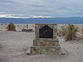
California Historical Landmark number 826, Old Stovepipe Wells, founded on August 7, 1968, reads:

NO. 826 OLD STOVEPIPE WELLS - This waterhole, the only one in the sand dune area of Death Valley, was at the junction of the two Indian trails. During the bonanza days of Rhyolite and Skidoo, it was the only known water source on the cross-valley road. When sand obscured the spot, a length of stovepipe was inserted as a marker. [9]

California Historical Landmark number 848, Eichbaum Toll Road, founded on May 19, 1971, reads:

NO. 848 EICHBAUM TOLL ROAD - In 1926, H. W. Eichbaum obtained a franchise for a toll road from Darwin Falls to Stovepipe Wells, the first maintained road into Death Valley from the west. It changed the area's economic base from mining to tourism and brought about the creation of Death Valley National Monument seven years later [10]

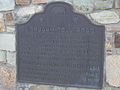
California Historical Landmark number 441, Burned Wagons Point, founded on October 24, 1949, reads:

NO. 441 BURNED WAGONS POINT - Near this monument, the Jayhawker group of Death Valley '49ers, gold seekers from the Middle West who entered Death Valley in 1849 seeking a short route to the mines of central California, burned their wagons, dried the meat of some oxen and, with surviving animals, struggled westward on foot. [11]

See also

Sources

  1. 1 2 U.S. Geological Survey Geographic Names Information System: Stovepipe Wells, California
  2. Climate Summary for Stovepipe Wells, California
  3. 1 2 "U.S. Climate Normals Quick Access – Station: Stovepipe Wells 1 SW, CA". National Oceanic and Atmospheric Administration. Retrieved July 5, 2023.
  4. "NOAA Online Weather Data – NWS Las Vegas". National Weather Service. Retrieved July 5, 2023.
  5. "Stovepipe Wells". Office of Historic Preservation, California State Parks. Retrieved October 7, 2012.
  6. Stovepipe Wells Hotel
  7. nps.gov Stovepipe Wells Campground
  8. California Parks, California Historical Landmark
  9. californiahistoricallandmarks.com Landmarks chl-826
  10. californiahistoricallandmarks.com Landmarks chl-848
  11. californiahistoricallandmarks.com Landmarks chl-441

Related Research Articles

<span class="mw-page-title-main">Death Valley National Park</span> National park in California and Nevada, United States

Death Valley National Park is an American national park that straddles the California–Nevada border, east of the Sierra Nevada. The park boundaries include Death Valley, the northern section of Panamint Valley, the southern section of Eureka Valley and most of Saline Valley.

<span class="mw-page-title-main">Independence, California</span> Census-designated place in California, United States

Independence is a census-designated place in Inyo County, California. Independence is located 41 miles (66 km) south-southeast of Bishop, at an elevation of 3930 feet. It is the county seat of Inyo County, California. The population of this census-designated place was 669 at the 2010 census, up from 574 at the 2000 census.

<span class="mw-page-title-main">Old Plank Road</span> Historical trail and road in Imperial County, California

The Old Plank Road is a plank road in Imperial County, California, that was built in 1915 as an east–west route over the Algodones Dunes. It effectively connected the extreme lower section of Southern California to Arizona and provided the last link in a commercial route between San Diego and Yuma.

<span class="mw-page-title-main">Saline Valley</span> Valley in Mojave Desert, California

Saline Valley is a large, deep, and arid graben, about 27 miles (43 km) in length, in the northern Mojave Desert of California, a narrow, northwest–southeast-trending tectonic sink defined by fault-block mountains. Most of it became a part of Death Valley National Park when the park was expanded in 1994. This area had previously been administered by the Bureau of Land Management. It is located northwest of Death Valley proper, south of Eureka Valley, and east of the Owens Valley. The valley's lowest elevations are about 1,000 ft (300 m) and it lies in the rain shadow of the 14,000 ft (4,300 m) Sierra Nevada range, plus the 11,000 ft (3,400 m) Inyo Mountains bordering the valley on the west.

<span class="mw-page-title-main">Places of interest in the Death Valley area</span>

Places of interest in the Death Valley area are mostly located within Death Valley National Park in eastern California.

<span class="mw-page-title-main">Eureka Valley (Inyo County)</span> Valley in Inyo County, California, United States

<span class="mw-page-title-main">Death Valley '49ers</span> Aspect of the California Gold Rush

The Death Valley '49ers were a group of pioneers from the Eastern United States that endured a long and difficult journey during the late 1840s California Gold Rush to prospect in the Sutter's Fort area of the Central Valley and Sierra Nevada in California. Their route from Utah went through the Great Basin Desert in Nevada, and Death Valley and the Mojave Desert in Southern California, in attempting to reach the Gold Country.

<span class="mw-page-title-main">Panamint City, California</span> Unincorporated community in California, United States

Panamint City is a ghost town in the Panamint Range, near Death Valley, in Inyo County, California, US. It is also known by the official Board of Geographic Names as Panamint. Panamint was a boom town founded after silver and copper were found there in 1872. By 1874, the town had a population of about 2,000. Its main street was one mile (1.6 km) long. Panamint had its own newspaper, the Panamint News. Silver was the principal product mined in the area. The town is located about three miles northwest of Sentinel Peak. According to the National Geographic Names Database, NAD27 latitude and longitude for the locale are 36°07′06″N117°05′43″W, and the feature ID number is 1661185. The elevation of this location is identified as being 6,280 feet AMSL. The similar-sounding Panamint Springs, California, is located about 25.8 miles at 306.4 degrees off true north near Panamint Junction.

<span class="mw-page-title-main">Panamint Valley</span> Basin in the Mojave Desert, California

The Panamint Valley is a long basin located east of the Argus and Slate ranges, and west of the Panamint Range in the northeastern reach of the Mojave Desert, in eastern California, United States.

<span class="mw-page-title-main">California State Route 190</span> Highway in California

State Route 190 is a state highway in the U.S. state of California that is split into two parts by the Sierra Nevada. The western portion begins at Tipton at a junction with State Route 99 and heads east towards Porterville before ending at Quaking Aspen in the Sequoia National Forest. The eastern portion begins at US 395 at Olancha, heads east through Death Valley National Park, and ends at State Route 127 at Death Valley Junction. The 43.0-mile (69.2 km) portion over the Sierra Nevada remains unconstructed, and the California Department of Transportation (Caltrans) has no plans to build it through the wilderness areas. SR 190 is a National Scenic Byway known as the Death Valley Scenic Byway.

<span class="mw-page-title-main">Panamint Springs</span>

Panamint Springs is private resort in Inyo County, California. It consists of a motel, cabins, RV and tent campsites, restaurant, and gas station, all operated by Cassell Enterprises, LLC. It lies at an elevation of 1926 feet.

The Kit Fox Hills is a mountain range located in east-central Death Valley National Park in Inyo County, California. The range is situated between the Mesquite Flat Sand Dunes to the west and Grapevine Mountains to the east, along the North Highway, east of Stovepipe Wells and north of Furnace Creek.

<span class="mw-page-title-main">Valley Wells, California</span> Census-designated place in California, United States

Valley Wells is a census-designated place in Inyo County, California. It lies at an elevation of 1,749 ft (533 m). Prior to 2010, for census purposes it was part of Homewood Canyon-Valley Wells CDP. The 2010 census reported that population was zero. The town is now registered as California Historical Landmark #443; in 1849, several groups of midwestern emigrants settled here to secure water from nearby Searles Lake.

<span class="mw-page-title-main">Burnt Wagons, California</span> Former settlement in California, United States

Burnt Wagons is a former settlement in Inyo County, California, near Stovepipe Wells. It was located in Death Valley 7 miles (11 km) northwest of Death Valley Junction. The name recalls the emigrants of 1849 who abandoned and burnt their wagons at the site. The site is now registered as California Historical Landmark #441. The monument's plaque reads:

Near this monument, the Jayhawker group of Death Valley Forty-Niners, gold seekers from Middle West, who entered Death Valley in 1849 seeking short route to the mines of central California, burned their wagons, dried the meat of some oxen and, with surviving animals, struggled westward on foot.

<span class="mw-page-title-main">Desert Spring, California</span> Former settlement in California, United States

Desert Spring is a former settlement in Kern County, California in the Fremont Valley, south of Red Rock Canyon State Park. It was located 1.5 miles (2.4 km) northeast of Cantil.

Lavers' Crossing is a former settlement in Kern County, California. It was located 1 mile (1.6 km) west-northwest of Glennville, at the current junction of White River and Jack Ranch roads.

<span class="mw-page-title-main">Santa Fe And Salt Lake Trail Monument</span> California Historic Landmark

The Santa Fe And Salt Lake Trail Monument was designated a California Historic Landmark (No.576) on May 17, 1957. Santa Fe And Salt Lake Trail Monument marks the place two Historic trail merged in Cajon Pass in San Bernardino County, California. The Old Spanish Trail and the Mohave Trail-Mojave Road merged in Cajon Pass. The large white marker is just off the Interstate 15 in Cajon Pass, was U.S. Route 66 in the past. It was built by the Pioneer Society of San Bernardino to remember and honor the pioneers that came west. The marker is 12 feet tall and 7 feet square at the base. Cajon Pass was home to the Serrano Indian, Native Californians that lived in the nearby Atongaibit village, in what is now Hesperia.

<span class="mw-page-title-main">Daley Toll Road</span> California Historic Landmark

The Daley Toll Road Monument was designated a California Historic Landmark (No.579) on May 17, 1957. Daley Toll Road Monument marker is in the San Bernardino Mountains. The Monument is on the first wagon road built in San Bernardino Mountains. Engineer Edward Daley Sr. and his sons built and opened the toll road in 1870. They Daley family ran the toll road till 1890. The toll road ran from the city of San Bernardino to Lake Arrowhead. The road was called the Twin and City Creek Turnpike and the turnpike into the mountains. In 1890 the road became a San Bernardino County, California road called the Daley Canyon Road. The road is now a US Forest Service fire road and is closed to the public. The Monument is near the current city of Rimforest, California on California State Route 18 at Daley Canyon Rd, about 0.6 miles East of Rim Forest. The road made good money for Daley family. The road was used by lumber men, cattle men and sheep herders. Edward Daley became a San Bernardino county supervisor from January 5, 1880, to January 8, 1883. He opened a farm ranch called Dell Rosa at the entrance to the toll road. Edward Daley in Council Bluffs, Iowa, married in 1846, Nancy Ann Hunt, daughter of Capt. Jefferson Hunt. Hunt made three trips over the Cajon Pass and Mojave Desert one in 1847, second in 1849 and last in 1851. Each trip he was the leader of wagon trains, bringing pioneer west, down one of the westward Expansion Trails. Edward and Nancy came to California on the 1849 trip, together they had 11 children: Laomi, Celia, Edward Jr., Charles Jefferson, John, Grace, Annetta, Frank, Lou, May and Kate. The road he built went up Strawberry Creek, crossed over to the west fork of City Creek, passed by the east of Strawberry Peak and then dropped into Little Bear Valley. Little Bear Valley is where the towns of Blue Jay and Lake Arrowhead are located. At the end of the toll road John Commerford ran the top end of the toll road. John Commerford ran a store at the location.

<span class="mw-page-title-main">Bennett-Arcane Long Camp</span> Historic site in Badwater Basin, Death Valley

Bennett-Arcane Long Camp was a 1849er camp set up in December 1849 in Death Valley as they traveled to the California Gold Rush. They were emigrants crossing the harsh desert to get to California. The camp was located just west of valley's Badwater Basin in present-day Death Valley National Park. Badwater Basin is lowest point in North America and the United States, at a depth of 282 ft (86 m) below sea level. The Bennett-Arcane party became known as the Death Valley '49ers. The Death Valley '49ers were pioneers from the Eastern United States travelling west to prospect in the Sutter's Fort area of the Central Valley and Sierra Nevada in California. The wagon train crossed Utah across the Great Basin Desert in Nevada. They made a wrong turn on got trapped in Death Valley. After exiting they crossed the Mojave Desert into Southern California. Still wanting to go to the California Gold Country. The group used the southern Desert part of the Old Spanish Trail, after hearing about the death of the Donner Party. Allegedly, the Bennett-Arcane group coined the name Death Valley.

Sonora Mono Toll Road is a historical road in Tuolumne County, California. The Sonora-Mono Road is a California Historical Landmark No. 422 listed on March 4, 1949. Sonora-Mono Road was 49 California Gold Rush road founded in 1852. The Tuolumne County Water Company started the road in 1852. On the road in Sugar Pine, California toll gate, hotel, and stables were built. The road to Bridgeport in Mono County was started in 1860 and completed in 1864. To complete a round trip on the road from Sonora and Bridgeport for a six-horse covered wagon took three weeks. for the round trip between Sonora and Bridgeport. Part of the road uses the Sonora Pass, that explorer Jedediah Smith in 1827.