California Historical Landmarks in Inyo County

Last updated

This list includes properties and districts listed on the California Historical Landmark listing in Inyo County, California. Click the "Map of all coordinates" link to the right to view a Google map of all properties and districts with latitude and longitude coordinates in the table below.

Image [1] Landmark nameLocationCity or townSummary
Bend City Owens Valley Sh-p6250166.jpg
Bend City
209 Bend City Mazourka Canyon Rd.
36°49′09″N118°07′50″W / 36.819167°N 118.130556°W / 36.819167; -118.130556 (Bend City)
Independence
Bennett-Arcane Long Camp Badwater Basin from Dante's View Overlook.JPG
Bennett-Arcane Long Camp
444 Bennett-Arcane Long Camp Death Valley National Park
36°09′48″N116°51′48″W / 36.163404°N 116.863351°W / 36.163404; -116.863351 (Bennett-Arcane Long Camp)
Just west of the Badwater Basin.
Bishop Creek Battleground North Bishop Creek in the Fall.jpg
Bishop Creek Battleground
811 Bishop Creek Battleground State Hwy 168 and Bishop Creek Rd.
37°20′29″N118°28′52″W / 37.341517°N 118.4812°W / 37.341517; -118.4812 (Bishop Creek Battleground)
Bishop
Burned Wagons Point Burned Wagons Point Plaque.JPG
Burned Wagons Point
441 Burned Wagons Point Death Valley National Park
36°36′24″N117°08′46″W / 36.606753°N 117.146181°W / 36.606753; -117.146181 (Burned Wagons Point)
Stovepipe Wells
Camp Independence Camp Independence Site.jpg
Camp Independence
349 Camp Independence Miller Ln. & Salvabell Ln.
36°49′59″N118°13′21″W / 36.833183°N 118.222567°W / 36.833183; -118.222567 (Camp Independence)
Independence, California
Cottonwood Charcoal Kilns Cottonwood Charcoal Kilns.jpg
Cottonwood Charcoal Kilns
537 Cottonwood Charcoal Kilns State Hwy 395
36°24′55″N118°00′43″W / 36.4152°N 118.012033°W / 36.4152; -118.012033 (Cottonwood Charcoal Kilns)
Cartago
Death Valley 49ers Gateway CA Hist Landmark 442.jpg
Death Valley 49ers Gateway
442 Death Valley 49ers Gateway California Route 190, near Badwater Rd.
36°26′55″N116°51′10″W / 36.448583°N 116.8527°W / 36.448583; -116.8527 (Death Valley 49ers Gateway)
Furnace Creek
Eichbaum Toll Road Eichbaum Toll Road Plaque.JPG
Eichbaum Toll Road
848 Eichbaum Toll Road Death Valley National Park
36°36′20″N117°08′51″W / 36.605501°N 117.147497°W / 36.605501; -117.147497 (Eichbaum Toll Road)
Stovepipe Wells
Farley's Olancha Mill Site Farley's Olancha Mill Bronze Plaque.jpg
Farley's Olancha Mill Site
796 Farley's Olancha Mill Site State Hwy 395
36°16′30″N118°00′10″W / 36.274944°N 118.002900°W / 36.274944; -118.002900 (Farley's Olancha Mill Site)
Olancha
Furnace of Owens Lake Silver-Lead Company Visible remains of Owens Lake Silver-Lead Furnace.JPG
Furnace of Owens Lake Silver-Lead Company
752 Furnace of Owens Lake Silver-Lead Company State Hwy 136
36°31′49″N117°54′49″W / 36.53014°N 117.913556°W / 36.53014; -117.913556 (Furnace of Owens Lake Silver-Lead Company)
Keeler
Grave of 1872 Earthquake Victims 1872-Earthquake-Grave.jpeg
Grave of 1872 Earthquake Victims
507 Grave of 1872 Earthquake Victims State Hwy 395
36°37′06″N118°04′07″W / 36.61835°N 118.068517°W / 36.61835; -118.068517 (Grave of 1872 Earthquake Victims)
Lone Pine
Laws Station Laws Station.jpg
Laws Station
953 Laws Station Silver Canyon Rd.
37°24′04″N118°20′46″W / 37.401°N 118.346°W / 37.401; -118.346 (Laws Station)
Bishop
Manzanar Relocation Center Manzanar shrine.jpg
Manzanar Relocation Center
850 Manzanar Relocation Center State Hwy 395
36°43′34″N118°08′41″W / 36.7262°N 118.144783°W / 36.7262; -118.144783 (Manzanar Relocation Center)
Independence Also on the NRHP list as NPS-76000484
Mary Austin's Home Mary Austin Home.JPG
Mary Austin's Home
229 Mary Austin's Home 253 Market St.
36°48′06″N118°12′07″W / 36.8017°N 118.2019°W / 36.8017; -118.2019 (Mary Austin's Home)
Independence
Mayfield Canyon Battlefield The Sierra crest from Bishop (15965869889).jpg
Mayfield Canyon Battlefield
211 Mayfield Canyon Battlefield Mayfield Canyon
37°26′49″N118°38′14″W / 37.446876°N 118.637344°W / 37.446876; -118.637344 (Mayfield Canyon Battlefield)
Bishop
Old Harmony Borax Works Harmony Borax Works.jpg
Old Harmony Borax Works
773 Old Harmony Borax Works Death Valley National Park
36°28′48″N116°52′24″W / 36.48°N 116.873472°W / 36.48; -116.873472 (Old Harmony Borax Works)
Furnace Creek Also on the NRHP list as NPS-74000339
Old Stovepipe Wells Old stovepipe wells 01.jpg
Old Stovepipe Wells
826 Old Stovepipe Wells Death Valley National Park
36°39′33″N117°04′44″W / 36.659167°N 117.078889°W / 36.659167; -117.078889 (Old Stovepipe Wells)
Stovepipe Wells
Owensville "Owens Valley from Sawmill Pass, Kings River Canyon (Proposed as a national park)," California, 1936., ca. 1936 - NARA - 519935.jpg
Owensville
230 Owensville State Hwy 6 & Silver Canyon Rd.
37°23′59″N118°21′09″W / 37.399600°N 118.352600°W / 37.399600; -118.352600 (Owensville)
Bishop Also called "First Permanent White Habitation in Owens Valley"
Putnam's Stone Cabin Independence California.JPG
Putnam's Stone Cabin
223 Putnam's Stone Cabin 139 Edwards St.
36°48′11″N118°12′00″W / 36.802933°N 118.200033°W / 36.802933; -118.200033 (Putnam's Stone Cabin)
Independence
San Francis Ranch SamuelAddisonBishop.jpg
San Francis Ranch
208 San Francis Ranch Red Hill Rd. & State Hwy 168
37°21′41″N118°27′12″W / 37.361317°N 118.4532°W / 37.361317; -118.4532 (San Francis Ranch)
Bishop
Valley Wells PaleowetlanddepositsatValleyWells.jpg
Valley Wells
443 Valley Wells Trona Wildrose Rd. & Valley Wells Rd.
35°49′42″N117°19′54″W / 35.828333°N 117.331667°W / 35.828333; -117.331667 (Valley Wells)
Valley Wells

Related Research Articles

<span class="mw-page-title-main">National Register of Historic Places listings in San Diego County, California</span>

This is a list of the National Register of Historic Places listings in San Diego County, California.

<span class="mw-page-title-main">National Register of Historic Places listings in Ventura County, California</span>

This is a list of the National Register of Historic Places listings in Ventura County, California.

<span class="mw-page-title-main">National Register of Historic Places listings in Humboldt County, California</span>

This is a list of the National Register of Historic Places listings in Humboldt County, California.

<span class="mw-page-title-main">National Register of Historic Places listings in Riverside County, California</span>

This is a list of the National Register of Historic Places listings in Riverside County, California.

<span class="mw-page-title-main">National Register of Historic Places listings in Nevada County, California</span>

This is a list of the National Register of Historic Places listings in Nevada County, California.

<span class="mw-page-title-main">National Register of Historic Places listings in Shasta County, California</span>

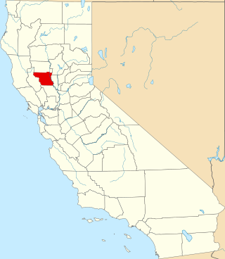
This is a list of the National Register of Historic Places listings in Shasta County, California.

<span class="mw-page-title-main">National Register of Historic Places listings in Solano County, California</span>

This is a list of the National Register of Historic Places listings in Solano County, California.

<span class="mw-page-title-main">National Register of Historic Places listings in Colusa County, California</span>

This is a list of the National Register of Historic Places listings in Colusa County, California.

<span class="mw-page-title-main">National Register of Historic Places listings in Mono County, California</span>

This is a list of the National Register of Historic Places listings in Mono County, California.

<span class="mw-page-title-main">National Register of Historic Places listings in Alpine County, California</span>

This is a list of the National Register of Historic Places listings in Alpine County, California.

<span class="mw-page-title-main">National Register of Historic Places listings in Stanislaus County, California</span>

This is a list of the National Register of Historic Places listings in Stanislaus County, California.

<span class="mw-page-title-main">National Register of Historic Places listings in Inyo County, California</span>

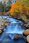
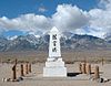
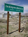
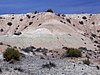
This is a list of the National Register of Historic Places listings in Inyo County, California.

<span class="mw-page-title-main">National Register of Historic Places listings in Calaveras County, California</span>

This is a list of the National Register of Historic Places listings in Calaveras County, California. This is intended to be a complete list of the properties and districts on the National Register of Historic Places in Calaveras County, California, United States. Latitude and longitude coordinates are provided for many National Register properties and districts; these locations may be seen together in an online map.

<span class="mw-page-title-main">National Register of Historic Places listings in Merced County, California</span>

This is a list of the National Register of Historic Places listings in Merced County, California.

<span class="mw-page-title-main">National Register of Historic Places listings in Tehama County, California</span>

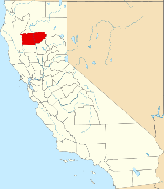
This is a list of the National Register of Historic Places listings in Tehama County, California.

<span class="mw-page-title-main">National Register of Historic Places listings in Trinity County, California</span>

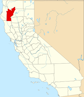
This is a list of the National Register of Historic Places listings in Trinity County, California.

List table of the properties and districts — listed on the California Historical Landmarks — within Calaveras County, California.

Properties and districts listed as California Historical Landmarks within Kern County.

List table of the properties and districts — listed on the California Historical Landmarks in Los Angeles County, Southern California.

List table of the properties and districts — listed on the California Historical Landmarks — within San Bernardino County, Southern California.

References

  1. "California Historical Landmarks By County". Ohp.parks.ca.gov. Retrieved 2019-04-03.

See also