Related Research Articles

Inyo County is a county in the eastern central part of the U.S. state of California, located between the Sierra Nevada and the state of Nevada. In the 2020 census, the population was 19,016. The county seat is Independence. Inyo County is on the east side of the Sierra Nevada and southeast of Yosemite National Park in Central California. It contains the Owens River Valley; it is flanked to the west by the Sierra Nevada and to the east by the White Mountains and the Inyo Mountains. With an area of 10,192 square miles (26,400 km2), Inyo is the second-largest county by area in California, after San Bernardino County. Almost one-half of that area is within Death Valley National Park. However, with a population density of 1.8 people per square mile, it also has the second-lowest population density in California, after Alpine County.

Owens Valley is an arid valley of the Owens River in eastern California in the United States. It is located to the east of the Sierra Nevada, west of the White Mountains and Inyo Mountains, and is split between the Great Basin Desert and the Mojave Desert. The mountain peaks on the West side reach above 14,000 feet (4,300 m) in elevation, while the floor of the Owens Valley is about 4,000 feet (1,200 m), making the valley the deepest in the United States. The Sierra Nevada casts the valley in a rain shadow, which makes Owens Valley "the Land of Little Rain". The bed of Owens Lake, now a predominantly dry endorheic alkali flat, sits on the southern end of the valley.

Elizabeth Lake is a natural sag pond that lies directly on the San Andreas Fault in the northern Sierra Pelona Mountains, in northwestern Los Angeles County, southern California.

The Fish Lake Valley is a 25 miles (40 km) long endorheic valley in southwest Nevada, one of many contiguous inward-draining basins collectively called the Great Basin. The alluvial valley lies just northwest of Death Valley and borders the southeast, and central-northeast flank of the massif of the White Mountains of California. The southwestern portion of the valley lies in California, with the southern tip at the edge of Inyo County east of the Chocolate Mountains, and a significant portion of the south end of the valley floor including the ranching community of Oasis, in Mono County. The valley is sparsely populated, primarily with ranchers and indigenous Paiute. The valley's Post Office and commercial services are located in the town of Dyer.

The Golden Trout Wilderness is a federally designated wilderness area in the Sierra Nevada, in Tulare County and Inyo County, California. It is located 40 miles (64 km) east of Porterville within Inyo National Forest and Sequoia National Forest.

Los Gatos Creek, formerly known as Arroyo Pasajero or Arroyo Poso de Chane, is a creek in Fresno County, California. Its source is in the north end of Garcia Canyon in the Diablo Range near Benito Pass. From there it runs through Los Gatos Canyon, in the eastern foothills of the Diablo Range, then passes across Pleasant Valley, north of Coalinga, where Warthan Creek joins it east of the town. Then it flows eastward to its confluence with Jacalitos Creek, before it passes to the north of the Guijarral Hills, into the San Joaquin Valley, where it is joined by Zapato Chino Creek.
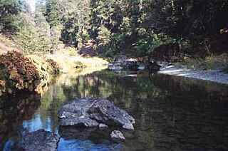
Owensville is a former settlement in Inyo County, California. It was located west of the future site of the modern-day town of Laws. Owensville was started as a mining camp in 1863. By 1871 it had been abandoned. The former settlement site is on U.S. Route 6 north of Bishop, California.
Rose's Corral is a former settlement in Nevada County, California, United States. It was located on the lower San Juan Ridge, between Anthony House on Deer Creek and Bridgeport on the South Yuba River. The merchant John Rose built it close to a trading post he had erected near where Pleasant Valley Road meets Del Mar Way. Established during the summer of 1848, it is notable for being the county's first settlement. It is named for a cattle corral built by John Rose, a trader.
Quartzburg is a former settlement in Mariposa County, California. It was located on Burns Creek 2 miles (3.2 km) upstream from Hornitos.
Hayfork Creek is a tributary of the South Fork Trinity River in Northern California in the United States. At over 50 miles (80 km) long, it is the river's longest tributary and is one of the southernmost streams in the Klamath Basin. It winds through a generally steep and narrow course north, then west through the forested Klamath Mountains, but also passes through the Hayfork and Hyampom Valleys, which are the primary agricultural regions of Trinity County.

Michigan Bluff is an unincorporated community in Placer County, California. Michigan Bluff is 4.35 miles (7.0 km) east-northeast of Foresthill. It is at an elevation of 3,510 feet (1,070 m).
El Camino Viejo a Los Ángeles, also known as El Camino Viejo and the Old Los Angeles Trail, was the oldest north-south trail in the interior of Spanish colonial Las Californias (1769–1822) and Mexican Alta California (1822–1848), present day California. It became a well established inland route, and an alternative to the coastal El Camino Real trail used since the 1770s in the period.
Poso de Chane or Poso Chane is a former settlement in Fresno County, California situated around the waterhole of that name, northwest just below the confluence of the Jacalitos Creek with Los Gatos Creek, 6 miles (9.7 km) east of Coalinga and northwest of the Guijarral Hills.

San Francisquito Creek, in Los Angeles County, is a tributary stream of the Santa Clara River. It drains the south facing slopes of the Sierra Pelona Mountains of the San Gabriel Mountains within the Transverse Range of California, United States.
Cottonwood Creek, is a stream in Kern County, California. Its headwaters are located on the eastern slopes of the Tehachapi Mountains, near a spring 2 miles northwest of the Libre Twins peak. It flows east then southeast into Antelope Valley in the western Mojave Desert.
White Mountain City (WMC) is a ghost town at the mouth of Wyman Canyon in Deep Springs Valley in Inyo County, California. The site is on a dirt road east of CA-168 near the Nevada border. Today, White Mountain City is marked by some ruins.
Lone Willow Station was a former settlement in Merced County, California, located near present-day Los Banos.

Cottonwood Creek is a major stream and tributary of the Sacramento River in Northern California. About 68 miles (109 km) long measured to its uppermost tributaries, the creek drains a large rural area bounded by the crest of the Coast Ranges, traversing the northwestern Sacramento Valley before emptying into the Sacramento River near the town of Cottonwood. It defines the boundary of Shasta and Tehama counties for its entire length. Because Cottonwood Creek is the largest undammed tributary of the Sacramento River, it is known for its Chinook salmon and steelhead runs.

Cirque Peak is a 12,900-foot-elevation (3,900-meter) mountain summit located on the crest of the Sierra Nevada mountain range in California. It is situated on the common border of Tulare County with Inyo County, as well as the shared boundary of Golden Trout Wilderness and John Muir Wilderness, on land managed by Inyo National Forest. It is 14 miles (23 km) southwest of the community of Lone Pine, 7.7 miles (12.4 km) south-southeast of Mount Whitney, and 3.2 miles (5.1 km) south of Mount Langley, the nearest higher neighbor. Cirque Peak is the highest point of the Golden Trout Wilderness, and ranks as the 175th highest peak in California. Topographic relief is significant as it rises 1,800 feet above Cirque Lake in approximately one mile. The Pacific Crest Trail traverses the southwest slope of this mountain, providing an approach option. The mountain was apparently named in 1890 by Joseph Nisbet LeConte and companions who noted the remarkable cirque on the north aspect.
References
- ↑ Chalfant, Willie Arthur (1922). The story of Inyo. The Internet Archive. Chicago: Published by the author through Hammond Press. p. 173.
- ↑ Hoover, Mildred Brook; Rensch, Hero Eugene; Rensch, Ethel Grace; Abeloe, William N.; Kyle, Douglas E. (2002). Historic spots in California. Internet Archive (5th ed.). Stanford: Stanford University Press. ISBN 978-0-8047-4482-9.
{{cite book}}: CS1 maint: date and year (link)
Municipalities and communities of Inyo County, California, United States | ||
|---|---|---|
| City |  | |
| CDPs | ||
| Unincorporated communities | ||
| Indian reservations | ||
| Ghost towns | ||
| Other | ||
| | This Inyo County, California-related article is a stub. You can help Wikipedia by expanding it. |