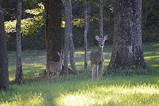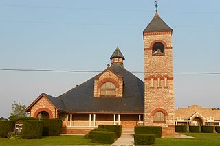
Mount Joy Township is a township in Adams County, Pennsylvania, United States. The population was 3,670 at the 2010 census.

Washington Township is a township in Erie County, Pennsylvania, United States. The population was 4,396 at the 2020 census, down from 4,432 at the 2010 census. The township surrounds the borough of Edinboro.

Henry Clay Township is a township in Fayette County, Pennsylvania, United States. The population was 1,764 at the 2020 census. The township was created June 9, 1824, from the eastern portion of Wharton Township. It is named for 19th-century American statesman Henry Clay. The northwestern corner of its territory was used to create Stewart Township on November 17, 1855. It is served by the Uniontown Area School District.

Antrim Township is a township in Franklin County, Pennsylvania, United States. The population was 15,778 at the 2020 census, an increase over the figure of 12,504 tabulated in 2000. It was named after County Antrim in Northern Ireland.

Freeport Township is a township in Greene County, Pennsylvania, United States. The population was 268 at the 2020 census.

Gilmore Township is a township in Greene County, Pennsylvania, United States. The population was 240 at the 2020 census, down from 260 at the 2010 census.

Carroll Township is a second class township in Perry County, Pennsylvania, United States. The population was 5,230 at the 2020 census. It is one of twenty-two (22) townships in Perry County and one of 1,456 townships in the Commonwealth of Pennsylvania.

Addison Township is a township in Somerset County, Pennsylvania, United States. The population was 932 at the 2020 census. It is part of the Johnstown, Pennsylvania, Metropolitan Statistical Area. The township is named for Alexander Addison, the first president judge overseeing Somerset County.

Black Township is a township in Somerset County, Pennsylvania, United States. The population was 899 at the 2020 census. It is part of the Johnstown, Pennsylvania, Metropolitan Statistical Area. The township was named for Jeremiah Sullivan Black, a native of Somerset County who became Chief Justice of the Supreme Court of Pennsylvania, U.S. Attorney General, and U.S Secretary of State.

Greenville Township is a township in Somerset County, Pennsylvania, United States. The population was 752 at the 2020 census. It is part of the Johnstown, Pennsylvania, Metropolitan Statistical Area.

Larimer Township is a township in Somerset County, Pennsylvania, United States. The population was 543 at the 2020 census. It is part of the Johnstown, Pennsylvania, Metropolitan Statistical Area. Larimer Township was named for General William Larimer, Jr., president of the Pittsburgh & Connellsville Railroad.

Quemahoning Township is a township in Somerset County, Pennsylvania, United States. The population was 1,838 at the 2020 census. It is part of the Johnstown, Pennsylvania, Metropolitan Statistical Area.

Salisbury is a borough in Somerset County, Pennsylvania, United States. The population was 707 at the 2020 census. It is part of the Johnstown, Pennsylvania, Metropolitan Statistical Area.

Summit Township is a township in Somerset County, Pennsylvania, United States. The population was 2,141 at the 2020 census. It is part of the Johnstown, Pennsylvania, Metropolitan Statistical Area.

Upper Turkeyfoot Township is a township in Somerset County, Pennsylvania, United States. The population was 1,063 at the 2020 census. It is part of the Johnstown, Pennsylvania metropolitan statistical area.

Pleasant Township is a township in Warren County, Pennsylvania, United States. The population was 2,250 at the 2020 census, down from 2,444 at the 2010 census.

Codorus Township is a township in York County, Pennsylvania, United States. The population was 3,898 at the 2020 census.

Fawn Township is a township in York County, Pennsylvania, United States. The population was 3,011 at the 2020 census.

Peach Bottom Township is a township in York County, Pennsylvania, 60 miles (97 km) south of Harrisburg. The population was 4,961 at the 2020 census.

Shrewsbury Township is a township in York County, Pennsylvania, United States. The population was 6,651 at the 2020 census.


