
St. Walburg is a town in west-central Saskatchewan's prairie region on Highway 26. St. Walburg is surrounded by the Rural Municipality of Frenchman Butte No. 501. The Bronson Provincial Forest is about 10 kilometres (6.2 mi) to the north.
Halbrite is a village in the Canadian province of Saskatchewan within the Rural Municipality of Cymri No. 36 and Census Division No. 2. The village is located approximately 20 kilometres south-east of the city of Weyburn on Highway 39 at the intersections of Highway 606 and 705.

Turtleford is a town in the Rural Municipality of Mervin No. 499, in the Canadian province of Saskatchewan. Turtleford is located on Highway 26 near the intersection / concurrency with Highway 3 and Highway 303. The nearest cities are North Battleford and Lloydminster. The Turtlelake River runs through Turtleford, and nearby are Brightsand Lake and Turtle Lake.

Midale is a town in the Rural Municipality of Cymri No. 36, in the Canadian province of Saskatchewan. It is located on Highway 39, midway between the cities of Weyburn and Estevan. It is 160 kilometres (100 mi) south-east of Regina.
Crichton is an unincorporated community within the Rural Municipality of Wise Creek No. 77, Saskatchewan, Canada. It is located between Admiral and Cadillac on the historic Red Coat Trail, also known as Highway 13. Like so many towns along the Red Coat Trail, Crichton has become a ghost town with only one family remaining and many empty buildings scattered throughout the town site.
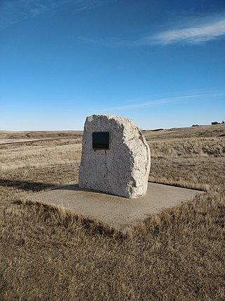
Govenlock is an unincorporated community within the Rural Municipality of Reno No. 51, Saskatchewan, Canada. It previously held the status of a village, with a peak population of 151 residents; its village status was dissolved on January 1, 1976. The former townsite of Govenlock is located on Highway 21 and Highway 13, also known as the historic Red Coat Trail, about 15 kilometres (9.3 mi) east of the Alberta-Saskatchewan border. Although many cement foundations and wooden sidewalks can still be found scattered around the town site, the only building that still stands as of 2010 is the old community hall and a commemorative plaque in remembrance of Govenlock's history.
Estuary is a hamlet in RM of Deer Forks No. 232 in the Canadian province of Saskatchewan. Very little remains of the former village of 800, other than a private residence and a pioneer cemetery on a small hill known as Cemetery Hill, overlooking the South Saskatchewan River.
Baljennie is an unincorporated community in Glenside Rural Municipality No. 377, Saskatchewan, Canada. Its first post office opened in 1891.
Lake Lenore is a village in the Canadian province of Saskatchewan within the Rural Municipality of St. Peter No. 369 and Census Division No. 15. The village is located 144 kilometres (89 mi) northeast of the city of Saskatoon. To the north of the village is Lenore Lake, which is designated as a migratory bird sanctuary, an Important Bird Area (IBA) of Canada, and has a National Wildlife Area on Raven Island. Services in Lake Lenore include a school, Co-op Grocery and Agro Service Station, a Credit Union, and Public Library.

Macoun is a village in the Canadian province of Saskatchewan within the Rural Municipality of Cymri No. 36 and Census Division No. 2. The village is located 28 kilometres (17 mi) northwest of the city of Estevan on Highway 39.

Canuck is an unincorporated community within the Rural Municipality of Lone Tree No. 18, Saskatchewan, Canada. It is on Highway 18, 12.5 kilometres (7.8 mi) east of the village of Climax.
Anerley is an unincorporated community in the western region of Saskatchewan located about 4 km north of Highway 44, about 20 km southwest of the Outlook and is about 125 km south west of Saskatoon.

Bents is an unincorporated community in Marriott No. 317, Saskatchewan, Canada. Prior to the town founding, the area was referred to as Piche. Bents took its name from Longniddry Bents in Scotland. Its derelict wooden grain elevator was once the subject of a National Geographic photograph. The remnants of the town are now located on private property.

Instow is an unincorporated community within the Rural Municipality of Bone Creek No. 108, Saskatchewan, Canada. The community is on Highway 13 also known as the historic Red Coat Trail, about 10 kilometres (6.2 mi) northeast of the town of Shaunavon.

Bromhead is an unincorporated community and ghost town in Souris Valley Rural Municipality No. 7, Saskatchewan, Canada. The community is approximately 5 km (3.1 mi) north of Highway 18 and 45 km (28 mi) west of the City of Estevan.
Dunblane is a ghost town in the Canadian province of Saskatchewan.
Eyre is a ghost town in Chesterfield Rural Municipality, Saskatchewan, Canada. Originally established by the Jewish Colonization Association. The Jewish block settlement was established in 1910 mostly of immigrants from Russia and some from the United States.
Cantuar is an unincorporated community in Rural Municipality of Swift Current No. 137, Saskatchewan, Canada. The site is still used as a freight station by the Great Sandhills Railway. The community is located approximately 23 kilometres (14 mi) northwest of the city of Swift Current at the intersection of Highway 32 and Highway 332.
Chandler is a ghost town in Cymri Rural Municipality, Saskatchewan, Canada. The site was on the Canadian Northern Railway line from Lampman to Radville. The site only had a train station that served the town of Midale two miles to the north by horse drawn stage coach. The Chandler town site was abandoned by the railway in 1927, and the rail-line abandoned in 1951.

Froude is an unincorporated community in the Canadian province of Saskatchewan, located in the Rural Municipality of Griffin No. 66, along the historic Ghost Town Trail, also known as the Red Coat Trail or Highway 13. The community is located approximately 42 km east of the city of Weyburn and 137 km southeast of the provincial capital city of Regina.
