Eltisley is a village and civil parish in South Cambridgeshire, England, on the A428 road about 5.5 miles (8.9 km) east of St Neots and about 11 miles (18 km) west of the city of Cambridge. The population in 2001 was 421 people, falling slightly to 401 at the 2011 Census. [1]
The name 'Eltisley' hints at its origin as an Anglo-Saxon settlement among woodland. [2] Eltisley (Hecteslei) is mentioned in the Domesday Book:
"In Longstow Hundred. The Canons of Bayeux hold 3 hides in Eltisley. Land for 9 ploughs. In lordship 1½ hides; 3 ploughs there; 6 villagers with 10 smallholders have 6 ploughs. 5 cottagers; 6 slaves. Meadow for 3 ploughs; woodland, 20 pigs. The total value is and always was £13. Earl Algar held this manor".. [3]
Eltisley has a large village green, which is at the junction of two ancient roads running from Cambridge to St Neots and from St Ives to Potton. The church, dedicated to St Pandionia and St John the Baptist, stands immediately west of the green and several buildings from the 16th, 17th and 18th centuries stand along its edge, suggesting that the green has been at the centre of the village for a long time. In 1868 it was earmarked for parishioners' recreation and exercise, [2] and cricket is played there in summer. Eltisley Cricket Club was established in 1854 and a thatched pavilion stands on the village green. [4] In 1967 an episode of the ITV television series The Prisoner filmed location scenes featuring a cricket match, for the episode The Girl who was Death , on this green.
Until 1868, when it was turned into allotments, another green was sited to the east. It appears that there have been at least two centres to the village since medieval times, [2] and in 1456, villagers were distinguished as living in either 'le Estende' or 'le Upende';
The parish's population doubled between 1801 and 1871, possibly because of its good road links. In addition to the St Neots–Cambridge and St Ives–Potton roads, the lane towards Caxton may also have been important (judging from its impact on that end of the village, which is known locally as Caxton End). After 1871 the population began to decline, and by 1961 only 253 people lived in Eltisley parish. [2]
During World War II, several babies were born in Mill House on The Green in Eltisley, the local nurse–midwife, Mrs Nell Rose (1905-1990), having taken in pregnant mothers for their confinements. [5] [6] In 2000, the Eltisley Historical Society published The Eltisley Millennium Book, which records the history of the village and the village as it was in the year 2000. [7]
Eltisley has a Parish Council. [8] The parish is represented on the South Cambridgeshire District Council by two councillors for the Papworth Everard ward [9] and on Cambridgeshire County Council by one councillor for the Papworth electoral division. [10] It is in the parliamentary constituency of South Cambridgeshire, represented at the House of Commons by Anthony Browne. [11]
Eltisley parish is on the border of the historical county of Huntingdonshire. Its borders are marked by isolated trees in many places, rather than following distinct geographical features. [2]
Eltisley village is on the western edge of the parish, south of the A428 road 'Cambridge Road' west of its junction with the A1198 at the Caxton Gibbet roundabout. A road redevelopment scheme, which includes a realignment the A428 road to the north of the village, is expected to be completed by 2027. [12]
The county town of Cambridge is 11 miles (18 km) to the east and the nearest town, St Neots, is 5.5 miles (8.9 km) west. London is 50 miles (80 km) south. Croxton is the next village west and Cambourne lies to the east. Papworth Everard is to the north along the B1040 and Waresley to the south.
The parish is largely flat [2] and ranges from 47 to 65 metres above sea level. [13] The soil is a heavy clay on gault which, coupled with the terrain, made drainage difficult. Eastern Brook flows towards Caxton [2] and is a tributary of the Bourn Brook. [13] Eltisley Wood had reached its modern state by the early 19th century; a small wood at Papley Grove, in the north of the parish, is presumably what is left of the woodland that belonged to the prioress of Hinchingbrooke. [2]
Eltisley has a limited-service bus connection to Cambridge. Bus No.X3 operates Mondays to Saturdays with one trip in each direction: leaving Eltisley early morning, returning from Cambridge late afternoon. [14]
At the time of the 2001 census, 421 people were resident in Eltisley parish. All were white; 75.7% described themselves as Christian, 0.7% followed another religion and 23.6% were not religious or did not state a religion. [15]
Two plaques in the churchyard's lych gate commemorate Eltisley men who were killed in the First and Second World Wars. [16]
Some 17 buildings and constructions in Eltisley are listed, including a red telephone box, [17] a village pump [18] and a mile stone on the St Ives road. [19]
By around 1230, Eltisley parish church was dedicated to St Pandionia (or Pandwyna), who was said to have been a nun in the parish in the 10th century. Robert Palmer, vicar in 1575, destroyed a well in the churchyard where St Pandionia's body was meant to have been buried originally (in 1576 he was accused of taking church paving for his own use, permitting the vicarage to be used as an ale-house and playing cards when he should have been in church). Her body was said to have been reburied in the church in 1344 [2] and the dedication to St John the Baptist was added later.
The oldest part of the current building, the aisled nave, dates from around 1200. The tower and spire were probably built around the 15th century. Robert Palmer may have defaced some monumental effigies during his incumbency and in 1644, William Dowsing destroyed a St Christopher. A strong gust of wind blew out the north window of the chapel in the 17th century and the whole north-west corner was rebuilt in the early 17th century. In 1878, £1,000 was spent on restoring the whole church. [2] It is a Grade II* listed building. [20]
In 1835 a Wesleyan Methodist chapel was constructed; in 1851 the congregation numbered 120 and 45 children came to Sunday school. In 1901 it could hold 140 people but was sold in 1964. A Primitive Methodist chapel was built near the green in 1846 and was still in use in 1968. In 1897, the vicar estimated that 40 out of 90 households in the parish were dissenters.
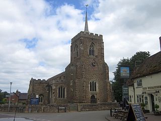
St Neots is a town and civil parish in the Huntingdonshire district of Cambridgeshire, England. It is 18 miles (29 km) west of Cambridge. The areas of Eynesbury, Eaton Ford, Eaton Socon, and Wintringham form part of the town.
Gamlingay is a village and civil parish in the South Cambridgeshire district of Cambridgeshire, England about 14 miles (23 km) west southwest of Cambridge.
Eynesbury is an urban area in the civil parish of St Neots, in the Huntingdonshire district of Cambridgeshire, England. It mainly consists of housing, although there is an area of light industry, and a large supermarket. In addition there is a large area of open grassland and a caravan park.
Cambourne is a town and civil parish in Cambridgeshire, England, in the district of South Cambridgeshire. It is a new settlement and lies on the A428 road between Cambridge, 9 miles (14 km) to the east, and St Neots and Bedford to the west. It comprises the three areas of Great Cambourne, Lower Cambourne and Upper Cambourne. The area is close to Bourn Airfield.
Caldecote is a village and civil parish in Cambridgeshire, in the district of South Cambridgeshire, England. It lies south of the A428, approximately six miles west of Cambridge and three miles east of Cambourne.
Everton is a small rural village of about 200 dwellings and civil parish in the Central Bedfordshire district of Bedfordshire, England about 9 miles (14 km) east of the county town of Bedford.
Caxton is a small rural village and civil parish in the South Cambridgeshire district of Cambridgeshire, England. It is 9 miles west of the county town of Cambridge. In 2001, the population of Caxton parish was 480 people, increasing to 572 at the 2011 Census. Caxton is most famous for the Caxton Gibbet.
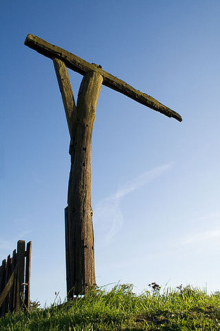
Caxton Gibbet is a small knoll on Ermine Street in England, running between London and Huntingdon, near its crossing with the road between St Neots and Cambridge.
Boxworth is a village in South Cambridgeshire, situated about eight miles to the north-west of Cambridge. It falls under the Papworth Everard and Caxton ward and lies within the diocese of Ely. The village covers an area of 1,053 ha. Boxworth is a relatively small village, with around 100 houses.
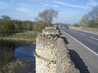
The A428 road is a major road in central and eastern England. It runs between the cities of Coventry and Cambridge by way of the county towns of Northampton and Bedford. Together with the A421,, the eastern section of the A428 forms the route between Cambridge and Oxford. The A428 was formerly part of the main route from Birmingham to Felixstowe before the A14 was fully opened in 1993.
Waresley is a village and former civil parish, now in the parish of Waresley-cum-Tetworth, in Cambridgeshire, England. Waresley lies approximately 11 miles (18 km) south of Huntingdon and 5 miles (8 km) south-east of the town of St Neots. Waresley is situated within Huntingdonshire which is a non-metropolitan district of Cambridgeshire as well as being a historic county of England.
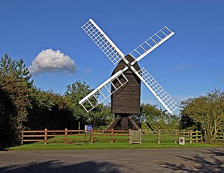
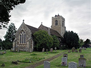
Great Gransden is a civil parish and village in the Huntingdonshire district of Cambridgeshire, England. In 2001, the parish population was 969, which rose to 1,023 at the 2011 Census. It lies 16 miles (25 km) west of Cambridge and 13 miles (21 km) south of Huntingdon. It contains the oldest post mill in England.
The A421 is an important road for east/west journeys across south central England. Together with the A428, the A43 and A34, it forms the route from Cambridge through Milton Keynes to Oxford. The section between the A1 and the A5 is a national primary route.
Croxton is a village and civil parish about 13 miles (21 km) west of Cambridge in South Cambridgeshire, England. In 2001, the resident population was 163 people, falling slightly to 160 at the 2011 Census. Croxton Park is to the south of the current village and contains a large house and parkland.
Longstanton is a village and civil parish in South Cambridgeshire, England, 6 miles (9.7 km) north-west of Cambridge city centre. Longstanton occupies 2,775 acres (1,123 ha). Longstanton was created in 1953 from the two parishes of Long Stanton All Saints and Long Stanton St Michael. While the village is called Longstanton, the alternative form Long Stanton is still in use, for example when referring to the separate pre-1953 parishes, or to the current ecclesiastical parish.
Hardwick is a village and civil parish in the county of Cambridgeshire, England with a large housing estate located about 6 miles (9.7 km) west of the city of Cambridge, England. The village lies immediately south of the A428 road between Cambridge and St Neots. It is about 4 miles (6.4 km) east of the newly developed town of Cambourne. The village is nearly on the Greenwich Meridian. The northern border of the village is St Neots Road, now largely bypassed by the A428, with no houses or property on the north side of the road. In the 2001 census, the population was 2,630 in 946 households, increasing to 2,670 in 1,017 households at the 2011 Census.
Caxton and Arrington was a rural district in Cambridgeshire, England, from 1894 to 1934.
Media related to Eltisley at Wikimedia Commons