Elz, Hesse

Last updated
Elz
Elz Luftbild 068.jpg
Aerial view
DEU Elz Banner.svg
DEU Elz (Westerwald) COA.svg
Location of Elz within Limburg-Weilburg district
Elz in LM.svgDornburgElzSeltersWaldbrunn
Germany adm location map.svg
Red pog.svg
Elz
Hesse location map.svg
Red pog.svg
Elz
Coordinates: 50°25′N8°2′E / 50.417°N 8.033°E / 50.417; 8.033
Country Germany
State Hesse
Admin. region Gießen
District Limburg-Weilburg
Government
   Mayor (201723) Horst Kaiser [1] (CDU)
Area
  Total16.86 km2 (6.51 sq mi)
Elevation
130 m (430 ft)
Population
 (2022-12-31) [2]
  Total7,949
  Density470/km2 (1,200/sq mi)
Time zone UTC+01:00 (CET)
  Summer (DST) UTC+02:00 (CEST)
Postal codes
65604
Dialling codes 06431
Vehicle registration LM, WEL
Website www.elz.de

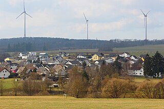
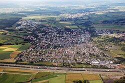
Elz is a municipality in Limburg-Weilburg district in western Hesse, Germany, on the boundary with Rhineland-Palatinate.

Contents

Geography

Location

Elz lies at an elevation of 110 to 291 m north of the Lahn in the Limburg Basin with the municipal area reaching into the heights on its western edge and thereby into the area of the Lower Westerwald (Elzer Wald). From north to south the municipal area is crossed by the flat-bottomed Elbbach valley, whose resident stream rises in the High Westerwald and flows south from Elz, emptying into the Lahn.

Geology

The Elbbach's broad lower reaches follow a tectonically created fault (Elzer Graben) which stretches northwards into the community of Dornburg. The Devonian bedrock here is, especially west of the Elbbach, overlain with thick sedimentary fill from the Tertiary (clays, sands, gravels) of which especially the quartz sand has afforded the region some economic importance. Overlying these in turn are layers of Ice Age loess deposits, which have laid the basis for fruitful agriculture.

Neighbouring communities

Elz borders in the north on the community of Hundsangen (in the Westerwaldkreis in Rhineland-Palatinate) and the town of Hadamar, in the east and south on the town of Limburg (both in Limburg-Weilburg), and in the west on the communities of Hambach (in the Rhein-Lahn-Kreis in Rhineland-Palatinate), Görgeshausen, Niedererbach and Obererbach (all three in the Westerwaldkreis).

Constituent communities

Elz's Ortsteile are, with population figures as at 31 December 2007, Elz (7,949) and Malmeneich (344).

All together, the community has 8,293 inhabitants. Elz's main centre, also called Elz, is, after Limburg an der Lahn's main centre the second biggest place in Limburg-Weilburg.

Climate

The yearly average temperature in Elz is 8.5 °C and in Malmeneich 7.9 °C.

The average yearly precipitation ranges from 600 to 650 mm in Elz and in Malmeneich is 720 mm.

Spring's onset falls on average in Elz sometime between 29 April and 5 May. [3]

History

The placename presumably springs from the alder (Erle in German). Elz crops up for the first time in the 933 Wiltrud document, now no longer in existence. The oldest existing document comes from the year 1145.

The village on the important strata publica, or Hohe Straße ("High Road") between Frankfurt am Main and Cologne was in the Middle Ages at first under royal rule. Later the property passed to the Electorate of Trier. The outlying countryside, however, belonged to the Counts of Nassau, which led to centuries-long border disputes.

On 1 September 1442, Elz was granted town rights by King Friedrich IV. The document attesting this, which guaranteed the Elz townsmen in the Late Middle Ages their freedom was effected by Archbishop of Trier Jacob I of Sierck. The original document has been lost, but in the Landeshauptarchiv Koblenz, three authenticated copies from 1442 and 1443 are kept (Bestand 1 A, Nr. 8101-8103). The town fortification that was soon built was later torn down by the Counts of Nassau. Complicated ownership relationships led to further disputes between the Landgraves of Hesse, the Electorate of Trier and Nassau.

With Secularization in 1802, Trier's overlordship ended and Elz passed to the Principality of Nassau-Weilburg. From 1806 it belonged to the Duchy of Nassau. In 1866 it passed to Prussia.

Religion

History

Until the 13th century, Elz belonged with some 20 other places to the parish of Dietkirchen, which with its Romanesque basilica was widely known throughout the Lahn valley. According to information handed down, Elz was already an autonomous parish beginning in 1234. [4]

Before the current parish church of Sankt Johannes der Täufer ("Saint John the Baptist"), which to a considerable extent shapes the village's appearance, a smaller church stood on the same spot, whose exact dimensions and appearance are only vaguely known. References can be found to a Romanesque building with a length of roughly 13.5 m and a breadth of 9.3 m. [5] The graveyard, now lying west of the church, lay at that time around the old parish church.

Current parish church

The foundation stones were laid on 27 June 1852, on the occasion of which a celebratory Mass by Bishop Peter Josef Blum and Vicar-General Klein was said. A stone plaque with the year 1852 over the sandstone architrave block facing Pfortenstraße still witnesses this event. After about two years, the church, albeit still without a steeple, could be consecrated by Bishop Blum on 19 November 1854.

In the altar are found relics of the martyrs Boniface, Clement and Blandinia. [6] The church consecration festival was set at that time to the first Sunday after the autumn Ember days (these being the Wednesday, Friday and Saturday in the week after Holy Cross Day on 14 September). Since the German Bishops' Conference in 1872 moved the festival, the third Sunday in September has been set as the deadline for the kermis.

On 22 April 1908, the church executive and community council approved the building of a new tower. Its height is 48 m, and since 8 December 1952 it has been fitted with a set of four bells. [7]

Pastors of the community since the 20th century

Politics

Elz Town Hall, in the background the parish church's (Saint John the Baptist) steeple Elz Rathaus.jpg
Elz Town Hall, in the background the parish church's (Saint John the Baptist) steeple

Community council

The municipal election held on 26 March 2006 yielded the following results:

Parties and voter communities%
2011
seats
2011
%
2006
seats
2006
CDU Christian Democratic Union of Germany 55.01760.719
SPD Social Democratic Party of Germany 28.7921.97
FWG Freie Wählergemeinschaft Elz16.3513.84
GBE Bündnis 90/Die Grünen 3.61
Total100.031100.031
voter turnout in %45.744.6

Council consists of 9 members.

Mayors since the 20th century

The mayor who currently holds office, Horst Kaiser (CDU) was elected on 25 September 2005 with 84.8% of the vote.

Culture and sightseeing

Local recreation area

The local recreation area "Anlagen" lies not far from the middle of the community, north of the parish church on a bank towards Malmeneich. After the decision to build a chapel on this bank was overturned, this area came into being in 1911 in the form of a little wood. The name "Anlagen" ("facilities" or "sites" in German) was in the beginning only meant to be the working name, but it so strongly worked its way into the inhabitants’ everyday speech that it stuck, and is still used as the area's name today. The "Anlagen" nowadays offer, besides the structuredly laid-out tree learning path, a miniature golf course and a playground. The Elz Beautification Club (Elzer Verschönerungsverein) has been taking care of the recreation area since 1913. [8]

Regular events

Culinary specialities

Economy and infrastructure

The community is home to more than 600 businesses with well over 2,000 jobs. A commercial park can be found on Bundesstraße 8 towards the outlying centre of Malmeneich.

Road transport

The community is also known countrywide for its Elzer Berg (mountain) on the notable drop in elevation from the Lower Westerwald into the Limburg Basin. This long sloped stretch of roadway on the A 3 (Cologne Frankfurt) near kilometre 100 going towards Frankfurt is a notorious accident black spot. The speed limit of 100 km/h for passenger cars and 40 km/h for trucks has watch kept over it by stationary speed measuring apparatus.

Through Elz runs Bundesstraße 8, on its way from the Dutch border to Passau. As traffic regularly backs up here, the plan for the long-distance federal roads has identified a bypass for Elz as an urgent need; the price for such work will be €12,600,000.

Rail transport

Elz has two railway stations: near the middle of the community is found Elz station on the Upper Westerwald Railway (Oberwesterwaldbahn) to Limburg and Au (Sieg). From the regional station at Limburg, the cities of Gießen, Koblenz, Frankfurt am Main and Wiesbaden may be reached directly. Furthermore, Elz is linked to the Limburg-Staffel–Siershahn line (Lower Westerwald Railway, Unterwesterwaldbahn) through a halt, Elz Süd.

The nearest InterCityExpress stop is Limburg Süd station on the Cologne-Frankfurt high-speed rail line. Alternatively, Montabaur station on the same high-speed rail line may be reached on the Unterwesterwaldbahn.

Air transport

It is roughly a 65-km drive to Frankfurt Airport on Bundesautobahn 3. Elz has its own airport at its disposal which is also home to Flugsportgruppe Elz e. V., a sport flying club.

Public facilities

Elz has a big outdoor swimming pool with broad outdoor facilities (table tennis table, volleyball field, basketball nets). Right next to it are found the central sporting ground and the tennis courts. The community also offers three sport halls: the Vereinsturnhalle ("club gymnasium"), the Süd-Schule Elz gymnasium (school) and since 30 May 2008 the Erlenbachhalle, a two-field sport hall belonging to the Erlenbachschule (school) on Hadamarer Straße.

There are two homes for the elderly in Elz that look after elderly residents and those in need of care.

Education

Elz has at its disposal three kindergartens, St. Martin, Unterm Regenbogen and Lollipop, the primary school Oranienschule (formerly known as Grundschule Elz Süd), and also the Erlenbachschule, which functions as a primary school, a Hauptschule and a Realschule.

Public institutions

Famous people

Sons and daughters of the town

Related Research Articles

<span class="mw-page-title-main">Limburg an der Lahn</span> Town in Hesse, Germany

Limburg an der Lahn is the district seat of Limburg-Weilburg in Hesse, Germany.
<span class="mw-page-title-main">Westerwald</span> Mountain range in Germany

The Westerwald is a low mountain range on the right bank of the river Rhine in the German federal states of Rhineland-Palatinate, Hesse and North Rhine-Westphalia. It is a part of the Rhenish Massif. Its highest elevation, at 657 m above sea level, is the Fuchskaute in the High Westerwald.

Limburg-Weilburg is a Kreis (district) in the west of Hesse, Germany. Neighboring districts are Lahn-Dill, Hochtaunuskreis, Rheingau-Taunus, Rhein-Lahn, Westerwaldkreis.

<span class="mw-page-title-main">Dreikirchen</span> Municipality in Rhineland-Palatinate, Germany

Dreikirchen is an Ortsgemeinde – a community belonging to a Verbandsgemeinde – in the Westerwaldkreis in Rhineland-Palatinate, Germany.
<span class="mw-page-title-main">Weilburg</span> Town in Hesse, Germany

Weilburg is, with just under 13,000 inhabitants, the third biggest town in Limburg-Weilburg district in Hesse, Germany, after Limburg an der Lahn and Bad Camberg.

<span class="mw-page-title-main">Nassau, Rhineland-Palatinate</span> Town in Rhineland-Palatinate, Germany

Nassau is a town located in the German state of Rhineland-Palatinate. It lies on the lower course of the Lahn River, on the mouth of the Mühlbach, between Limburg an der Lahn and the spa town of Bad Ems, and is located in the Nassau Nature Park, surrounded by the Westerwald to the north and the Taunus to the south. The town is on the German-Dutch holiday road, the Orange Route. As of 2021, it had a population of 4,592.

<span class="mw-page-title-main">Selters (Taunus)</span> Municipality in Hesse, Germany

Selters (Taunus) is a municipality with 8,000 inhabitants north of Bad Camberg in Limburg-Weilburg district in Hesse, Germany.
<span class="mw-page-title-main">Hünfelden</span> Municipality in Hesse, Germany

Hünfelden is a municipality in Limburg-Weilburg district in Hesse, Germany. Hünfelden lies on the Hühnerstraße, an historic part of Bundesstraße 417.

<span class="mw-page-title-main">Brechen</span> Municipality in Hesse, Germany

Brechen is a municipality in Limburg-Weilburg district in Hesse, Germany.

<span class="mw-page-title-main">Selters (Lahn)</span> Place in Limburg-Weilburg, Löhnberg

Selters is a village in the district Limburg-Weilburg, Hesse, Germany. It is situated at the Taunus side of the river Lahn and belongs to the municipality Löhnberg. The village has a total population of 319.

<span class="mw-page-title-main">Hundsangen</span> Municipality in Rhineland-Palatinate, Germany

Hundsangen is an Ortsgemeinde – a community belonging to a Verbandsgemeinde – in the Westerwaldkreis in Rhineland-Palatinate, Germany.

<span class="mw-page-title-main">Villmar</span> Municipality in Hesse, Germany

Villmar is a market village and municipality in the Limburg-Weilburg district in Hesse, Germany. The community is the centre for quarrying and processing the so-called Lahn Marble.

<span class="mw-page-title-main">Stein-Neukirch</span> Municipality in Rhineland-Palatinate, Germany

Stein-Neukirch is an Ortsgemeinde – a community belonging to a Verbandsgemeinde – in the Westerwaldkreis in Rhineland-Palatinate, Germany.

<span class="mw-page-title-main">Nentershausen, Rhineland-Palatinate</span> Municipality in Rhineland-Palatinate, Germany

Nentershausen is an Ortsgemeinde – a community belonging to a Verbandsgemeinde – in the Westerwaldkreis in Rhineland-Palatinate, Germany.
<span class="mw-page-title-main">Niedererbach</span> Municipality in Rhineland-Palatinate, Germany

Niedererbach is an Ortsgemeinde – a community belonging to a Verbandsgemeinde – in the Westerwaldkreis in Rhineland-Palatinate, Germany.

<span class="mw-page-title-main">Molsberg (Germany)</span> Municipality in Rhineland-Palatinate, Germany

Molsberg is an Ortsgemeinde – a community belonging to a Verbandsgemeinde – in the Westerwaldkreis in Rhineland-Palatinate, Germany.

<span class="mw-page-title-main">Seck</span> Municipality in Rhineland-Palatinate, Germany

Seck is an Ortsgemeinde – a community belonging to a Verbandsgemeinde – in the Westerwaldkreis in Rhineland-Palatinate, Germany.
<span class="mw-page-title-main">Kaden</span> Municipality in Rhineland-Palatinate, Germany

Kaden is an Ortsgemeinde – a community belonging to a Verbandsgemeinde – in the Westerwaldkreis in Rhineland-Palatinate, Germany.

<span class="mw-page-title-main">Lahngau</span>

The Lahngau was a medieval territory comprising the middle and lower Lahn River valley in the current German states of Hesse and (partially) Rhineland-Palatinate. The traditional names of the Gau are Loganahe Pagus or Pagus Logenensis.

<span class="mw-page-title-main">Lahntal railway</span> Railway line in Germany

The Lahntal railway is a railway line between Niederlahnstein in the German state of Rhineland-Palatinate to Wetzlar in Hesse. Its western terminus was originally in Oberlahnstein. Trains now mostly operate between Koblenz and Gießen. The line was opened by the Nassau Rhine and Lahn Railway Company and the Nassau State Railway between 1858 and 1863 and is one of the oldest railways in Germany.
References

  1. "Ergebnisse der letzten Direktwahl aller hessischen Landkreise und Gemeinden" (XLS) (in German). Hessisches Statistisches Landesamt. 5 September 2022.
  2. "Bevölkerung in Hessen am 31.12.2022 nach Gemeinden" (XLS) (in German). Hessisches Statistisches Landesamt. June 2023.
  3. Klimadaten auf www.elz.de
  4. Kleinfeld, G., Weirich H.: "Die mittelalterliche Kirchenorganisation im oberhessischen-nassauischen Raum" (Schriften XVI 1937 S.144 f.)
  5. Erhard Weimer "Elzer Chronik", Seite 136
  6. Diözesanarchiv Limburg, E 14 Elz: O. E. 1004, 1854, Nov. 21
  7. Pfarrarchiv, Elz. S. 86
  8. Erhard Weimer, Elzer Atlas Seite 125f.

Further reading