Emsger

Last updated
Emsger
South-bish.jpg
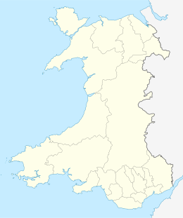
Wales location map.svg
Red pog.svg
Emsger
Geography
Coordinates 51°51′05.51″N5°24′43.88″W / 51.8515306°N 5.4121889°W / 51.8515306; -5.4121889 Coordinates: 51°51′05.51″N5°24′43.88″W / 51.8515306°N 5.4121889°W / 51.8515306; -5.4121889
Archipelago Bishops and Clerks
Area1.4 ha (3.5 acres) [1]
Administration
Wales
County Pembrokeshire
Demographics
Population0

Emsger or South Bishop is an islet situated west of Ramsey Island, Pembrokeshire, Wales. It is the largest of the Bishops and Clerks group of islets and rocks.
Contents

Etymology

Its name can also be shown as Em-sger, Emskir or Emskyr. The second element is from Old Norse sker a skerry, an isolated rock in the sea.

Lighthouse

The South Bishop Lighthouse, designed by James Walker, was built on the island and started operating in 1839. [2] [3]

It reaches a height of 37 metres (121 feet), North Bishop reaching 44 metres (144 feet).[ clarification needed ]

Related Research Articles

Pembrokeshire Coast Path

The Pembrokeshire Coast Path, also often called the Pembrokeshire Coastal Path, is a designated National Trail in Pembrokeshire, southwest Wales. It was established in 1970, and is 186 miles (299 km) long, mostly at cliff-top level, with a total of 35,000 feet (11,000 m) of ascent and descent. At its highest point – Pen yr afr, on Cemaes Head – it reaches a height of 574 feet (175 m), and at its lowest point – Sandy Haven crossing, near Milford Haven – it is just 6 feet (2 m) above low water. Whilst most of the coastline faces west, it offers – at varying points – coastal views in every direction of the compass.

Strumble Head Lighthouse

Strumble Head Lighthouse stands on Ynys Meicel, also known as Strumble Head, a rocky island at the northwest corner of Pencaer area, five miles west of the town of Fishguard, in northern Pembrokeshire, Wales.

Skokholm

Skokholm or Skokholm Island is an island 2.5 miles (4.0 km) off the coast of Pembrokeshire, Wales, south of the neighbouring island of Skomer. The surrounding waters are a marine reserve and all are part of the Pembrokeshire Coast National Park. Both islands are listed as Sites of Special Scientific Interest.

Skomer

Skomer or Skomer Island is an island off the coast of Pembrokeshire, in the community of Marloes and St Brides in west Wales. It is well known for its wildlife: around half the world's population of Manx shearwaters nest on the island, the Atlantic puffin colony is the largest in southern Britain, and the Skomer vole is unique to the island. Skomer is a national nature reserve, a Site of Special Scientific Interest and a Special Protection Area. It is surrounded by a marine nature reserve and is managed by the Wildlife Trust of South and West Wales.

Ramsey Island

Ramsey Island is an island about 1 kilometre (0.62 mi) off St David's Head in Pembrokeshire on the northern side of St Brides Bay, in southwest Wales. It is 259 hectares in area. Ramsey means Hrafn's island.

Tidal island Island accessible by foot at low tide

A tidal island is a piece of land that is connected to the mainland by a natural or man-made causeway that is exposed at low tide and submerged at high tide. Because of the mystique surrounding tidal islands, many of them have been sites of religious worship, such as Mont Saint-Michel with its Benedictine Abbey. Tidal islands are also commonly the sites of fortresses because of their natural fortifications.

Strumble Head

Strumble Head is a rocky headland in the community of Pencaer in Pembrokeshire, Wales, within the Pembrokeshire Coast National Park. It marks the southern limit of Cardigan Bay. Three islands lie off the head: Ynys Meicel – 112 feet (34 m) – Ynys Onnen and Carreg Onnen.

Ynys Bery

Ynys Bery is a small island south of Ramsey Island, Pembrokeshire, Wales, in the community of St David's and the Cathedral Close.

Bishops and Clerks

The Bishops and Clerks are a group of rocks and islets, approximately 1 12 miles (2.4 km) west of Ramsey Island, Pembrokeshire, Wales.

South Bishop Lighthouse

The South Bishop Lighthouse is a lighthouse on South Bishop Island, a small rock approximately 5 miles (8 km) west of St Davids Head in Pembrokeshire, Wales.

Skokholm Lighthouse

Skokholm Lighthouse is a lighthouse on Skokholm Island, just off the southwest coast of Pembrokeshire, Wales.

St Anns Head Lighthouse

St. Ann's Head Lighthouse is a lighthouse that overlooks the entrance to the Milford Haven waterway, one of Britain's deep water harbours, from St. Ann's Head near Dale in Pembrokeshire.

Caldey Lighthouse

Caldey Lighthouse is located on the south end of Caldey Island, three miles (5 km) off the south Pembrokeshire, Wales coastline, a small island inhabited by a Cistercian monastery.

Round Island Light, Isles of Scilly

Round Island Lighthouse, in the Isles of Scilly was designed by William Tregarthen Douglass for Trinity House and completed in 1887. At the time of building it was one of three lights in the Isles of Scilly, the others being the Bishop Rock and St Agnes lighthouse. The light was modernised in 1966, automated in 1987 and the island designated as a Site of Special Scientific Interest (SSSI) in 1995. It is now managed by the Isles of Scilly Wildlife Trust, and except for the maintenance of the Grade 2 listed lighthouse, landing is not allowed.

Lampione

Lampione is a small rocky island located in the Mediterranean Sea, which belongs geographically to the Pelagie Islands and administratively to the comune of Lampedusa e Linosa, Province of Agrigento, region of Sicily, Italy. It is about 200 metres long and 180 metres across, and has an area of 4 hectares and a highest elevation of 36 metres.

Freshwater West Human settlement in Wales

Freshwater West is a beach near Castlemartin, Pembrokeshire in West Wales. It lies along the B4319 road and is part of the Pembrokeshire Coast National Park. Freshwater West, noted for its strong waves and currents, is one of Wales' top surfing locations, and regularly hosts surfing tournaments such as the Welsh National Surfing Championships. Since 2010 the beach has had a lifeguard service during the busier summer months. The Castlemartin MOD firing range is located nearby.

Sommers

Sommers is an islet and a lighthouse in the eastern part of the Gulf of Finland, an arm of the Baltic Sea, just outside the Gulf of Vyborg, about 19 kilometres south of Virolahti, Finland, but it is now possessed by Russia. The lighthouse is situated on a rocky skerry, which is elevated a maximum of 16 metres above the Baltic Sea.

Skerries Lighthouse

The Skerries Lighthouse was first lit on the highest point of the largest island in The Skerries, Isle of Anglesey after 1716. A patent for the lighthouse was subsequently obtained in 1824. The builder was William Trench, who lost his son off the rocks and died in debt in 1725. He is said to have originally been allowed a pension from the Post Office, rather than payment from shipping tolls. An act of 1730 allowed his son-in-law, Sutton Morgan, to increase the dues charged for shipping and confirmed the patent on the light to Morgan's heirs forever.

Nobbys Head Light Lighthouse in New South Wales, Australia

Nobbys Head Light is an active lighthouse on Nobbys Head, a headland on the south side of the entrance to Newcastle Harbour, New South Wales, Australia. An image of the lighthouse is included in the Coat of Arms of the City of Newcastle.

Carn Llidi Hill in Wales

Carn Llidi is a hill east of St David's Head in Pembrokeshire, Wales. Carn Llidi and its surrounding area is part of the Pembrokeshire Coast National Park.

References

  1. Area estimated by overlaying a 90 x 160 metre rectangle on Bing Maps aerial view
  2. "South Bishop Lighthouse". Coflein. Royal Commission on the Ancient and Historical Monuments of Wales. 2009. Retrieved 4 June 2020.
  3. Dennis Kelsall and Jan Kelsall (2016). The Pembrokeshire Coast Path. Cicerone Press Limited. p. 194. ISBN   9781783623266 . Retrieved April 12, 2016.