Licking County is a county located in the central portion of the U.S. state of Ohio. At the 2020 census, the population was 178,519. Its county seat is Newark. The county was formed on January 30, 1808, from portions of Fairfield County.

Beechwood Trails is a census-designated place (CDP) in Harrison Township, Licking County, Ohio, United States. The population was 3,276 at the 2020 census.
Granville South is a census-designated place (CDP) in Licking County, Ohio, United States. The population was 1,420 at the 2020 census.

Harbor Hills is a census-designated place (CDP) in southern Licking County, Ohio, United States. The population was 1,565 at the 2020 census.

Pataskala is a city in Licking County, Ohio, United States, approximately 19 miles (31 km) east of Columbus. The population was 17,886 at the 2020 census. Pataskala was a small community until 1996, when what was then the village of Pataskala merged with Lima Township, vastly increasing its population and geographic area.

Winesburg is an unincorporated community and census-designated place (CDP) in Paint Township, Holmes County, Ohio, in the United States. The population was 340 at the 2020 census. The community sits on the crest of a hill in the Amish country of Ohio. It lies along U.S. Route 62.

Pettisville is an unincorporated community and census-designated place (CDP) in Clinton and German townships, Fulton County, Ohio, United States. Located at the intersection of County Road 19 and Country Road D, its elevation is 755 feet (230 m). As of the 2020 census the population was 469.
Jacksontown is a census-designated place (CDP) in central Licking Township, Licking County, Ohio, United States. It has a post office with the ZIP code 43030. It lies at the intersection of U.S. Route 40 with State Route 13.

Brownsville is an unincorporated community and census-designated place (CDP) in northeastern Bowling Green Township, Licking County, Ohio, United States. As of the 2020 census, it had a population of 214. It lies at the intersection of U.S. Route 40 with State Route 668.

Collins is a census-designated place (CDP) in central Townsend Township, Huron County, Ohio, United States. As of the 2020 census the population of the CDP was 628. The CDP includes the unincorporated communities of Collins and East Townsend. Collins has a post office, with the ZIP code of 44826.

East Rochester is an unincorporated community and census-designated place (CDP) in southern West Township, Columbiana County, Ohio, United States. The population was 224 as of the 2020 census. It lies along U.S. Route 30, and has a post office with the ZIP code 44625. It is a part of the Salem micropolitan area, about 20 miles (32 km) east of Canton.

Opal is an unincorporated community and census-designated place (CDP) in Fauquier County, Virginia, United States. It is on U.S. Highway 15/U.S. Route 17 and U.S. Route 29, at an elevation of 449 feet (137 m). The population as of the 2010 census was 691.
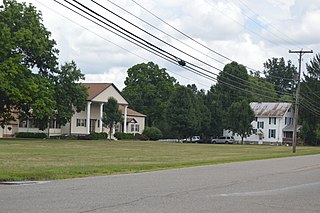
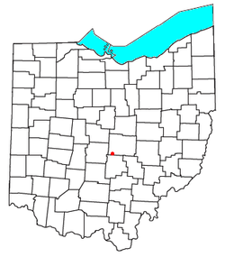
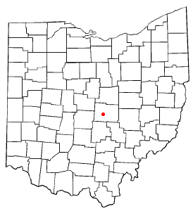
Marne is an unincorporated community and census-designated place (CDP) in Licking County, Ohio, United States. As of the 2020 census it had a population of 772.
Earling is an unincorporated community and census-designated place (CDP) in Logan County, West Virginia, United States. It was first listed as a CDP prior to the 2020 census. The Earling post office closed on July 1, 1989. The town now shares ZIP Code 25632 with Lyburn and Taplin.
Justice Addition is an unincorporated community and census-designated place (CDP) in Logan County, West Virginia, United States. The community was first listed as a CDP prior to the 2020 census. The population was 331 at the 2020 census.
Wolfhurst is a census-designated place (CDP) in Belmont County, Ohio, United States. It is part of the Wheeling, West Virginia Metropolitan Statistical Area. The population was 1,119 at the 2020 census.
Kanauga is an unincorporated community and census-designated place (CDP) in Gallia County, Ohio, United States. As of the 2020 census it had a population of 185.

Pottery Addition is a census-designated place (CDP) in Jefferson County, Ohio, United States. Its population was 258 as of the 2020 census. The community is located along the Ohio River and is served by Ohio State Route 7.
Rainbow Lakes is a census-designated place (CDP) located in Parsippany-Troy Hills, Morris County, in the U.S. state of New Jersey. It is in the western part of the township and consists of housing built around Rainbow Lake, plus a zone of commercial buildings to the east of the lakes. It is bordered to the east by Parsippany proper, to the north by the borough of Mountain Lakes, and to the west by Denville Township. The northern edge of the CDP is formed by U.S. Route 46 and the NJ Transit Montclair-Boonton Line, and Interstate 80 forms the southern edge. It is 21 miles (34 km) northwest of Newark and 30 miles (48 km) west of the George Washington Bridge over the Hudson River.
Miller is an unincorporated community and census-designated place (CDP) in Lawrence County, Ohio, United States, along the Ohio River. It was first listed as a CDP prior to the 2020 census.