Harbor Hills, Ohio

Last updated
Harbor Hills, Ohio
OHMap-doton-Harbor Hills.png
Location of Harbor Hills, Ohio
Coordinates: 39°56′12″N82°26′07″W / 39.9367314°N 82.4351542°W / 39.9367314; -82.4351542
Country United States
State Ohio
County Licking
Township Licking
Area
[1]
  Total3.48 sq mi (9.02 km2)
  Land2.75 sq mi (7.14 km2)
  Water0.73 sq mi (1.89 km2)
Elevation
[2]
929 ft (283 m)
Population
 (2020)
  Total1,565
  Density568.06/sq mi (219.33/km2)
Time zone UTC-5 (Eastern (EST))
  Summer (DST) UTC-4 (EDT)
FIPS code 39-33362 [3]
GNIS feature ID1867456 [2]

Harbor Hills is a census-designated place (CDP) in southern Licking County, Ohio, United States. The population was 1,565 at the 2020 census.

Contents

A post office called Harbor Hills was established in 1927, and remained in operation until 1943. [4]

Geography

Harbor Hills is located in southern Licking County on the north and northeast sides of Buckeye Lake. The CDP is in the southern part of Licking Township and is bordered to the west by the village of Buckeye Lake in Union Township of Licking County, and to the south by Thornport in Perry County. Interstate 70 forms the northern edge of the CDP, and Ohio State Route 13 forms the eastern edge. The neighborhood of Harbor Hills is in the western part of the CDP, while Edgewater Beach is in the southeast corner of the CDP. Both neighborhoods have shorefront on Buckeye Lake.[ citation needed ]

From State Route 13, Interstate 70 leads west 32 miles (51 km) to Columbus and east 21 miles (34 km) to Zanesville, while State Route 13 leads north 8 miles (13 km) to Newark, the Licking county seat, and southeast 13 miles (21 km) to Somerset.

According to the United States Census Bureau, the Harbor Hills CDP has a total area of 3.5 square miles (9.0 km2), of which 2.7 square miles (7.1 km2) are land and 0.73 square miles (1.9 km2), or 20.94%, are water. [5] The water area is part of Buckeye Lake, a reservoir constructed in the 19th century as part of the Ohio and Erie Canal project, but is now primarily used for recreation.

Demographics

Historical population
CensusPop.Note
2020 1,565
U.S. Decennial Census [6]

As of the census [3] of 2000, there were 1,303 people, 575 households, and 411 families living in the CDP. The population density was 478.1 inhabitants per square mile (184.6/km2). There were 676 housing units at an average density of 248.0 per square mile (95.8/km2). The racial makeup of the CDP was 98.39% White, 0.15% African American, 0.15% Asian, 0.15% Pacific Islander, and 1.15% from two or more races. Hispanic or Latino of any race were 0.15% of the population.

There were 575 households, out of which 19.8% had children under the age of 18 living with them, 63.1% were married couples living together, 5.7% had a female householder with no husband present, and 28.5% were non-families. 22.8% of all households were made up of individuals, and 10.1% had someone living alone who was 65 years of age or older. The average household size was 2.27 and the average family size was 2.66.

In the CDP the population was spread out, with 16.4% under the age of 18, 6.9% from 18 to 24, 22.3% from 25 to 44, 35.1% from 45 to 64, and 19.3% who were 65 years of age or older. The median age was 48 years. For every 100 females there were 101.4 males. For every 100 females age 18 and over, there were 101.7 males.

The median income for a household in the CDP was $48,510, and the median income for a family was $51,429. Males had a median income of $43,594 versus $27,361 for females. The per capita income for the CDP was $26,095. About 2.1% of families and 2.4% of the population were below the poverty line, including none of those under age 18 and 5.2% of those age 65 or over.

Related Research Articles

<span class="mw-page-title-main">Licking County, Ohio</span> County in Ohio, United States

Licking County is a county located in the central portion of the U.S. state of Ohio. At the 2020 census, the population was 178,519. Its county seat is Newark. The county was formed on January 30, 1808, from portions of Fairfield County.

<span class="mw-page-title-main">Fairfield County, Ohio</span> County in Ohio, US

Fairfield County is a county located in the U.S. state of Ohio. As of the 2020 census, the population was 158,921. Its county seat and largest city is Lancaster. Its name is a reference to the Fairfield area of the original Lancaster.

<span class="mw-page-title-main">Desert Hills, Arizona</span> CDP in Mohave County, Arizona

Desert Hills is an unincorporated community and census-designated place (CDP) in Mohave County, Arizona, United States. The population was 2,764 at the 2020 census, up from 2,245 at the 2010 census.

Fox Lake Hills is an unincorporated community and census-designated place (CDP) in Lake Villa Township, Lake County, Illinois, United States. Per the 2020 census, the population was 2,684.

<span class="mw-page-title-main">Claryville, Kentucky</span> Census-designated place in Kentucky, United States

Claryville is an unincorporated community and census-designated place (CDP) in Campbell County, Kentucky, United States. The population was 2,355 at the 2010 census.

<span class="mw-page-title-main">Carrollwood (CDP), Florida</span> Census-designated place in Florida, United States

Carrollwood is a census-designated place (CDP) in northwestern Hillsborough County, Florida, United States. The population was 33,365 at the 2010 census. The census area includes the unincorporated communities of Carrollwood and Carrollwood Village. For the 2000 census the area was enumerated under the name "Greater Carrollwood" and had a population of 33,519. A similar area was listed as "Lake Carroll" in 1970 and 1980; for the 1990 census it was split into the smaller Carrollwood and Carrollwood Village CDPs.

<span class="mw-page-title-main">Collings Lakes, New Jersey</span> Populated place in Atlantic County, New Jersey, US

Collings Lakes is an unincorporated community and census-designated place (CDP) located within Buena Vista Township in Atlantic County, in the U.S. state of New Jersey. As of the 2010 United States Census, the CDP's population was 1,706.

<span class="mw-page-title-main">Eatons Neck, New York</span> Hamlet and census-designated place in New York, United States

Eatons Neck is a hamlet and census-designated place (CDP) in the Town of Huntington in Suffolk County, on the North Shore of Long Island, in New York, United States. The population was 1,406 at the 2010 census.

<span class="mw-page-title-main">Crystal Lakes, Ohio</span> Census-designated place in Ohio, United States

Crystal Lakes is a census-designated place (CDP) in Clark County, Ohio, United States. The population was 1,394 at the 2020 census. It is part of the Springfield, Ohio Metropolitan Statistical Area.

<span class="mw-page-title-main">Fairfield Beach, Ohio</span> Census-designated place in Ohio, United States

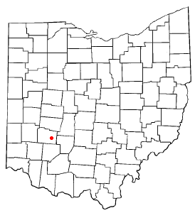
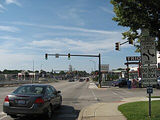
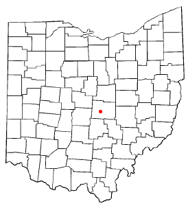
Fairfield Beach is an unincorporated community and census-designated place (CDP) in Fairfield County, Ohio, United States. The population was 1,267 at the 2020 census.

<span class="mw-page-title-main">Lake Darby, Ohio</span> Census-designated place in Ohio, United States

Lake Darby is an unincorporated community and census-designated place in Franklin County, Ohio, United States, located mostly in Prairie Township and partly in Brown Township. It is more commonly known among locals as Darby Estates, which is also the name of the older housing development there, with the newer development called "West Point". As of the 2020 census, the CDP had a population of 4,731.

<span class="mw-page-title-main">Shawnee Hills, Greene County, Ohio</span> Census-designated place in Ohio, United States

Shawnee Hills is a census-designated place (CDP) in Greene County, Ohio, United States. Shawnee Hills consists of a planned community centered on the 250-acre (1.0 km2) Shawnee Lake. The population was 2,171 at the 2010 census, down from 2,355 at the 2000 census. It is part of the Dayton Metropolitan Statistical Area, and should not be confused with the incorporated village of Shawnee Hills in Delaware County.

<span class="mw-page-title-main">Kenwood, Ohio</span> Census-designated place in Ohio, United States

Kenwood is a census-designated place (CDP) in Sycamore Township, Hamilton County, Ohio, United States. The population was 7,570 at the 2020 census. It is a major shopping destination for the Cincinnati area, featuring properties such as Kenwood Towne Centre and The Kenwood Collection.

<span class="mw-page-title-main">North Madison, Ohio</span> Census-designated place in Ohio, United States

North Madison is a census-designated place (CDP) comprising the unincorporated communities of Redbird and Madison-on-the-Lake in Lake County, Ohio, United States. The population was 8,188 at the 2020 census. The area uses a mailing address of "Madison", with the ZIP Code 44057.

<span class="mw-page-title-main">Beechwood Trails, Ohio</span> Census-designated place in Ohio, United States

Beechwood Trails is a census-designated place (CDP) in Harrison Township, Licking County, Ohio, United States. The population was 3,276 at the 2020 census.

<span class="mw-page-title-main">Granville South, Ohio</span> Census-designated place in Ohio, United States

Granville South is a census-designated place (CDP) in Licking County, Ohio, United States. The population was 1,420 at the 2020 census.

<span class="mw-page-title-main">Portage Lakes, Ohio</span> CDP in Ohio, United States

Portage Lakes is a census-designated place (CDP) in Summit County, Ohio, United States. The population was 9,870 at the 2000 census. The city of Green is adjacent to the southeast and Akron on the north. The nearby Portage Lakes of the area include but are not limited to Turkeyfoot Lake, Nimisila Reservoir, Mud Lake, and Long Lake. The lakes are connected by a series of "channels". There is a Portage Lakes State Park with boat launching ramps and seasonal beach swimming.

<span class="mw-page-title-main">Conneaut Lakeshore, Pennsylvania</span> Census-designated place in Pennsylvania, United States

Conneaut Lakeshore is a census-designated place (CDP) in Crawford County, Pennsylvania, United States. The population was 2,395 at the 2010 census.

<span class="mw-page-title-main">Buckeye Lake, Ohio</span> Village in Ohio, United States

Buckeye Lake is a village in Fairfield and Licking counties in the U.S. state of Ohio. The population was 2,520 at the 2020 census. It is named for Buckeye Lake, a large lake along which the village is built.

Bar Harbor is a census-designated place (CDP) in the town of Bar Harbor in Hancock County, Maine, United States. The CDP population was 2,552 at the 2010 census, out of a population of 5,235 in the town of Bar Harbor as a whole.

References

  1. "ArcGIS REST Services Directory". United States Census Bureau. Retrieved September 20, 2022.
  2. 1 2 U.S. Geological Survey Geographic Names Information System: Harbor Hills, Ohio
  3. 1 2 "U.S. Census website". United States Census Bureau . Retrieved 2008-01-31.
  4. "Licking County". Jim Forte Postal History. Retrieved 6 December 2015.
  5. "U.S. Gazetteer Files: 2019: Places: Ohio". U.S. Census Bureau Geography Division. Retrieved July 17, 2020.
  6. "Census of Population and Housing". Census.gov. Retrieved June 4, 2016.