"},"elevation_ft":{"wt":"837"},"coordinates":{"wt":"{{coord|40|01|23|N|82|26|30|W|region:US_type:city|display=inline,title}}"},"postal_code_type":{"wt":"[[ZIP code]]"},"postal_code":{"wt":"43056"},"area_code":{"wt":"[[Area code 740|740&220]]"},"blank_name":{"wt":"[[Federal Information Processing Standard|FIPS code]]"},"blank_info":{"wt":"39-34748{{cite web|url=https://www.census.gov|publisher=[[United States Census Bureau]]|access-date=2008-01-31|title=U.S. Census website}}"},"blank1_name":{"wt":"[[Geographic Names Information System|GNIS]] feature ID"},"blank1_info":{"wt":"1086463{{GNIS|1086463}}"},"website":{"wt":"http://www.heathohio.gov/"},"footnotes":{"wt":""}},"i":0}}]}" id="mwBQ">City in Ohio, United States
Heath, Ohio | |
---|---|
![]() Entrance to the Great Circle Earthworks | |
Motto: "City of Progress——Citizens With Pride" | |
![]() Location of Heath, Ohio, in Licking County | |
Coordinates: 40°01′23″N82°26′30″W / 40.02306°N 82.44167°W | |
Country | ![]() |
State | ![]() |
County | Licking |
Area | |
• Total | 11.13 sq mi (28.84 km2) |
• Land | 11.06 sq mi (28.65 km2) |
• Water | 0.07 sq mi (0.19 km2) |
Elevation | 837 ft (255 m) |
Population (2020) | |
• Total | 10,412 |
10,693 | |
• Density | 941.16/sq mi (363.38/km2) |
Time zone | UTC-5 (Eastern (EST)) |
• Summer (DST) | UTC-4 (EDT) |
ZIP code | 43056 |
Area code | 740&220 |
FIPS code | 39-34748 [4] |
GNIS feature ID | 1086463 [2] |
Website | http://www.heathohio.gov/ |
Heath is a city in Licking County, Ohio, United States, and is located approximately 30 mi (48 km) east of Columbus. The population was 10,412 at the 2020 census.
This area is known to have been populated by the Hopewell Indians through the first century CE. They built large earthworks, including ancient burial mounds which are now preserved within Moundbuilders State Memorial on the north side of the city.
This also has the Great Circle Earthwork, considered part of the Newark Earthworks, which has two other sections within the boundaries of nearby Newark, Ohio. The complex originally covered more than 3,000 acres, and was surveyed before 1850 by a team for the Smithsonian Institution. The 1,054-foot (321 m)-wide Newark Great Circle is one of the largest circular earthwork in the Americas, at least in construction effort. A 5-foot (1.5 m) deep moat is encompassed by walls that are 8 feet (2.4 m) high; at the entrance, the dimensions are even more grand. [5]
The Newark Earthworks is operated as a state park by the Ohio History Connection. Designated as a National Historic Landmark, in 2006 the Newark Earthworks was also designated as the "official prehistoric monument of the State of Ohio." [6]
Early European-American settlement did not take place until the nineteenth century. Much of the county was originally devoted to agriculture. In the process of clearing and cultivating land, farmers destroyed some of the earthworks in the 19th and 20th centuries. Other development also encroached on the ancient works.
After World War II, Newark Air Force Base was established here, and it operated for 35 years as the seat of United States Air Force Aerospace Guidance and Metrology Center. This function is now served by AFMETCAL and the contractor-operated Air Force Primary Standards Lab. [7]
Heath was incorporated as a village in 1952, with Richard Hoback being elected as the first mayor. Over the next decade, Heath grew quickly, going from a population of 2,426 in 1960 to 6,066 in 1965, when it was chartered as the 196th city in Ohio. It is one of three in the county.
In 1986, Indian Mound Mall opened in Heath, the first and only indoor shopping mall in Licking County. By 1990, the city had a population of 7,231. [8] Despite the large population growth on the western edge of Licking County, Heath remains the third-largest municipality in the county, and one of only three cities. Other residential areas nearby include Newark, Granville, and Hebron.
According to the United States Census Bureau, the city has a total area of 11.00 square miles (28.49 km2), of which 10.92 square miles (28.28 km2) is land and 0.08 square miles (0.21 km2) is water. [9]
Census | Pop. | Note | %± |
---|---|---|---|
1960 | 2,426 | — | |
1970 | 6,768 | 179.0% | |
1980 | 6,969 | 3.0% | |
1990 | 7,231 | 3.8% | |
2000 | 8,527 | 17.9% | |
2010 | 10,310 | 20.9% | |
2020 | 10,412 | 1.0% | |
2023 (est.) | 10,693 | [3] | 2.7% |
Sources: [10] [11] [4] [12] |
As of the census [13] of 2010, there were 10,310 people, 4,131 households, and 2,772 families residing in the city. The population density was 944.1 inhabitants per square mile (364.5/km2). There were 4,426 housing units at an average density of 405.3 per square mile (156.5/km2). The racial makeup of the city was 93.7% White, 2.6% African American, 0.2% Native American, 0.7% Asian, 0.6% from other races, and 2.2% from two or more races. Hispanic or Latino of any race were 1.5% of the population.
There were 4,131 households, of which 32.8% had children under the age of 18 living with them, 49.0% were married couples living together, 13.1% had a female householder with no husband present, 5.1% had a male householder with no wife present, and 32.9% were non-families. 27.6% of all households were made up of individuals, and 13.2% had someone living alone who was 65 years of age or older. The average household size was 2.45 and the average family size was 2.96.
The median age in the city was 40.1 years. 24.3% of residents were under the age of 18; 7.8% were between the ages of 18 and 24; 24.7% were from 25 to 44; 26.2% were from 45 to 64; and 16.9% were 65 years of age or older. The gender makeup of the city was 47.9% male and 52.1% female.
As of the census [4] of 2000, there were 8,527 people, 3,403 households, and 2,375 families residing in the city. The population density was 816.6 inhabitants per square mile (315.3/km2). There were 3,593 housing units at an average density of 344.1 per square mile (132.9/km2). The racial makeup of the city was 95.59% White, 1.98% African American, 0.33% Native American, 0.82% Asian, 0.01% Pacific Islander, 0.32% from other races, and 0.95% from two or more races. Hispanic or Latino of any race were 1.01% of the population.
There were 3,403 households, out of which 32.9% had children under the age of 18 living with them, 55.1% were married couples living together, 10.9% had a female householder with no husband present, and 30.2% were non-families. 25.5% of all households were made up of individuals, and 10.8% had someone living alone who was 65 years of age or older. The average household size was 2.46 and the average family size was 2.94.
In the city, the population was spread out, with 24.9% under the age of 18, 8.1% from 18 to 24, 29.7% from 25 to 44, 22.3% from 45 to 64, and 15.0% who were 65 years of age or older. The median age was 37 years. For every 100 females, there were 90.2 males. For every 100 females age 18 and over, there were 87.0 males.
The median income for a household in the city was $40,120, and the median income for a family was $50,156. Males had a median income of $35,781 versus $25,143 for females. The per capita income for the city was $20,890. About 4.2% of families and 8.5% of the population were below the poverty line, including 10.2% of those under age 18 and 11.4% of those age 65 or over.
Perry County is a county located in the U.S. state of Ohio. As of the 2020 census, the population was 35,408. Its county seat is New Lexington. It was established on March 1, 1818, from parts of Fairfield, Washington and Muskingum counties. The county is named for Oliver Hazard Perry, a hero of the War of 1812. Perry County is included in the Columbus, OH Metropolitan Statistical Area. One of the poorest counties in the state, this is where the lawsuit challenging Ohio's school funding system, DeRolph v. State, began.
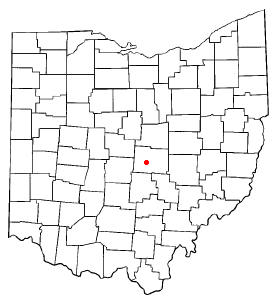
Licking County is a county located in the central portion of the U.S. state of Ohio. At the 2020 census, the population was 178,519. Its county seat is Newark. The county was formed on January 30, 1808, from portions of Fairfield County.
Fairfield County is a county located in the U.S. state of Ohio. As of the 2020 census, the population was 158,921. Its county seat and largest city is Lancaster. Its name is a reference to the Fairfield area of the original Lancaster. Fairfield County is part of the Columbus, OH Metropolitan Statistical Area.
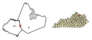
Sardis is a home rule-class city in Mason and Robertson counties in the U.S. state of Kentucky. The population was 60 as of the 2020 census, down from 103 in 2010.
Centerburg is a village in Knox County, Ohio, United States, along the North Fork of the Licking River. As of the 2020 census, the village population was 1,690. Centerburg is located near the geographical center of Ohio.
Alexandria is a village in Licking County, Ohio, United States. The population was 483 at the 2020 census.
Beechwood Trails is a census-designated place (CDP) in Harrison Township, Licking County, Ohio, United States. The population was 3,276 at the 2020 census.
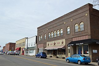
Granville is a village in Licking County, Ohio, United States. The population was 5,946 at the 2020 census. The village is located in a rural area of hills, known locally as the Welsh Hills, in central Ohio. It is 35 miles (56 km) east of Columbus, the state capital, and 7 miles (11 km) west of Newark, the county seat.
Granville South is a census-designated place (CDP) in Licking County, Ohio, United States. The population was 1,420 at the 2020 census.
Hanover is a village in Licking County, Ohio, United States. The population was 1,270 at the 2020 census. The village lies along Ohio State Route 16.
Harbor Hills is a census-designated place (CDP) in southern Licking County, Ohio, United States. The population was 1,565 at the 2020 census.
Hebron is a village in Licking County, Ohio, United States. The population was 2,326 at the 2020 census.
Johnstown is a city in Licking County, Ohio, United States. The population was 5,182 at the 2020 census. The city is most notable for the finding of a nearly complete mastodon skeleton under the city.
Kirkersville is a village in Licking County, Ohio, United States, along the South Fork of the Licking River. The population was 471 at the 2020 census.
Newark is a city in, and the county seat of, Licking County, Ohio, United States; it is located 40 miles (64 km) east of Columbus at the junction of the forks of the Licking River. The population was 49,934 at the 2020 census, making it the 18th-largest city in Ohio. It is most known for having the world's largest basket, former headquarters of the now defunct Longaberger Company. The city is part of the Columbus metropolitan area.
Pataskala is a city in Licking County, Ohio, United States, approximately 19 miles (31 km) east of Columbus. The population was 17,886 at the 2020 census. Pataskala was a small community until 1996, when what was then the village of Pataskala merged with Lima Township, vastly increasing its population and geographic area.
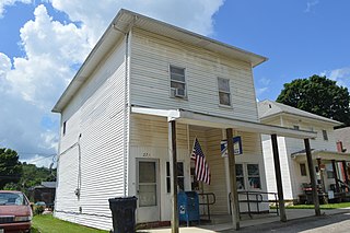
St. Louisville or Saint Louisville is a village in Licking County, Ohio, United States, along the North Fork of the Licking River. The population was 352 at the 2020 census.
Buckeye Lake is a village in Fairfield and Licking counties in the U.S. state of Ohio. The population was 2,520 at the 2020 census. It is named for Buckeye Lake, a large lake along which the village is built.
Reynoldsburg is a city in Fairfield, Franklin, and Licking counties in the U.S. state of Ohio. It is a suburban community in the Columbus, Ohio metropolitan area. The population was 41,076 at the 2020 census, making it the 30th-biggest city in Ohio.
Utica is a village in Knox and Licking counties in the U.S. state of Ohio, along the North Fork of the Licking River. The population was 2,064 at the 2020 census.