This page lists the city flags of Adygea , Russia. It is a part of the List of city flags of Russia, which is split into federal subjects due to its size.
This page lists the city flags of Adygea , Russia. It is a part of the List of city flags of Russia, which is split into federal subjects due to its size.
| Flag | City/Town | Date | Description |
|---|---|---|---|
 | Adygeysk | 5 September 2019 [1] – today | Banner of arms. The oak tree is a sacred tree to the Circassians. It is said that it can give people inflexibility, strength, constancy, longevity, wisdom and endurance. The Green represents hope, abundance, freedom and joy. Its branches and leaves represents original settlements that were merged by the Krasnodar Reservoir to become the Adygeysk. Yellow symbolizes nobility, power, wealth, faith, justice, mercy and humility. Yellow is also the colour of the steppes. Green and yellow are Adygea's federal subject colours. The coat of arms contains two red bulls, symbolling the origin of the name of the town. According to the Adyghe, they stand for fertility since the 3rd millennium BC (Maykop is home to a lost archaeological culture). During the Soviet era, the bulls represent an emerging power. Red stands for courage and fearlessness. [2] |
 | Maykop | 20 June 2008 – today | Banner of arms. Red for courage and beauty and yellow for wealth and prosperity. The apple tree represents apple farming in various valleys in the outskirts of Maykop (which is beneficial till this day) which gave the city its name from the Adyghe language. The bull heads are representations of figures of bull heads that are founded in 1897 during excavations of the Maykop mound, stored in the State Hermitage Museum in St. Petersburg. They symbolized industrial agriculture. The shamrock is a good luck symbol for fertility and a good harvest and the staff is said to give people wisdom and power. [3] |
| Flag | Rural locality | Date | Description |
|---|---|---|---|
 | Giaginskaya | 16 February 2012 – today | Banner of arms. The shashkas in a scabbard represents the peace and courage with Giaginskaya's defence readiness and build-up. The kubanka hat represents its Cossack history. The wheat ears represent agricultural benefits of the harvest season, and the total number of ears represents the settlements that made up the rural locality. The eight-pointed star (wind rose) represents the Virgin Mary, harmony, restoration and rebirth. The star represents its position as the intersection of transport and railway lines. Blue symbolizes honour, nobility and spirituality (as it is the colour of the Virgin Mary). Blue is also the colour of the 1st Caucasus Army Corps. Yellow symbolizes wealth, stability, respect, intelligence. Red represents courage, dedication, heroism, courage, labour and blood spilled through military glory. The wavy edges represent the Giaga river. Designed by A.E. Danilchenko A.E., S.M. Dzeboev and S.V. and Chernov S.V. [4] |

Yoshkar-Ola is the capital city of Mari El, Russia. Yoshkar-Ola means “red city” in Mari and was formerly known as Tsareovokokshaysk (Царевококшайск) before 1919, as Krasnokokshaysk (Краснококшайск) between 1919 and 1927 both after the Malaya Kokshaga River and Charla (Чарла), by the Mari people.

Kasimov is a town in Ryazan Oblast, Russia, located on the left bank of the Oka River. Population: 33,491 (2010 Russian census); 35,816 (2002 Census); 37,521 (1989 Soviet census); 17,000 (1910).

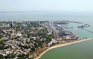
Taganrog is a port city in Rostov Oblast, Russia, on the north shore of Taganrog Bay in the Sea of Azov, several kilometers west of the mouth of the Don River. It is in the Black Sea region. Population: 245,120 (2021 Census); 257,681 (2010 Russian census); 281,947 (2002 Census); 291,622 (1989 Soviet census).

Novoshakhtinsk is a mining city in Rostov Oblast, Russia, within 20 kilometres of the Dovzhansky border crossing to Ukraine.

Novomoskovsk is a city and the administrative center of Novomoskovsky District in Tula Oblast, Russia, located at the source of the Don and Shat Rivers. Population: 131,386 (2010 Russian census); 134,081 (2002 Census); 146,302 (1989 Soviet census); 143,000 (1974); 107,000 (1959); 76,000 (1939).

Bogotol is a town in Krasnoyarsk Krai, Russia, located 6 kilometers (3.7 mi) of the Chulym River and 252 kilometers (157 mi) west of Krasnoyarsk, the administrative center of the krai. Population: 21,051 (2010 Russian census); 24,369 (2002 Census); 27,752 (1989 Soviet census).

Slavgorod is a town in Altai Krai, Russia, located between Lakes Sekachi and Bolshoye Yarovoye. The population of the town is 32,389 (2010 Russian census).

Novy Urengoy is a city in Yamalo-Nenets Autonomous Okrug, Russia. Population: 107,251 (2021 Census); 104,107 (2010 Russian census); 94,456 (2002 Census); 93,235 (1989 Soviet census). It is the largest city in the autonomous okrug.

Sasovo is a town in Ryazan Oblast, Russia, located on the Tsna River 184 kilometers (114 mi) southeast of Ryazan. Population: 28,118 (2010 Russian census); 30,736 (2002 Census); 35,875 (1989 Soviet census).

Primorsky District is the name of several administrative and municipal districts in Russia. The name literally means "near the sea".

Muravlenko is a town in Yamalo-Nenets Autonomous Okrug, Russia, located 480 kilometers (300 mi) southeast of Salekhard. Population: 33,391 (2010 Russian census); 35,926 (2002 Census).
Vostochny District is the name of several administrative and municipal districts in Russia. The name literally means "eastern".

Ryazansky District is an administrative and municipal district (raion), one of the twenty-five in Ryazan Oblast, Russia. It is located in the northwest of the oblast. The area of the district is 2,170 square kilometers (840 sq mi). Its administrative center is the city of Ryazan. Population: 56,869 ; 56,836 (2002 Census); 74,721 (1989 Soviet census).

Sasovsky District is an administrative and municipal district (raion), one of the twenty-five in Ryazan Oblast, Russia. It is located in the east of the oblast. The area of the district is 1,819 square kilometers (702 sq mi). Its administrative center is the town of Sasovo. Population: 18,504 ; 21,012 (2002 Census); 26,665 (1989 Soviet census).

Leninsky District is an administrative district (raion), one of the twenty-three in Tula Oblast, Russia. It is located in the northern central part of the oblast. The area of the district is 1,351.21 square kilometers (521.71 sq mi). Its administrative center is the rural locality of Leninsky. Population: 63,355 ; 64,412 (2002 Census); 70,013 (1989 Soviet census). The population of the administrative center accounts for 11.1% of the district's total population.

Novomoskovsky District is an administrative district (raion), one of the twenty-three in Tula Oblast, Russia. Within the framework of municipal divisions, it is incorporated as Novomoskovsk Urban Okrug. It is located in the east of the oblast. The area of the district is 906 square kilometers (350 sq mi). Its administrative center is the city of Novomoskovsk. Population: 143,848 ; 25,211 (2002 Census); 26,289 (1989 Soviet census). The population of Novomoskovsk accounts for 91.3% of the district's total population.

Anapa Urban Okrug is a municipal formation in Krasnodar Krai, Russia, one of the seven urban okrugs in the krai. Its territory comprises the territories of two administrative divisions of Krasnodar Krai — Anapsky District and the Town of Anapa. The area of the urban okrug is 981.86 square kilometers (379.10 sq mi).
Tula Urban Okrug is a municipal formation in Tula Oblast, Russia, one of the seven urban okrugs in the oblast. Its territory comprises the territories of two administrative divisions of Tula Oblast—Leninsky District and Tula City Under Oblast Jurisdiction.
Leninsky is a rural locality and the administrative center of Leninsky District, Tula Oblast, Russia. Population: 7,054 (2010 Russian census); 10,120 (2002 Census); 10,761 (1989 Soviet census).