The Flathead Indian Reservation, located in western Montana on the Flathead River, is home to the Bitterroot Salish, Kootenai, and Pend d'Oreilles tribes - also known as the
Confederated Salish and Kootenai Tribes of the Flathead Nation. The reservation was created through the July 16, 1855, Treaty of Hellgate.

The Confederated Salish and Kootenai Tribes of the Flathead Reservation are a federally recognized tribe in the U.S. state of Montana. The government includes members of several Bitterroot Salish, Kutenai and Pend d'Oreilles tribes and is centered on the Flathead Indian Reservation.

Flathead Lake is a large natural lake in northwest Montana, and is the largest natural freshwater lake by surface area that is west of the source of the Missouri River in the contiguous United States.

The Flathead River, in the northwestern part of the U.S. state of Montana, originates in the Canadian Rockies to the north of Glacier National Park and flows southwest into Flathead Lake, then after a journey of 158 miles (254 km), empties into the Clark Fork. The river is part of the Columbia River drainage basin, as the Clark Fork is a tributary of the Pend Oreille River, a Columbia River tributary. With a drainage basin extending over 8,795 square miles (22,780 km2) and an average discharge of 11,380 cubic feet per second (322 m3/s), the Flathead is the largest tributary of the Clark Fork and constitutes over half of its flow.

The Flathead National Forest is a national forest in the western part of the U.S. state of Montana. The forest covers 2,404,935 acres of which about 1 million acres (4,000 km2) is designated wilderness. It is named after the Flathead Native Americans who lived in the area. The forest is located in the Rocky Mountains with elevations ranging from 4,500 to 8,500 feet. The forest provides habitat for approximately 250 species of wildlife and 22 species of fish. This includes bald eagle, wolverine, beaver, elk, porcupine, cougar, moose, bobcat,
white-tailed deer, coyote, grizzly bear, timber wolf two species of fox, mountain goat, Canadian lynx, woodchuck, bighorn sheep and bull trout.

The Big Belt Mountains are a section of the Rocky Mountains in the U.S. state of Montana. Situated mainly in the Helena National Forest, the mountains are used for logging and recreation for the surrounding residents. Nearby is Helena, Montana, Canyon Ferry Lake, the Missouri River, Townsend, Montana, and White Sulphur Springs, Montana. The highest point in the Big Belt Range is Mount Edith at 9,504 feet (2,897 m) while the center of the range is 7,385 feet (2,251 m)
The Salish Mountains are located in the northwest corner of the U.S. State of Montana. Much of the range is bordered on the east by Flathead Lake. With peaks ranging from just under 7,000 feet tall to named hills that are a little short of 3,600 feet in elevation the Salish Mountain range is a lesser known mountain range in northwestern Montana. Many of the peaks in the range are rounded tree-covered summits but occasionally the mountain summits are found on open grassy slopes that afford great views into the surrounding valleys and neighboring mountain ranges. The Salish Mountains cover a triangle-shaped land mass of about 4,125 square miles of lush forests and peaks.

The Mission Mountains or Mission Range are a range of the Rocky Mountains located in northwestern Montana in the United States. They lie chiefly in Lake County and Missoula County and are south and east of Flathead Lake and west of the Swan Range. On the east side of the range is the Swan
River Valley and on the west side the Mission Valley.

The Lewis Range is a mountain range located in the Rocky Mountains of northern Montana, United States and extreme southern Alberta, Canada. It was formed as a result of the Lewis Overthrust, a geologic thrust fault resulted in the overlying of younger Cretaceous rocks by older Proterozoic rocks. The range is located within Waterton Lakes National Park in Alberta, Canada and Glacier National Park and the Bob Marshall Wilderness Complex in Montana, United States. The highest peak is Mount Cleveland at 10,466 ft (3,190 m).
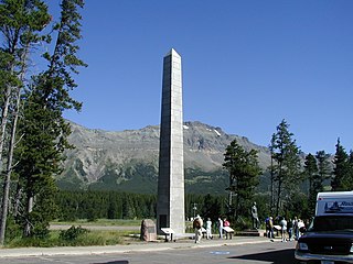
Marias Pass is a high mountain pass near Glacier National Park in northwestern Montana in the United States.
Diamond Peak may refer to:
The Flathead Valley, located in Northwestern Montana, is a region of the U.S. state of Montana. It includes Flathead County, and part of Lake County. Notable towns include Bigfork, Kalispell, Columbia Falls, Polson, and Whitefish. The geography of the Flathead roughly corresponds to the valley where Flathead Lake is located. In addition to the lake, the area's proximity to attractions such as Glacier National Park and Whitefish Mountain Resort have made the area a major resort destination. Many outdoor activities can be pursued there such as hiking, backpacking, rafting, canoeing, skiing, hunting, and some of the best trout fishing in the world. The Flathead Valley is also home to a portion of the Flathead Indian Reservation.
The Flathead Range is a mountain range of the Northern Rocky Mountains located south-east of Whitefish, Montana in the Great Bear Wilderness, part of the Bob Marshall Wilderness Complex. It is east of the Swan Range and southeast of the Whitefish Range. Its west side is drained by the South Fork Flathead River which forms Hungry Horse Reservoir.

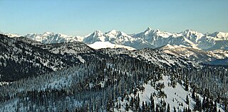
The Swan Range is a mountain range in western Montana in the United States. Its peaks typically rise to around 8,000 to 9,000 feet. The range is bounded by the South Fork Flathead River to the east, the Flathead River to the north and northwest, the Swan River to the west, and lie to the southwest of Glacier National Park, just south of the Canada–US border. It runs about 99 miles (159 km) from north-northwest to south-southeast. Major cities near the Swan Range include Kalispell and Bigfork to the northeast, and Seeley Lake on the south.
The Whitefish Range is a mountain range stretching north-south from British Columbia, Canada to Montana, United States. It is about 76 miles (122 km) long and 58 miles (93 km) wide. Water flowing from its east side drains down the North Fork Flathead River and its west side drains into the Whitefish River, both part of the Columbia River drainage basin.

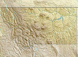
The Regional designations of Montana vary widely within the U.S state of Montana. The state is a large geographical area that is split by the Continental Divide, resulting in watersheds draining into the Pacific Ocean, Gulf of Mexico and Hudson's Bay. The state is approximately 545 miles (877 km) east to west along the Canada–United States border and 320 miles (510 km) north to south. The fourth largest state in land area, it has been divided up in official and unofficial ways into a variety of regions. Additionally, Montana is part of a number of larger federal government administrative regions.
Montana Highway 35 is an approximately 51-mile-long (82 km) state highway in the west of the US state of Montana. It begins at U.S. Highway 93 in Polson in the Flathead Indian Reservation and ends at U.S. Highway 2 in Evergreen, the eastern portion of the city of Kalispell. As well as serving the townships along the eastern shore of Flathead Lake, it also serves as a de facto alternative route of US 93 between Polson and Kalispell.