Fontenelle Reservoir

Last updated
Fontenelle Reservoir
Shallow grassy edge of the Fontanelle Reservoir in Wyoming.tiff
Fontenelle Reservoir in 1972
USA Wyoming relief location map.svg
Red pog.svg
Fontenelle Reservoir
Usa edcp relief location map.png
Red pog.svg
Fontenelle Reservoir
Location Lincoln / Sweetwater counties, Wyoming, USA
Coordinates 42°02′00″N110°04′00″W / 42.03333°N 110.06667°W / 42.03333; -110.06667
Type reservoir
Primary inflows Green River
Primary outflows Green River
Catchment area 4,156 sq mi (10,760 km2)
Basin  countriesUnited States
Max. length20 miles (32 km)
Surface area8,000 acres (3,200 ha)
Water volume345,360 acre-feet (0.42600 km3)

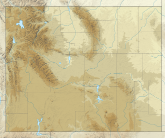
Fontenelle Reservoir is an artificial reservoir located in southwest Wyoming. It lies almost entirely within Lincoln County, although the east end of the Fontenelle Dam and a tiny portion of the reservoir are actually in northwestern Sweetwater County. Impounded by Fontenelle Dam, the reservoir acts primarily as a storage reservoir for the U.S. Bureau of Reclamation's Colorado River Storage Project, retaining Wyoming water in the state as a means of asserting Wyoming's water rights, with a secondary purpose of power generation. Water from Fontenelle Reservoir is used in local industries such as mining and power generation. Although initially projected to provide irrigation water for agriculture, the irrigation component was downgraded after difficulties with efficient irrigation in Wyoming's high semi-desert became apparent. [1] [2]

Contents

Plagued by chronic leakage problems at the dam, the reservoir was hurriedly emptied in 1965 and 1986 amid concerns about dam failure. [1] The reservoir has facilities for recreation, with boat launching ramps and campgrounds. Fishing is available for brown, cutthroat and rainbow trout. [3]

The land used for the Fontenelle Reservoir and dam was previously the Stepp Ranch, owned by one of the few black ranching families in Wyoming in the 1960s. The Stepps fought for their land in court, but ultimately lost. The land had been in the Stepp family since the turn of the 20th century. [4]

See also

Related Research Articles

<span class="mw-page-title-main">Columbia Basin Project</span> American irrigation project

The Columbia Basin Project in Central Washington, United States, is the irrigation network that the Grand Coulee Dam makes possible. It is the largest water reclamation project in the United States, supplying irrigation water to over 670,000 acres (2,700 km2) of the 1,100,000 acres (4,500 km2) large project area, all of which was originally intended to be supplied and is still classified irrigable and open for the possible enlargement of the system. Water pumped from the Columbia River is carried over 331 miles (533 km) of main canals, stored in a number of reservoirs, then fed into 1,339 miles (2,155 km) of lateral irrigation canals, and out into 3,500 miles (5,600 km) of drains and wasteways. The Grand Coulee Dam, powerplant, and various other parts of the CBP are operated by the Bureau of Reclamation. There are three irrigation districts in the project area, which operate additional local facilities.

<span class="mw-page-title-main">Pick–Sloan Missouri Basin Program</span> Flood control

The Pick–Sloan Missouri Basin Program, formerly called the Missouri River Basin Project, was initially authorized by the Flood Control Act of 1944, which approved the plan for the conservation, control, and use of water resources in the Missouri River Basin.

<span class="mw-page-title-main">Curecanti National Recreation Area</span> National Park Service in Colorado, US

Curecanti National Recreation Area is a National Park Service unit located on the Gunnison River in western Colorado. Established in 1965, Curecanti National Recreation Area is responsible for developing and managing recreational facilities on three reservoirs, Blue Mesa Reservoir, Morrow Point Reservoir and Crystal Reservoir, constructed on the upper Gunnison River in the 1960s by the U.S. Bureau of Reclamation to better utilize the vital waters of the Colorado River and its major tributaries. A popular destination for boating and fishing, Curecanti offers visitors two marinas, traditional and group campgrounds, hiking trails, boat launches, and boat-in campsites. The state's premiere lake trout and Kokanee salmon fisheries, Curecanti is a popular destination for boating and fishing, and is also a popular area for ice-fishing in the winter months.

<span class="mw-page-title-main">Keyhole State Park</span> State park in Wyoming, United States

Keyhole State Park is a public recreation area surrounding Keyhole Reservoir, ten miles (16 km) northeast of Moorcroft in Crook County, Wyoming. The state park is managed by the Wyoming Division of State Parks and Historic Sites.

<span class="mw-page-title-main">Elephant Butte Dam</span> Dam on the Rio Grande in New Mexico, United States

Elephant Butte Dam or Elephant Butte Dike, originally Engle Dam, is a concrete gravity dam on the Rio Grande near Truth or Consequences, New Mexico. The dam impounds Elephant Butte Reservoir, which is used mainly for agriculture but also provides for recreation, hydroelectricity, and flood and sediment control. The construction of the dam has reduced the flow of the Rio Grande to a small stream for most of the year, with water being released only during the summer irrigation season or during times of exceptionally heavy snow melt.

<span class="mw-page-title-main">Friant Dam</span> Dam in Madera/Fresno Counties, California

Friant Dam is a concrete gravity dam on the San Joaquin River in central California in the United States, on the boundary of Fresno and Madera Counties. It was built between 1937 and 1942 as part of a U.S. Bureau of Reclamation (USBR) water project to provide irrigation water to the southern San Joaquin Valley. The dam impounds Millerton Lake, a 4,900-acre (2,000 ha) reservoir about 15 miles (24 km) north of Fresno.

<span class="mw-page-title-main">Palisades Dam</span> Dam in Bonneville County, Idaho

Palisades Dam is an earth-fill dam in the western United States, on the upper Snake River in eastern Idaho. Located in Bonneville County near the Wyoming border, the dam was completed 67 years ago in 1957.

<span class="mw-page-title-main">Blue Mesa Reservoir</span> Lake on the Gunnison River in Colorado, United States

Blue Mesa Reservoir is an artificial reservoir located on the upper reaches of the Gunnison River in Gunnison County, Colorado. The largest lake located entirely within the state, Blue Mesa Reservoir was created by the construction of Blue Mesa Dam, a 390 feet (120 m) tall earthen fill dam constructed on the Gunnison by the U.S. Bureau of Reclamation in 1966 for the generation of hydroelectric power. Managed as part of the Curecanti National Recreation Area, a unit of the National Park Service, Blue Mesa Reservoir is the largest lake trout and Kokanee salmon fishery in Colorado.

<span class="mw-page-title-main">Jackson Lake Dam</span> Dam in Wyoming, in Grand Teton National Park

Jackson Lake Dam is a concrete and earth-fill dam in the western United States, at the outlet of Jackson Lake in northwestern Wyoming. The lake and dam are situated within Grand Teton National Park in Teton County. The Snake River emerges from the dam and flows about eight hundred miles (1,300 km) through Wyoming, Idaho, Oregon, and Washington to its mouth on the Columbia River in eastern Washington.

<span class="mw-page-title-main">Yellowtail Dam</span> Dam in Big Horn County, Montana

Yellowtail Dam is a dam across the Bighorn River in south central Montana in the United States. The mid-1960s era concrete arch dam serves to regulate the flow of the Bighorn for irrigation purposes and to generate hydroelectric power. The dam and its reservoir, Bighorn Lake, are owned by the U.S. Bureau of Reclamation.

<span class="mw-page-title-main">Buffalo Bill Dam</span> Dam in Wyoming

Buffalo Bill Dam is a concrete arch-gravity dam on the Shoshone River in the U.S. state of Wyoming. Originally 325-foot (99 m), it was the tallest dam in the world when it opened in 1910; a 25-foot (7.6 m) extension was added in 1992 in one of numerous changes and improvements to the structure and its support facilities, which include two full time power generators and two seasonal operations added between 1920 and 1994, and a 2.8-mile (4.5 km) irrigation tunnel completed in 1939.

<span class="mw-page-title-main">Colorado River Storage Project</span> US Bureau of Reclamation project

The Colorado River Storage Project is a United States Bureau of Reclamation project designed to oversee the development of the upper basin of the Colorado River. The project provides hydroelectric power, flood control and water storage for participating states along the upper portion of the Colorado River and its major tributaries.

<span class="mw-page-title-main">Anderson Ranch Dam</span> Dam in Elmore County, Idaho

Anderson Ranch Dam is an earth rockfill type dam in the western United States, on the South Fork of the Boise River in southwestern Idaho. In Elmore County northeast of Mountain Home, it is several miles north of U.S. Route 20 and operated by the U.S. Bureau of Reclamation.

<span class="mw-page-title-main">Fontenelle Dam</span> Dam on the Green River in Wyoming

Fontenelle Dam was built between 1961 and 1964 on the Green River in southwestern Wyoming. The 139-foot (42 m) high zoned earthfill dam impounds the 345,360-acre-foot (0.42600 km3) Fontenelle Reservoir. The dam and reservoir are the central features of the Seedskadee Project of the U.S. Bureau of Reclamation, which manages the Fontenelle impoundment primarily as a storage reservoir for the Colorado River Storage Project. The dam suffered a significant failure in 1965, when the dam's right abutment developed a leak. Emergency releases from the dam flooded downstream properties, but repairs to the dam were successful. However, in 1983 the dam was rated "poor" under Safety Evaluation of Existing Dams (SEED) criteria, due to continuing seepage, leading to an emergency drawdown. A concrete diaphragm wall was built through the core of the dam to stop leakage.

<span class="mw-page-title-main">Minidoka Project</span>

The Minidoka Project is a series of public works by the U.S. Bureau of Reclamation to control the flow of the Snake River in Wyoming and Idaho, supplying irrigation water to farmlands in Idaho. One of the oldest Bureau of Reclamation projects in the United States, the project involves a series of dams and canals intended to store, regulate and distribute the waters of the Snake, with electric power generation as a byproduct. The water irrigates more than a million acres (4,000 km²) of otherwise arid land, producing much of Idaho's potato crop. Other crops include alfalfa, fruit and sugar beets. The primary irrigation district lies between Ashton in eastern Idaho and Bliss in the southwestern corner of the state. Five main reservoirs collect water, distributing it through 1,600 miles (2,600 km) of canals and 4,000 miles (6,400 km) of lateral distribution ditches.

<span class="mw-page-title-main">Seminoe Dam</span> Dam in Carbon County, Wyoming

Seminoe Dam is a concrete thick-arch dam on the North Platte River in the U.S. state of Wyoming. The dam stores water for irrigation and hydroelectricity generation and is owned and operated by the U.S. Bureau of Reclamation. It is the uppermost dam on the North Platte River and is located directly upstream from the Kortes Dam. It lies in a narrow, isolated canyon formed by the North Platte cutting through the Seminoe Mountains about 40 miles (64 km) northeast of Rawlins. The 295-foot (90 m) dam forms Seminoe Reservoir, which covers more than 20,000 acres (8,100 ha) when full. Seminoe State Park is adjacent to the reservoir. The small village of Seminoe Dam abuts the dam and reservoir and provides residence for the dam attendants and park services personnel.

<span class="mw-page-title-main">Alcova Dam</span> Dam in Wyoming, USA

Alcova Dam is a 265-foot (81 m) tall zoned earthfill dam in central Wyoming, built in 1935-38 on the North Platte River and operated by the U.S. Bureau of Reclamation for water storage and hydroelectric power generation. The dam was built as part of the Kendrick Project, formerly the Casper-Alcova Project, whose central features are Alcova and Seminoe dams.

The Seedskadee Project is a water resources development project of the U.S. Bureau of Reclamation. The project focuses on the upper Green River in western Wyoming, storing the river's waters in Fontenelle Reservoir. The project is associated with the Colorado River Storage Project, retaining the waters of the Green for use in the upper Colorado Basin. Water held behind Fontenelle Dam, built from 1961 to 1968, is used for hydroelectric power generation and industrial use. The reservoir supports recreational use.

Meeks Cabin Dam is a dam on the Blacks Fork of the Green River, located in Uinta County, southwestern Wyoming. It impounds Meeks Cabin Reservoir, which is mostly in Wyoming, with a portion extending south over the state line into Utah.

References

  1. 1 2 Lineberger, Toni Rae. "Seedskadee Project" (PDF). U.S. Bureau of Reclamation. Retrieved 24 May 2011.
  2. Reisner, Marc (1993). Cadillac Desert: the American West and its disappearing water . Penguin Books. ISBN   978-1-4406-7282-8.
  3. "Fontenelle Reservoir". National Recreation Reservation Service. Retrieved 26 May 2011.