Flaming Gorge Reservoir

Last updated • 2 min readFrom Wikipedia, The Free Encyclopedia
Flaming Gorge Reservoir
Flaming Gorge (Utah) 23-9-2014 12-49-13.JPG
Flaming Gorge Reservoir in Utah
USA Wyoming relief location map.svg
Red pog.svg
Flaming Gorge Reservoir
USA Utah relief location map.svg
Red pog.svg
Flaming Gorge Reservoir
Usa edcp relief location map.png
Red pog.svg
Flaming Gorge Reservoir
Location Sweetwater County, Wyoming / Daggett County, Utah, US
Coordinates 41°09′41″N109°33′04″W / 41.16139°N 109.55111°W / 41.16139; -109.55111
Lake type Hydroelectric reservoir
Primary inflows Green River

Blacks Fork

Henrys Fork
Primary outflows Green River
Catchment area 39,100 km2 (15,100 sq. miles)
Basin  countriesUnited States
Surface area 42,020 acres (170 km2)
Water volume 3,788,900  acre⋅ft (4.6735 km3)
Surface elevation6,040 ft (1841 m)
Settlements Manila, Utah; Dutch John, Utah; Green River, Wyoming

Flaming Gorge Reservoir is the largest reservoir in Wyoming, on the Green River, impounded behind the Flaming Gorge Dam. Construction on the dam began in 1958 and was completed in 1964. The reservoir stores 3,788,900 acre-feet (4.6735×10⁹ m3) of water when measured at an elevation of 6,040 feet (1,841 m) above sea-level (maximum).
Contents

Location

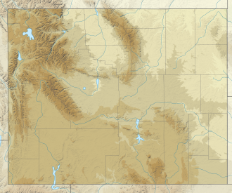
The reservoir is mainly in southwest Wyoming and partially in northeastern Utah. The northern tip of the reservoir is 10 miles (16 km) southeast of Green River, Wyoming, 14 miles (23 km) southwest of Rock Springs, Wyoming, and the Southern tip is approximately 40 miles (64 km) north of Vernal, Utah. The lake straddles the Utah-Wyoming border. The nearby town of Dutch John, Utah, was built to serve as a base camp during construction of the dam, and as an administrative site afterwards.[ citation needed ]

Aerial view of Flaming Gorge Reservoir in Wyoming Flaming Gorge Reservoir aerial.jpg
Aerial view of Flaming Gorge Reservoir in Wyoming
Drainage basin of the Flaming Gorge Reservoir Flaming gorge drainage basin.png
Drainage basin of the Flaming Gorge Reservoir

Geology

The foundation of the reservoir is a steep-sided narrow canyon composed of siliceous sandstone and hard quartzites inter-bedded with softer shales, siltstones, and argillites. About 1.5 miles (2.4 km) east of the dam, a road cut has revealed a fault scarp on the southbound side with about 9 feet (3 m) of slippage.

Recreation

Visitors enjoy hiking, boating, fishing, windsurfing, camping, backpacking, cross-country skiing, and snowmobiling within Flaming Gorge National Recreation Area, which is operated by Ashley National Forest. Camp sites can be found close to the dam and along Highway 191 for a fee, as well as free throughout the area. Campgrounds operated by the U.S. Forest Service close in the winter months, with the exception of Dripping Springs near Dutch John. There are also public camp sites at Buck Board and Lucerne Marinas, along Highway 530 on the west side of the reservoir. The many available fish species in the reservoir and surrounding lakes are Colorado River Cutthroat trout, Brown trout, Rainbow trout, Lake trout, Kokanee salmon, Smallmouth bass, Burbot and Common carp. The Green River is a popular spot for fishing, mainly below the dam. The river's ice cold water and beautiful structure make it a world class, world-renowned fly fishing stream.

See also

Further reading

A panorama of Flaming Gorge Reservoir taken from the observation platform on Highway 191 during the summer. Flaming-Gorge-Reservoir-pano.jpg
A panorama of Flaming Gorge Reservoir taken from the observation platform on Highway 191 during the summer.

Related Research Articles

<span class="mw-page-title-main">Manila, Utah</span> Town in the state of Utah, United States

Manila is a small town located on the northern edge of Daggett County, Utah, United States, just south of the Wyoming border. The town is at the junction of State Route 43 and State Route 44, and is the county seat of Daggett County. Nearby sites include the Flaming Gorge National Recreation Area and the Flaming Gorge Reservoir just east of town, and to the south is Ashley National Forest, which includes Kings Peak (13,528 ft), the highest point in Utah.

<span class="mw-page-title-main">Deschutes River</span> River in Oregon, United States

The Deschutes River in central Oregon is a major tributary of the Columbia River. The river provides much of the drainage on the eastern side of the Cascade Range in Oregon, gathering many of the tributaries that descend from the drier, eastern flank of the mountains. The Deschutes provided an important route to and from the Columbia for Native Americans for thousands of years, and then in the 19th century for pioneers on the Oregon Trail. The river flows mostly through rugged and arid country, and its valley provides a cultural heart for central Oregon. Today the river supplies water for irrigation and is popular in the summer for whitewater rafting and fishing.

<span class="mw-page-title-main">Lake Powell</span> Reservoir in Utah and Arizona, United States

Lake Powell is a reservoir on the Colorado River in Utah and Arizona, United States. It is a major vacation destination visited by approximately two million people every year. It holds 24,322,000 acre-feet (3.0001×10¹⁰ m3) of water when full, second in the United States to only Lake Mead - though Lake Mead has fallen below Lake Powell in size several times during the 21st century in terms of volume of water, depth and surface area.

<span class="mw-page-title-main">Green River (Colorado River tributary)</span> River in Wyoming, Utah, and Colorado, United States

The Green River, located in the western United States, is the chief tributary of the Colorado River. The watershed of the river, known as the Green River Basin, covers parts of the U.S. states of Wyoming, Utah, and Colorado. The Green River is 730 miles (1,170 km) long, beginning in the Wind River Mountains of Wyoming and flowing through Wyoming and Utah for most of its course, except for a short segment of 40 miles (64 km) in western Colorado. Much of the route traverses the arid Colorado Plateau, where the river has carved some of the most spectacular canyons in the United States. The Green is slightly smaller than Colorado when the two rivers merge but typically carries a larger load of silt. The average yearly mean flow of the river at Green River, Utah is 6,121 cubic feet (173.3 m3) per second.

<span class="mw-page-title-main">Payette River</span> River in Idaho

The Payette River is an 82.7-mile-long (133.1 km) river in southwestern Idaho and a major tributary of the Snake River.

<span class="mw-page-title-main">Curecanti National Recreation Area</span> National Park Service in Colorado, US

Curecanti National Recreation Area is a National Park Service unit located on the Gunnison River in western Colorado. Established in 1965, Curecanti National Recreation Area is responsible for developing and managing recreational facilities on three reservoirs, Blue Mesa Reservoir, Morrow Point Reservoir and Crystal Reservoir, constructed on the upper Gunnison River in the 1960s by the U.S. Bureau of Reclamation to better utilize the vital waters of the Colorado River and its major tributaries. A popular destination for boating and fishing, Curecanti offers visitors two marinas, traditional and group campgrounds, hiking trails, boat launches, and boat-in campsites. The state's premiere lake trout and Kokanee salmon fisheries, Curecanti is a popular destination for boating and fishing, and is also a popular area for ice-fishing in the winter months.

<span class="mw-page-title-main">Ashley National Forest</span> National Forest in Utah and Wyoming, United States

Ashley National Forest is a National Forest located in northeastern Utah and southwestern Wyoming. Within the Forest's bounds are 1,382,346 acres (5,594 km2) of vast forests, lakes, and mountains, with elevations ranging from 6,000 to 13,500 feet. The forest covers portions of Daggett, Duchesne, Summit, Uintah, and Utah counties in Utah and Sweetwater County in Wyoming. Some of the most popular landmarks located in the forest include the Flaming Gorge National Recreation Area and the Uinta Mountains, which contains the highest mountain peak in Utah. The forest also includes 276,175 acres (1,117.64 km2), or about 60.5%, of the High Uintas Wilderness. The headquarters for the Ashley National Forest are located in Vernal, Utah with ranger district offices in Vernal; Duchesne, Utah; Roosevelt, Utah; Manila, Utah; and Green River, Wyoming.

<span class="mw-page-title-main">Flaming Gorge Dam</span> Dam on the Green River in Utah, United States

Flaming Gorge Dam is a concrete thin-arch dam on the Green River, a major tributary of the Colorado River, in northern Utah in the United States. Flaming Gorge Dam forms the Flaming Gorge Reservoir, which extends 91 miles (146 km) into southern Wyoming, submerging four distinct gorges of the Green River. The dam is a major component of the Colorado River Storage Project, which stores and distributes upper Colorado River Basin water.

<span class="mw-page-title-main">Piru Creek</span> Creek in Ventura County, California

Piru Creek is a major stream, about 71 miles (114 km) long, in northern Los Angeles County and eastern Ventura County, California. It is a tributary of the Santa Clara River, the largest stream system in Southern California that is still relatively natural.

<span class="mw-page-title-main">Blue Mesa Reservoir</span> Lake on the Gunnison River in Colorado, United States

Blue Mesa Reservoir is an artificial reservoir located on the upper reaches of the Gunnison River in Gunnison County, Colorado. The largest lake located entirely within the state, Blue Mesa Reservoir was created by the construction of Blue Mesa Dam, a 390 feet (120 m) tall earthen fill dam constructed on the Gunnison by the U.S. Bureau of Reclamation in 1966 for the generation of hydroelectric power. Managed as part of the Curecanti National Recreation Area, a unit of the National Park Service, Blue Mesa Reservoir is the largest lake trout and Kokanee salmon fishery in Colorado.

<span class="mw-page-title-main">Flaming Gorge National Recreation Area</span> Place in Wyoming and Utah

Flaming Gorge National Recreation Area is a United States national recreation area in Wyoming and Utah. Its centerpiece is the 91 miles (146 km) long Flaming Gorge Reservoir.

<span class="mw-page-title-main">Salmon River (Clackamas County, Oregon)</span> River in Oregon, United States

The Salmon River is a 33.5-mile (53.9 km) river in the Cascade Range in the U.S. state of Oregon that drains part of southwestern Mount Hood. The entire length of the river is a protected National Wild and Scenic River. Several portions are in protected wilderness. It is affluent to the Sandy River, a tributary of the Columbia River.

<span class="mw-page-title-main">Crooked River (Oregon)</span> River in Oregon, United States

The Crooked River is a tributary, 125 miles (201 km) long, of the Deschutes River in the U.S. state of Oregon. The river begins at the confluence of the South Fork Crooked River and Beaver Creek in southeastern Crook County. Of the two tributaries, the South Fork Crooked River is the larger and is sometimes considered part of the Crooked River proper. A variant name of the South Fork Crooked River is simply "Crooked River". The Deschutes River flows north into the Columbia River.

<span class="mw-page-title-main">Yellowtail Dam</span> Dam in Big Horn County, Montana

Yellowtail Dam is a dam across the Bighorn River in south central Montana in the United States. The mid-1960s era concrete arch dam serves to regulate the flow of the Bighorn for irrigation purposes and to generate hydroelectric power. The dam and its reservoir, Bighorn Lake, are owned by the U.S. Bureau of Reclamation.

The Central Utah Project is a United States federal water project that was authorized for construction under the Colorado River Storage Project Act of April 11, 1956, as a participating project. In general, the Central Utah Project develops a portion of Utah's share of the yield of the Colorado River, as set out in the Colorado River Compact of 1922.

<span class="mw-page-title-main">U.S. Route 191 in Utah</span> Section of U.S. Highway in Utah, United States

U.S. Route 191 (US-191) is a major 404.168-mile (650.445 km), north–south U.S. Numbered Highway through eastern Utah, United States. The present alignment of US-191, which stretches from Mexico to Canada, was created in 1981 through Utah. Previously the route had entered northern Utah, ending at US-91 in Brigham City, but with the completion of I-15 it was truncated to Yellowstone National Park and re-extended on a completely different alignment. In addition to a large portion of US-163, this extension absorbed several state routes: SR-33, most of SR-44, and SR-260.

<span class="mw-page-title-main">Colorado River Storage Project</span> US Bureau of Reclamation project

The Colorado River Storage Project is a United States Bureau of Reclamation project designed to oversee the development of the upper basin of the Colorado River. The project provides hydroelectric power, flood control and water storage for participating states along the upper portion of the Colorado River and its major tributaries.

<span class="mw-page-title-main">Flaming Gorge-Uintas Scenic Byway</span>

The Flaming Gorge - Uintas Scenic Byway is a National Scenic Byway in the state of Utah. It spans approximately 80 miles (130 km) as it travels from Vernal, Utah northward through the Ashley National Forest and the Uintah Mountains to the area around Flaming Gorge National Recreation Area in the northeastern corner of the state.

<span class="mw-page-title-main">Wyoming Highway 530</span> State highway in Wyoming, United States

Wyoming Highway 530 is a 45.34-mile-long (72.97 km) state road that lies in southwestern Sweetwater County, Wyoming that runs along the west side of the Green River/Flaming Gorge Reservoir.

<span class="mw-page-title-main">Little Dell Reservoir</span> Reservoir in the state of Utah, United States

Little Dell Reservoir is a reservoir in eastern Salt Lake County, Utah, United States, about 13 miles (21 km) east of Salt Lake City in the western Wasatch Mountains.